The Colestin Rural Fire District is no longer operational. As a courtesy to our local community, this website will continue to be maintained on a limited basis and for a limited period of time; however, we are no longer liable for responding to fire calls, medical calls, or any other emergencies. We have not yet been annexed into Jackson County Fire District 5, although we will have their support during fire season, so at this time, District 5 is not primarily responsible for responses within our district. Instead, all calls should be directed to 9-1-1. The appropriate resources will be dispatched accordingly, and as they are available.

The
top end of the Colestin Rural Fire District: view of
Mt. Ashland from the Siskiyou Summit
The
Geographic Boundaries of the Fire District
Our
geographic boundaries can be roughly described as: Just beyond
Interstate 5 to the east, the Mt. Ashland ski road to the
north, Cottonwood drainage to the west, and the California-Oregon
border to the south.
More exactly, the District is located in Jackson County Townships
40 and 41 South, and in Ranges 1 and 2 East.
The District's area encompasses approximately 17 square miles.
The closest fire agency to this area, after our own, has an
average response time of about 40 minutes.

View a larger
version of this topographic map (file size 755 KB).
View a high-resolution
U.S.G.S. topographic map - color version of the District
and nearby area (file size 1633 KB).
View a regional
U.S.G.S. topographic map - color version of the District
and regional area (includes Medford, OR.) (file size 1496
KB).


THE
THICK BLACK OUTLINED AREA in the High Risk Wildfire Area map
above denotes our legal district boundary. (Note that the
two smaller outlined areas on the right represent residents
across the I-5 corridor who have legally annexed their properties
into our district.) Colestin Road runs up through the middle
of this map; Mt. Ashland Road ("the ski road") runs just under
the northern district boundary line.
THE SLANTED GREY SHADED AREA represents HIGH RISK WILDFIRE
AREA. This area has been determined by recent studies conducted
on the potentially hazardous urban-rural forest interface
zones throughout the State of Oregon.
NOTE THE IMMENSE AREA OF OVERLAP BETWEEN THE HIGH RISK WILDFIRE
AREA AND THE AREA WITHIN OUR DISTRICT BOUNDARIES.
THIS IS THE DISTRICT WE LIVE IN.

This
map and related information was provided to us by courtesy
of Government Information Systems Maps, and through the kind
services of Connie Florie, in G.I.S. (Geographic Information
Systems) Mapping of Jackson County.
View a larger
version of the above High Risk Wildfire Area map
(file size 515 KB)
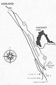
Additional
Maps of the Colestin - Mt. Ashland area:
(View
larger versions)


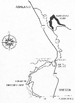
The
Colestin Rural Fire District is located just inside of the
State of Oregon, above the Oregon-California border. The 17-square-mile
area that the District protects is approximately half-way
inland from the coast at the top of the State of California,
and to the immediate west of Interstate-5.
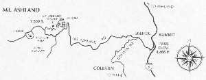
Road access into the top end of the district is at the Mount
Ashland Ski Road exit from Interstate-5 just north of the
Siskiyou Summit in Oregon, and at the lower end, at the Hilt
exit from I-5 in California. Old Highway 99 South, the old
route over the Siskiyous, also provides local access to the
Mt. Ashland Ski Road and connects to I-5 near Hilt. Both the
Mt. Ashland Ski Road and the Hilt-Hungry Creek Road connect
with Colestin Road, which runs through the center of the district.

The lower end of the Fire District: Hilt
and lower Colestin Road, view northwest from I-5 at Hilt exit
Both Old Highway 99 and Colestin Road were originally logging
roads; Colestin Road alone consists of about 8 miles of winding
hairpin turns, and is sometimes closed at the north end going
over the Siskiyous in winter. While these back roads serve
local residents, they are not able to accommodate 18-wheel
trucks or other large traffic, which are advised to use only
the freeway.
Because of these road conditions, along with unpredictable
winter weather, and the added fact that most of Colestin's
District has no roads at all, our fire trucks and emergency
response vehicles are almost entirely decked out with 4X4
capacity for difficult off-road travel.

Where in Southern Oregon are we? This map
provides an overview of all of southern Oregon's regional
fire protection districts, and shows the relative sizes involved.
The Colestin Rural Fire District on this Jackson County map
at the bottom center, just to the left of Interstate-5 (the
district is shown in an olive-green color). Other fire districts
are located on the map according to the legend (bottom left).
Areas in pale yellow are not located in a fire protection
district.
Colestin's area, just inside of the State of Oregon above
the Oregon-California border, is 17 square miles. This relatively
smaller size, compared to other districts, can make fire protection
appear to be deceptively easier here than it is, since the
mountainous, steep topography of Colestin's district is not
evident.

See
a larger
view of Jackson County's Regional Fire Protection Districts
Map (1981KB).
Our regional location: We straddle the convergence
of 3 National Forests: the Klamath National Forest, the Rogue
River National Forest, and the Siskiyou National Forest.
This is the result of our location at the northern peak of
the Siskiyou Summit, and at the crest of the east-west
continental divide along the Cascade Mountain Range.

Where
in the West are we? (Link to western U.S. maps)


A view from the south end of the Colestin valley
in Hilt looking northward toward Mt. Ashland - in autumn
Return
to CRFD Home Page


