
10/13/23 -
"Consistent Fall weather" with rain brings the 2023 fire season to an end, as of 9 am Friday, October 13th, declared by the Oregon Dept. of Forestry in a news release also on Friday morning, 10/13/23.
All public fire season regulations have been lifted.
The text of ODF's Fri. 10/13/23 news release announcing the end of fire season is posted on our Current Fire Restrictions page.
8/21/23 - The ODF and BLM issued a joint news release on 8/21, "Firefighters respond to numerous fires over the weekend." The fires were "largely due to thunderstorms that impacted Jackson and Josephine counties beginning Saturday afternoon. Just under 300 lightning strikes were recorded by the National Weather Service throughout the storms, mainly in Jackson County. As a result, many lightning-sparked fires were reported and detected. In all, ODF responded to 12 lightning fires..." All of these fires are now extinguished. The news release also states:
"While firefighters have been able to make quick work of these incidents, the possibility of more lightning-caused fires sparking up remains. These holdover fires can smolder for days to weeks and will ignite in the right conditions. Firefighters will remain vigilant in responding to new reports of fires, and our Detection Center staff will continue to monitor the areas impacted by lightning for any signs of smoke or fire.
"Additional thunderstorms may impact the area into the beginning of this week, and rain may accompany storms . . . Despite the decrease in temperatures and chance for precipitation, Extreme Fire Danger remains in effect in Jackson and Josephine counties, and current regulations can be found here: https://swofire.com/public-fire-restrictions/. Please help firefighters by following all regulations, designed to decrease human-caused fires, as they continue to battle natural fires that can’t be prevented."
PLEASE REMAIN VIGILANT DURING AND AFTER LIGHTNING STORMS, AND REPORT ANY FIRES OR SUSPICIOUS SMOKE TO 9-1-1. Thank you for your participation in fire safety and prevention.
(Read ODF's 8/21/23 complete news release at: www.swofire.com.)

We are in fire season. All open burning (debris, slash, burn barrels, etc.) is prohibited.
ALERT: The Fire Danger Level is now EXTREME (RED), as of Sat. 7/29/23.
The use of regulated power equipment is now under a 24/7 curfew (a total shutdown).
The text of ODF's 7/28/23 news release announcing the increase to EXTREME, with updated details for some fire restrictions, is posted on our Current Fire Restrictions page.
Oregon State Fire Marshal launches a one-stop shop website to educate about defensible space
News Release from Oregon State Fire Marshal - 6-20-23,
re-posted here 6-20-23
SALEM, Ore. - To better prepare Oregonians for wildfire and give them resources to help create defensible space, the Oregon State Fire Marshal (OSFM) has launched a new defensible space educational tool. The Oregon Defensible Space Program offers Oregon-specific wildfire preparedness best practices, resources for download, and an in-person defensible space property assessment request portal. Creating defensible space is something everyone can do to reduce the wildfire risk to their home or business from wildfire. This website provides a one-stop shop for Oregonians with information and other resources they need to protect their homes and neighborhoods.
Whether people want to connect with local programs, gain insight into maintaining defensible space, or begin a defensible space plan, Oregonians can find resources on Oregon Defensible Space (https://oregondefensiblespace.org/). Defensible space can prevent ember ignition of your home and stop wildfire flames from reaching your home. Defensible space also creates a safer space for firefighters to work while battling a wildfire and protecting your home. Remember to keep your defensible space well-maintained, dry grass cut low, and your roof clear of leaves or needles.
To support Oregonians with tailored recommendations, visit this new website to request a defensible space assessment of your home. These free one-on-one property walkthroughs will provide homeowners/renters with voluntary recommendations to create improvements and follow best practices for their homes. When you request an assessment, a member of your local fire agency or a deputy state fire marshal from the OSFM will schedule a time to assess your property and recommend defensible space action items.
"We invite each person in Oregon to help reduce their risk from wildfire by creating defensible space," Assistant Chief Deputy State Fire Marshal Chad Hawkins said. "You are the state's greatest resource in protecting homes, neighborhoods, and firefighters."
The OSFM's defensible space program was created in 2021 through Senate Bill 762, Oregon's wildfire omnibus bill. The law instituted wildfire prevention, community risk reduction, and proactive emergency response tools for the OSFM. Preparing homes and communities for wildfire impact creates resiliency and fire adapted communities. A fire adapted community acknowledges its wildfire risk and takes action to improve safety for homes, neighborhoods, businesses and infrastructure, forests, parks, and open spaces.
To explore the Oregon Defensible Space Program and learn how to prepare your home and property, visit https://oregondefensiblespace.org.
Posted Tues., 30 May 2023, updated Thurs. 6/1/23:
Fire Season begins TODAY, Thursday, 6/1
On 5/30 the ODF announced the start of the 2023 fire season on Thursday, June 1st, at 12:01 am. The fire danger level is Low (green).
We are now in fire season. All open burning (debris, slash, burn barrels, etc.) is now prohibited.
For details, see Current Fire Restrictions.
PREPARE FOR WILDFIRE SEASON BY HAVING AN EVACUATION PLAN
News Release from Oregon Department of Emergency Management - 5-30-23
 Salem, Ore. – May 30, 2023 – To close out Wildfire Awareness Month, the Oregon Department of Emergency Management (OEM) is urging everyone to prepare for the upcoming wildfire season by having an evacuation plan.
OEM has information and resources to help Oregonians plan for what to do before, during and after a wildfire to keep themselves, their loved ones and their communities safe. Taking simple steps to prepare today can make a big difference in being ready when an evacuation occurs.
Continue reading: Prepare for Wildfire Season by Having an Evacuation Plan
From the Oregon Dept. of Forestry's "News & Updates" bulletin, 5/8/23:
Prevent Wildfires: Consider alternatives to debris burning
SALEM, OR – The Oregon Department of Forestry (ODF) and other fire prevention experts urge the public to exercise caution when disposing of yard debris this spring. With fires already occurring in the state, particularly in the Southwest and Central Oregon District, Oregonians need to keep fire prevention at the top of their mind.
Now is a great time to trim trees and bushes, and tidy up plants around your home to create a “defensible space” around your property. Defensible space creates a buffer around your home that can help protect your home from catching fire and provides firefighters with a safe space to work from.
After your clean up, you will have a lot to dispose of. Debris burning is the leading human-related fire cause on ODF-protected lands, so as you begin this spring clean-up, the Oregon Department of Forestry and Keep Oregon Green urge you to put some extra thought into how you want to dispose of your yard debris.
Considering alternatives to burning like composting, chipping, or slowly disposing of it via your yard debris bin (if you have one) helps to prevent wildfire in your area. Check with your local disposal company for recycling options. By choosing an alternative disposal method, or burning under safe conditions outside of fire season, you can help significantly reduce the risk of a wildfire.
If you would still prefer to burn your yard debris, consider waiting until the rainy fall and winter seasons. Delaying your burn plans will give the debris more time to cure and avoid holdover fires when the weather gets hotter and drier over the next several weeks. You can cover part of the pile with plastic to preserve a dry area to start your fire.
If burning now is the only option to dispose of yard debris, fire prevention specialists ask people to follow safe burning practices. The following tips can help stop runaway burn piles:
Call before you burn – Burning regulations vary by location depending on the weather and fuel conditions. If you are planning to burn, check with your local ODF district, fire protective association, fire department, or air protection authority to learn about current burning restrictions or regulations, and if you need a permit.
Stay with the fire until it is out cold – NEVER leave your debris burn unattended. State laws requires monitoring of debris burn piles from start to finish until it is out cold. This law is intended to ensure sparks or embers that jump from the fire can be put out quickly.
Know the weather – Burn early in the day and never burn on dry or windy days, because fires can spread out of control more easily.
Clear a 10-foot fuel-free buffer around the pile – Make sure there are no tree branches or power lines above.
Keep burn piles small – Large burn piles can cast hot embers long distances. Keep piles small, maximum of four feet by four feet. Add debris to the pile in small amounts as the pile burns.
Always have water and fire tools nearby – When burning, have a charged water hose or a bucket of water, and shovel on hand to put out the fire. Drown the pile with water, stir the coals, and drown again, repeating until the fire is cold to the touch.
Go back and check burn piles. They can retain heat for several weeks and restart when the weather warms up and winds blow.
Never use gasoline or other flammable or combustible liquids to start or speed up your fire.
Burn only yard debris – State laws prohibit burning materials or trash that create dense smoke or noxious odors.
Costs of runaway debris burns – State law requires the proper clearing, building, attending and extinguishing of open fires all year. If your debris burn spreads out of control, you may have to pay for suppression costs, as well as the damage to your neighbors’ properties, which can be extremely expensive.
More tips on wildfire prevention, including campfire safety, motorized equipment use, and fire-resistant landscaping can be found on the Keep Oregon Green website. Check the public use restrictions for Oregon Department of Forestry protected lands before you burn.
KICK OFF WILDFIRE AWARENESS MONTH BY CREATING DEFENSIBLE SPACE
News Release from Oregon State Fire Marshal
Posted on FlashAlert: May 1st, 2023 10:59 AM, re-posted here 5/2/23
SALEM, Ore. – During the month of May, the Oregon State Fire Marshal is asking Oregonians to take part in Wildfire Awareness Month by creating defensible space around their homes. This zone gives your home added protection against wildfire. Defensible space can prevent embers from igniting your home or prevent flames from reaching it. Another important advantage of defensible space is it creates a safe space for firefighters to work during a wildfire.
Creating defensible space can seem like a daunting task for some homeowners, but tackling one project at a time over the course of Wildfire Awareness Month can make all the difference. Oregonians should tackle defensible space projects now before the heat of summer arrives.
“Pick a project to complete this weekend; maybe it is making sure your gutters are clear of needles and leaves. Next weekend, limb your trees to ensure flames can’t reach the lower branches,” Oregon State Fire Marshal Mariana Ruiz-Temple said. “Simple steps over time can culminate into added protection against a wildfire.”
Start with a plan. Walk around your home and identify areas where an ember could land and ignite. Look at the base of your home and work outward. Studies show the leading cause of home fires during a wildfire is embers igniting combustible materials, spreading fire to the house.
Consider the following defensible space projects at your home:
Space and prune trees. (see linked diagram)
Remove leaves, needles, wood, bark mulch, and other debris from within 100 feet of the structure or to the property line.
Keep roofs and gutters clean of leaves, needles, and other debris.
Move flammable material away from the outside of your home, including mulch, flammable plants, leaves and needles, and firewood piles.
Keep flammable or tall plants from growing directly under the eaves; a minimum of five feet away is recommended.
Keep firewood piles and lumber at least 30 feet from any structure.
Keep plants in your yard healthy and maintained. Clean out old leaves or pine needles from your plants. Prune away any dead portions.
One home with defensible space gives added protection against wildfire for that single home. When neighbors create defensible space as a community, protection increases exponentially for everyone involved. To learn more about creating defensible space as a community, read about the Firewise USA program here.
For more information, visit the OSFM Wildfire Awareness Month page.
WILDFIRE PREP DAY 2023
Posted Thurs. 4/27/23
Each year on the first Saturday in May, the NFPA (National Fire Protection Assn.) holds Wildfire Prep Day - a day for improving wildfire prevention and resilience, either for your own property, home and family, or together with your community.
This year, Wildfire Prep Day falls on May 6th. While we don't have any planned community projects, there are lots of individual projects that can be done that will contribute to making yourself, and our community, better prepared for wildfire.
One very useful blog we, as a public agency, cannot endorse but can refer you to, is that of the Fire Adapted Communities Learning Network (FAC Net), and their excellent article, "Wildfire Prep Day 2023: All Projects Big and Small."
This is both a great review of what you can do to improve your own wildfire resilience, and a checklist of possible projects, listed by categories of time requirements. Even one project completed makes you, and all of us, safer in the event of wildfire.
Posted Wed. 4/26/23
Be #WildfireAware: As we approach Wildfire Awareness Month in May, the Oregon Office of State Fire Marshal is kicking off a series of webinars to help prepare Oregonians for wildfire.
During the months of April, May & June, the OSFM's fire risk reduction specialists will cover a plethora of topics from how defensible space works to emergency preparedness and everything in between.
These webinars are free and will offer a wealth of knowledge to get you and your family prepared for wildfire. There are many things you can do to be prepared for wildfire, one of which is creating defensible space. The OSFM has several resources to help you create and maintain defensible space. These simple actions could make all the difference in the event of a wildfire.
A full schedule and links to register can be found at OSFM Wildfire Webinar Series (https://www.oregon.gov/osp/programs/sfm/SiteAssets/Pages/Wildfire-Awareness-Month/WAM%20Webinars.pdf) in the "education" section. (Recordings are available for webinars once they take place.)
Here is the webinar schedule with details:
April
April 19: Noon – 1 p.m. | Defensible Space 101 | Webinar Recording
Join the OSFM for a defensible space 101 presentation to get you and your property ready for wildfire. Fire Risk Reduction Specialist, Kyle Reed, will talk about the science behind defensible space and how it can give your home added protection against wildfire.
April 20: Noon – 1 p.m. | Home Hardening 101 | Webinar Recording
Is your home ready for wildfire season? Join the OSFM to learn how to make your home more resistant to wildfire. In this webinar, we’ll explore different techniques to harden your home with expert John Rizza.
May
May 3: Noon – 1 p.m. | Firewise USA: What motivates people to start a community?
It takes a community to rise to the challenge of wildfire in Oregon. Kick off Wildfire Awareness Month with a discussion about how communities can work better together on wildfire preparedness and how your community can take your neighborhood to the next level.
May 10: Noon - 1 p.m. | 5 E's of CRR (wildfire focus for the fire service)
Our actions in the fire service are based on the national community risk reduction framework. Come join a discussion focused on applying the 5 E’s to wildfire mitigation in Oregon communities.
May 16: Noon - 1 p.m. | Community Wildfire Protection Plans 101
Planning at the right levels leads to action in our communities. Come learn about the keystone planning tools for communities with wildfire risk: Community Wildfire Protection Plans (CWPP). Whether you
have an existing plan or want to learn how to start one, join fellow wildfire planners for CWPP 101.
May 24: Noon – 1 p.m. | Emergency Preparedness
Evacuations during an emergency can happen in a matter of minutes. Are you prepared and ready to go at a moment's notice? Join the OSFM and the Department of Emergency Management and learn from
the experts about all things evacuation preparedness. Get ready today to be prepared for tomorrow.
May 31: Noon – 1 p.m. | Fire-resistant plants and flammable plants
Add a splash of color and a bit of flair to your defensible space plan. Join the OSFM as we dive into fire-resistant plants. Some are better than others. We’ll talk about which to add or keep and which could
spell disaster.
June
June 14: Noon – 1 p.m. | Public Safety Power Shut-off
Are you ready in the event of a public safety power shutoff? From food to medication, how do you prepare for the lights to be turned off during dangerous weather conditions to prevent wildfires? Join us
as we talk with the experts.
June 21: 12:30 p.m. - 1:30 p.m. Fire Season Forecast
There are many aspects that go into predicting a wildfire season. Will the snowpack and wet early spring have an impact on this fire season? Join us for a discussion with experts on how the 2023 fire season is
shaping up.
Previous Webinars - 2022
The OSFM's fire risk reduction specialists hosted a series of webinars in 2022 to share information about wildfire preparedness and community risk reduction. The webinars take a deep dive into topics like how homes really ignite during a wildfire and how to be financially prepared if a wildfire does impact your life. Each webinar was recorded. View past webinars here: https://www.oregon.gov/osp/programs/sfm/pages/fire-adapted-oregon.aspx
[Source: https://www.oregon.gov/osp/programs/sfm/Pages/Wildfire-Awareness-Month.aspx]
Posted Mon. 4/24/23
[From a JOINT NEWS RELEASE on 4/24/23 by the
Oregon Department of Forestry Southwest Oregon District and the
Bureau of Land Management Medford District:]
ODF Southwest Oregon District Responds to First Fires of the Year, Warm Weather in the Forecast Could Bring Increased Risk
". . . These fires are a good reminder that, while snowpack levels are higher than in recent years, rainfall in the valleys is still below average and a slight drought persists across southern Oregon. With warm and windy conditions forecasted this week, the risk of fires spreading naturally increases . . . This shift in weather signals the potential for fires on the landscape.
"Residents should be aware of the added risk, especially when debris burning . . . "
Read the full news release on ODF's wildfire news blog at:
https://swofire.com/2023/04/24/odf-southwest-oregon-district-responds-to-first-fires-of-the-year-warm-weather-in-the-forecast-could-bring-increased-risk/
Additional information about the ODF Southwest Oregon District is always available online at www.swofire.com.
Oregon Dept. of Forestry SW Oregon District - News Release - 8 Feb. 2023
"Forestland Classification Process Continues in Jackson County"
"Landowners Newly Added in the Reclassification Will Receive Notices This Week"
"JACKSON COUNTY, Ore. (Feb. 8, 2023) – Property owners in Jackson County whose land has been newly classified as forestland within the current reclassification process will begin receiving notifications of their forest patrol assessment from the Oregon Department of Forestry (ODF) Southwest Oregon district this week. This is the final phase of the Forestland Classification process..."
For the full news release, see ODF's SW District blog: https://swofire.com/2023/02/08/forestland-classification-process-continues-in-jackson-county/.
News Release from Oregon State Fire Marshal - 1/13/23
OREGON STATE FIRE MARSHAL KICKS OFF COMMUNITY RISK REDUCTION WEEK
SALEM, Ore. – Oregon State Fire Marshal Mariana Ruiz-Temple is calling on Oregonians to practice fire safety at home by taking steps to help eliminate the risk of a fire. To bring attention to this effort, the OSFM is marking January 16-22, 2023, as Community Risk Reduction (CRR) Week.
Community risk reduction is a data-driven effort to identify and prioritize local risks and take steps to reduce their occurrence and impact to keep communities safer.
Across Oregon, cooking was the number one cause of home fires in 2021 making up 19 percent of reported fires. Heating was the number two cause of fires, making up 15 percent of all reported fires. Also in 2021, fires within the wildland-urban interface caused more than $186,000 in property damage.
“These statistics show the importance of practicing fire safety and being aware of the risks of fire,” Ruiz-Temple said. “There are several simple things that Oregonians and visitors can do to reduce the risk of fire in and around their homes.”
Cooking Fire Safety
- Keep an eye on what you’re cooking; don’t leave cooking unattended.
- Keep cooking areas clean and clear of potholders, food packaging, towels, etc., and wipe up surface spills.
- Create a three-foot kid- and pet-free zone around the stove.
- Older children should only cook under adult supervision.
- Have a lid or cookie sheet within reach while cooking to smother flames in case of a fire.
Home Heating/Electrical Safety
- Keep things that burn such as paper, curtains, bedding, or furniture, at least three feet away from all heating equipment, including fireplaces, wood stoves, and pellet stoves.
- Unplug portable space heaters when not in use, before going to bed, or when leaving the room.
- Plug appliances (portable space heaters, refrigerators, stoves, washers,dryers, etc.) directly into a wall outlet and never a power strip or extension cord. Extension cords are for temporary use only.
Wildfire Defensible Space
- Remove dead and dry vegetation, mulch, and other materials.
- Keep roofs, gutters, and decks free of combustible materials.
- Consider having fire-resistive plants within the designated defensible space area.
The Oregon State Fire Marshal has several resources available to help Oregonians reduce the risk of a fire. To learn more, visit the CRR Week page on the OSFM website: www.oregon.gov/osp/programs/sfm/Pages/CRR-Week.aspx.
Oregon Dept. of Forestry Southwest District News Release - 10 January 2023
ODF Southwest Oregon District Now Hiring for Fire Season 2023
Entry-level and experienced firefighter, dispatcher and detection specialist positions available
JACKSON & JOSEPHINE COUNTIES, Ore. (Jan. 10, 2023) – The Oregon Department of Forestry Southwest Oregon District is recruiting for multiple positions for the upcoming fire season, including entry-level and experienced firefighters, dispatchers and detection specialists, totaling approximately 130 jobs in Jackson and Josephine counties. These seasonal positions generally span from June through October, however, duration may vary depending on conditions. Both Medford and Grants Pass offices are actively hiring; benefits include medical, dental and vision health coverage and paid holidays, as well as personal business, vacation and sick leave.
The deadline to apply for all positions is June 30, however interviews will take place from March on; applying early is highly encouraged. Job descriptions and applications can be found here:
2023 Seasonal Wildland Fire Positions – Medford
2023 Seasonal Wildland Fire Positions – Grants Pass
Wildland Fire Dispatcher – Medford/Grants Pass Units
Wildland Fire Dispatcher (Camera Detection) – Medford
All jobs are listed on ODF Southwest Oregon District’s website. [See the jobs announcement page: https://swofire.com/2023/01/10/odf-southwest-oregon-district-now-hiring-for-fire-season-2023/.]
For more information about the Oregon Department of Forestry, please call or visit the Southwest Oregon District unit office nearest to you:
Medford Unit, 5286 Table Rock Rd., Central Point – (541) 664-3328
Grants Pass Unit, 5375 Monument Dr., Grants Pass – (541) 474-3152
Additional information is also available online on our website, www.swofire.com, our Facebook page, @ODFSouthwest and our Twitter account, @swofire.
ODF News Release - 11/30/22
"Grant program helps reduce wildfire risks: Oregon grant program aims to reduce wildfire risk, protect lives and property"
"SALEM, Ore.—A $20 million landscape resiliency grant program is making Oregon’s landscapes more resistant to the threat of wildfire by treatments done through unique partnerships with private landowners and other local, county, state, and federal agencies.
Oregon’s 2021 Legislature invested nearly $195 million to address Oregon’s wildfire crisis through Senate Bill 762. Of this $195 million, $20 million created a two-year landscape resiliency and mitigation grant program that the Oregon Department of Forestry (ODF) has been administering. [ . . . ]
Just over 200,000 acres of Oregon landscapes are planned to be treated by June 2023 when the program ends. These projects in some of the highest-risk landscapes will greatly reduce the risk of catastrophic wildfire in those treated areas. Not only will it make the forestland around communities and resources safer, but it will also encourage forest health, resiliency, ecosystem health, and shared stewardship." [ . . . ]
“Access to programs like this enable ODF to work closely with our public and private partners to support communities, local economies, and natural resources while making them safer from wildfires,” Burns said. “At the end of these projects, we hope we can show a level of success that will encourage future funding for this type of work.”
For more information [on the Landscape Resiliency Grant Program], visit ODF’s Landscape Resiliency Grant Program website."
For other land management assistance programs, including Bark Beetle Mitigation, Community Wildfire Defense Grant Program, and Small Forestland Grant Program, see ODF's web page listing various Grants & Incentives: https://www.oregon.gov/odf/aboutodf/pages/grantsincentives.aspx.
November 1, 2022
Oregon Department of Forestry - FOR IMMEDIATE RELEASE
Southwest Oregon District
5286 Table Rock Rd.
Central Point, OR 97502
Contact: Natalie Weber, Public Information Officer
Restrictions on Industrial Slash Burning Lifted,
Expect Additional Burns During Cool, Wet Weather
JACKSON & JOSEPHINE COUNTIES, Ore. (Nov. 1, 2021) – A persistent weather pattern of cooler temperatures and consistent rain has prompted a decrease in restrictions for industrial slash burning, effective immediately. As a result, prescribed fire and industrial slash burning may increase in high-elevation, remote areas throughout Jackson and Josephine Counties. Additional information can be found here: https://www.oregon.gov/odf/fire/Pages/burn.aspx
These restrictions are specifically for industrial use and are separate from general public debris burning regulations. Before a debris or barrel burn, members of the public should first contact their local fire district for any needed permits, and on the day of the debris burn, contact the appropriate county burn line to confirm it is a burn day:
• Jackson County: (541) 776-7007
• Josephine County: (541) 476-9663
Even though the fire season is officially over, please continue to practice fire prevention when burning debris by ensuring a burn pile is never left un-attended and using caution when using machinery that could cause a spark. Please be aware that fires can still spread during dry periods in fall and winter conditions. This region is extremely prone to wildfire, and for that reason, fire knows no season.
Fire prevention tips and information from the ODF Southwest Oregon District is available online at our Facebook page, @ODFSouthwest and our website, www.swofire.com.
Thank you,
Natalie Weber
Public Information Officer
Oregon Department of Forestry
Southwest Oregon District
Online: www.swofire.com | Facebook: @ODFSouthwest | Twitter: @swofire
10/31/22 - ODF News & Updates:
With the end of fire season, dispose of yard debris responsibly
SALEM, OR – The Oregon Department of Forestry and other fire prevention experts urge the public to exercise caution when disposing of yard debris this fall.
With the end of fire season, many Oregonians have debris piles ready to be disposed of that cured over the summer. Preferable options for removal, aside from burning, include composting or recycling. Check with your local disposal company for recycling options.
If burning now is the only option to dispose of yard debris, fire prevention specialists ask people to follow safe burning practices. The following tips can help stop run-away burn piles:
Call before you burn – Burning regulations vary by location depending on the weather and fuel conditions. If you are planning to burn, check with your local Oregon Department of Forestry district, fire protective association, fire department, or air protection authority to learn about current burning restrictions or regulations, and if you need a permit.
Know the weather – Burn early in the day and never burn on dry or windy days, because fires can spread out of control more easily.
Clear a 10-foot fuel-free buffer around the pile – Scrape a ten-foot trail down to mineral soil around the perimeter of the pile to keep the fire contained in one place. Make sure there are no tree branches or power lines above
Keep burn piles small – Large burn piles can cast hot embers long distances. Keep piles small, maximum of four feet by four feet. Add debris to the pile in small amounts as the pile burns.
Always have water and fire tools nearby – When burning, have a charged water hose, and shovel on hand to put out the fire. Keep the area around the pile damp during the burning process. When finished, drown the pile with water, stir the coals, and drown again, repeating until the fire is out cold.
Stay with the fire until it is out cold – State laws requires monitoring of debris burn piles from start to finish until it is out cold. This law is intended to ensure sparks or embers that jump from the fire can be put out quickly.
Recheck burn piles. They can retain heat for several weeks and restart when the weather warms up and winds blow.
Never use gasoline or other flammable or combustible liquids to start or speed up your fire.
Burn only yard debris – State laws prohibit burning materials or trash that create dense smoke or noxious odors.
Costs of run-away debris burns– State law requires the proper clearing, building, attending and extinguishing of open fires all year. If your debris burn spreads out of control, you may have to pay for suppression costs, as well as the damage to your neighbors’ properties. This can be extremely expensive.
More tips on wildfire prevention, including campfire safety, motorized equipment use, and fire-resistant landscaping can be found on the Keep Oregon Green website. Find public use restrictions for Oregon Department of Forestry protected lands before your burn.
Oct. 20th - News Release from Oregon Department of Emergency Management
GREAT OREGON SHAKEOUT TAKES PLACE TODAY
WHAT
Earthquakes can strike at any time without warning. When the earth starts to shake, people need to know how to best protect themselves. The Great Oregon ShakeOut is part of a global drill for people to practice how to stay safe during an earthquake.
WHO
Over half a million Oregonians have registered to take part in this year’s self-led Great ShakeOut drill, pledging to Drop (or Lock), Cover and Hold On for at least 60 seconds as if a major earthquake was occurring at that moment.
WHEN
The Great ShakeOut takes place at 10:20 a.m. today. NOTE: Some locations opt to hold their drill at different times. Please do not show up at a venue without checking their details first.
WHERE
The Great Oregon ShakeOut is happening at schools, businesses, government agencies, homes and more. View the list of participants by county and organization here.
“The earthquake that struck Linn County on Oct. 7 rattled some folks and was a wake-up call that we live in earthquake country,” said Oregon Emergency Management Director Andrew Phelps. “Knowing what to do when the earth starts shaking helps people reduce their risk and better protect themselves to prepare for earthquakes. Every person in Oregon should practice Drop, Cover and Hold On until it becomes a familiar routine. It’s an effective and no-cost addition to your preparedness plan.”
“A Cascadia quake will devastate the entire Pacific Northwest region, impacting critical infrastructure like energy, drinking water and sewer services, transportation routes and lifesaving health-care facilities for weeks to months or longer,” said Phelps. “Knowing this makes it even more important to build a culture of preparedness in the state. Half a million Oregonians practicing earthquake preparedness at the same time is impressive, but it’s not enough. We need to work toward every Oregonian registering for the Great Oregon ShakeOut as an important step toward keeping themselves safe in the event of a Cascadia quake.”
NO-COST, LOW-COST PREPAREDNESS STEPS
• Make an emergency plan.
• Secure your space by identifying hazards and securing moveable items
• Sign up to receive local emergency alerts at ORAlert.org.
• Enable Wireless Emergency Alerts (WEA) on cell phones. People in Oregon, Washington and California who’ve opted into WEA automatically receive ShakeAlert earthquake early warnings notifications (for quakes in their area with a magnitude of 4.5 or greater), which can offer critical seconds of warning to seek cover from falling objects and brace themselves.
• Practice Drop, Cover and Hold On until it becomes routine.
• OEM’s 2 Weeks Ready program offers several resources in multiple languages to help people prepare.
Great ShakeOut Earthquake Drills - Messages, Graphics, and Other Resources
 Fire season ended Oct. 26th.
In a news release on Tues. 10/25/22, the Oregon Dept. of Forestry declared the official end to the 2022 fire season, effective at 12:01 am Wed., 10/26/22.
"The termination of fire season removes fire prevention regulations on equipment use and the use of fire for debris burning. This applies to the public and industrial operations on forestlands; however, industrial slash burning is still prohibited."
The text of ODF's 10/25/22 news release is posted on our Current Fire Restrictions page.
In an era of increasingly challenging fire seasons, and while lightning is always the wild card, everyone's participation in wildfire prevention and cooperation with fire season regulations is essential for avoiding human-caused fires. We would like to thank our community for helping us all to get through this past fire season safely.
As we head into the wet season, here are some fire safety reminders:
If you do any outdoor debris or slash burning this fall, please follow proper safety procedures. And while we do not require permits, a call ahead of your burn helps us to avoid false alarms.
Test your smoke alarms (every month), and replace batteries as needed; also check the dates on the back and replace any alarm that is over 10 years old. This small time investment can help save lives in the event of a fire, and is one of the most important (and easiest) things you can do to keep yourself and your family safe.
If you heat with wood, clean your stove pipe or chimney before use this fall and periodically during the winter to avoid creosote build-up. This is crucial: creosote build-up can cause a sudden, extremely hot fire, threatening lives and property. Cleaning maintenance and safely operating wood-burning appliances are key elements of home fire safety.
Stock up on food, water, any necessary medications, and other basic essentials: prepare for emergencies by having enough supplies to last for at least several weeks. Arrange emergency contacts ahead of time, and discuss plans with family members. Sign up for Emergency Alerts (Jackson County’s Citizen Alert!) to get emergency information quickly (phone, cell phone, email, text), at: www.jacksoncounty.org/alert.
Please drive safely and within posted speed limits. The roads in our district were not designed for high-volume, high-speed travel and have many blind turns and narrow or one-lane sections. Avoidable accidents is a sad way to have to use our resources.
Information on home fire safety, slash burning safety, emergency preparation and more is available here on our website. If you have any questions or concerns, call us at 541-488-1768 or call Chief Steve Avgeris directly at (cell) 541-821-8339.
Thank you for continuing to practice fire safety and for being a part of our volunteer fire district’s fire prevention efforts. Have a pleasant and safe fall and winter.
9/16/22 - The ODF has a "News & Updates" message for all Oregonians:
Remain aware and continue to practice wildfire prevention as weather changes
Salem, OR— The Oregon Department of Forestry wants to remind Oregonians that even with the weather starting to transition to fall, fire is still on the landscape and fire season is still in effect. Oregon is still experiencing severe drought in majority of the state, dry fuels, higher temperatures and low humidity, the department wants to warn the public against complacency.
“East wind events, like the one we experienced this past weekend, are very common around this time of year. There is still potential for more fire starts and the season isn’t over yet” Mike Shaw, Fire Protection Division Chief, said. “We are prepared for new fire starts; however, the less human caused fires we have, the less strained our resources will be.”
Even with lower temperatures, there is still potential for a fire to start and grow significantly. Thus far in the season, Oregonians have done a good job of keeping human-caused fires below the 10-year average. ODF encourages the public to keep up the good work and persist until the official end of fire season.
“With the temperature changes, it’s easy to think that fires are lessening. However, we are still seeing new fire starts daily throughout the state of Oregon,” Levi Hopkins, Wildfire Prevention and Policy Manager, said.
Wildfire prevention means:
 Debris burning is prohibited during fire season without a permit. Cover your pile and wait until fire season is over. A dry, covered pile is cleaner and safer to burn late fall and winter.
Don’t park your car over dried grass, and make sure your vehicle or ATV is regularly serviced.
Dispose of your cigarette using designated receptacles, and NEVER discard butts on the ground or in vegetation outdoors.
Check local restrictions before lighting a campfire.
Several ODF districts have updated their fire danger levels recently; however most of the state remains between moderate and extreme fire danger. Visit Oregon.gov/odf to find local fire restrictions and keeporegongreen.org for more wildfire prevention tips.
###
All Hilt-Colestin district residents/owners are invited to join us for a complimentary picnic-barbeque lunch:
Grilled hamburgers and hotdogs, veggie burgers, baked beans, potato salad, chips, and other possible side dishes. Ice-cold beverages will also be provided (a variety of soft drinks and bottled water; no alcohol is permitted on the premises). There will also be cake for dessert.
Our community picnic is an opportunity to meet us and learn about your local volunteer fire district, and to meet and chat with your neighbors.
This event takes place rain or shine - there is plenty of indoors and shaded outdoor seating.
Since we haven't been able to hold this event for several years due to the Covid pandemic, we are expecting an especially large crowd this year.
8/4/22: State Forester announces next steps for statewide wildfire risk map
"... In response to input received since posting, we have decided to remove the current iteration of the wildfire risk map from the Oregon Explorer and withdraw the notices sent. We will immediately begin working with Oregon State University on some refinements to improve the accuracy of risk classification assignments based on what we’ve heard from property owners thus far..."
Read the full news release at https://oregonforestry.wpengine.com/.
__________________
News Release from the Oregon Dept. of Forestry - 7/28/22
Virtual community info session on Wildfire Risk Map available to view on YouTube
The video of the Oregon Department of Forestry virtual community information session on the Oregon wildfire risk map held on July 27 is now available on ODF’s YouTube channel.
The video includes presentations about the map’s function and purpose, how wildfire risk is assessed, and how property owners may appeal their assigned risk class. There is also an extensive question and answer session following the presentation in the video.
To learn more about the risk map visit the ODF Wildfire Risk webpage.
For questions about the state wildfire risk map, please contact ODF by phone at 503-945-7310 or by email at sb762.rulemaking@odf.oregon.gov.
Resources
ODF Wildfire Risk Map webpage
Risk assessment appeals information
Wildfire Risk Map
OSU Explanation of Wildfire Risk Assessment
Oregon State Fire Marshal Defensible Space Code
Division of Financial Regulation (DFR) Wildfire Insurance Resources
DFR One-Pager on Risk Map and Insurance
___________________
News Release from the Oregon Dept. of Forestry - 6/30/22
Wildland-urban interface and statewide wildfire risk map available today
The wildland-urban interface (WUI) and statewide wildfire risk map is now available through the Oregon Explorer, as required by Senate Bill 762 (2021). The map is a tool to help inform decision making and planning related to mitigating wildfire risk for communities throughout Oregon.
Oregon State University produced the map based on administrative rules adopted by the Board of Forestry at their June 8 meeting. The rules—developed in consultation with a rulemaking advisory committee comprised of 26 members representing a wide variety of stakeholder interests—outline:
boundary criteria for the WUI,
how each of five wildfire risk classes are assigned to individual properties,
how property owners in the extreme and high risk classes are to be notified, and
how property owners may appeal their assigned risk class.
There are approximately 1.8 million tax lots in Oregon. The map identifies:
4% of Oregon’s land area is in the wildland-urban interface, which includes 956,496 tax lots.
8% of total tax lots in Oregon are in the wildland-urban interface and in high or extreme risk classifications, which is 120,276 tax lots.
Approximately 80,000 of the 120,276 tax lots in the WUI and high or extreme risk classifications currently have a structure that may be subject to new codes or standards, which is about 5% of tax lots.
Property owners in the high and extreme risk classes will receive written notice from ODF indicating the property’s risk class and whether it’s in the wildland urban interface. The notice will inform them if they may be subject to future defensible space or building code requirements and how to find information on those requirements. It will also provide information on the process to appeal a property’s risk classification.
While property owners in the high and extreme risk classes will receive letters about their property, anyone can use the online risk map to get information on where they live.
ODF will soon announce information sessions to address questions about the map’s function and purpose and help Oregonians understand the process to appeal their risk class.
For properties in the WUI and a risk classification of high or extreme, Senate Bill 762 requires actions to help mitigate the risk of wildfire through adoption of defensible space and home hardening building codes. Oregon State Fire Marshal is passing defensible space code requirements through a public process. Code adoption of defensible space requirements will occur December 2022, after the map validation and appeals period is closed. Those requirements won’t apply until later. Visit OSFM’s website for more information. Building Codes Division (BCD) will adopt home hardening building codes through a public process. Building codes will be adopted October 1, 2022 and will be effective April 1, 2023. Visit BCD’s website for more information.
News Release from Oregon State Fire Marshal - 6/30/22
OREGON DEFENSIBLE SPACE CODE DEVELOPMENT
SALEM, Ore. – Today, the Oregon Department of Forestry and Oregon State University launched Oregon's Wildfire Risk Map. Some homes and properties identified within the map may be subject to future defensible space regulations the Oregon Office of State Fire Marshal (OSFM) and its partners are currently developing through an open public process.
Through legislation, Senate Bill 762, which was passed and signed into law last summer, the OSFM was tasked with developing the Oregon Defensible Space Code. The code development process is currently underway and involves a wide range of stakeholders across Oregon. Senate Bill 762 outlines that the code must be completed by December 2022. The OSFM and its stakeholders are on track to meet that timeline. For context, the development of the Oregon Defensible Space Code is following the same process the OSFM uses to adopt and codify the Oregon Fire Code every three years.
The Oregon Defensible Space Code intends to protect life and property in the event of a wildfire. The code may apply to properties that meet two requirements. First, the home or property must be in the wildland-urban interface and at high or extreme risk on the Oregon Wildfire Risk Map.
According to OSU and ODF, approximately 80,000 of the 120,276 tax lots in the wildland-urban interface and at high or extreme risk classifications currently have a structure that may be subject to new codes or standards. According to OSU and ODF, this figure represents approximately five percent of properties in Oregon.
The OSFM would like to stress the importance of defensible space and the added protection it could provide your family and home. The OSFM has developed several tools to help homeowners begin defensible space projects. More information and potential grant opportunities can be found on the OSFM's website, under Oregon Defensible Space Code. The Office welcomes public comments and feedback on the defensible space code through this form.
"We know from decades of wildfires in Oregon that wildfire does not recognize map lines," said Oregon State Fire Marshal Mariana Ruiz-Temple. "Even if people find that they are not within the boundaries where future standards might apply, the majority of Oregon still has an elevated risk. We ask that all Oregonians take the necessary steps to create defensible space, no matter where they fall on the map. The more we do together to prepare our homes, the more resilient our communities will become against the rising threat of wildfire."
In the last year, the OSFM launched two initiatives to rise to the challenge of wildlife, Response Ready Oregon and Fire Adapted Oregon. We've set up special sections on our website to learn more about how these initiatives are already helping.
Response Ready Oregon
Fire Adapted Oregon
###
UPDATE 6/1/22 - Office of the State Fire Marshal Webinars:
"If you are interested in viewing any of our previous webinars, please go to our website at Oregon State Police: Fire Adapted Oregon: Office of the State Fire Marshal: State of Oregon. You will find a list of presentations about halfway down the page under “Educational Webinars”. There are also registration links available for our future presentations."
Previously: Posted 6/20/22 - JOIN THE OFFICE OF STATE FIRE MARSHAL
FOR A FIREWISE USA(R) WEBINAR
Webinar by the Oregon State Fire Marshal's Office: Tues. June 28th, 12-1 pm:
June Focus: Home Survival in a Wildfire
"Thank you to everyone who attended one of our four webinars during Wildfire Awareness Month. If you missed any of the May webinars they are available to watch on our website.
"As Oregon heads into the summer months our Fire Risk Reduction Specialists are continuing to focus on ways people can prepare and protect their homes from wildfire.
"Join us on June 28th, 2022 at 12 p.m., as we take a look at the Camp and Marshall Fires and what lessons were learned there.
"Yana Valachovic will be our guest speaker. Yana is a forester and scientist whose skills and interests cover a broad set of natural resource fields. She is the co-lead of the Northern California region of the California Fire Science Consortium and is a founding member of the Northern California Prescribed Fire Council.
"Join us for this fascinating case study and helpful information learned from these fires.
"Use the blue "Registration Link" box to sign up."
Previously: Posted 5/2/22 - JOIN THE OFFICE OF STATE FIRE MARSHAL
FOR A FIREWISE USA(R) WEBINAR

Upcoming Webinars
Financial Preparedness:
How to review your insurance coverage and be prepared for disasters
Tues. May 3rd, 2022
6:00 pm to 7:00 pm
Registration Link
Home Ignition: How homes really ignite during a wildfire and what can be done to better protect the home
Thurs. May 12th, 2022
6:00 pm to 7:00 pm
Registration Link
Evacuation Preparedness:
Be Ready, Be Set, GO! Oregon Evacuation Levels and what they mean
Thurs. May 19th, 2022
12:00 pm to 1:00 pm
Registration Link
Fire Resistant Plants:
What fire-resistant plants Oregonians can use in their defensible space plan
Tues. May 24th, 2022
12:00 pm to 1:00 pm
Registration Link
4/29/22 - Posted 5/2/22
News release from the Office of the Oregon State Fire Marshal:
REGISTER TODAY FOR UPCOMING OSFM WEBINARS
May Focus: Preparing for Wildfire
"Thank you to everyone who attended the April webinar focused on the Firewise USA® Program! We hope that it was informative, and you were able to take away some valuable information to help prepare yourself and your communities for the threat of wildfire.
"With May being Wildfire Awareness Month in Oregon, the Office of State Fire Marshal (OSFM) will be hosting weekly webinars on several different topics ranging from financial readiness for wildfire to a fascinating look at fire-resistant plants.
"On the right is a list of the upcoming webinars and a link to register [through Eventbrite]. The registration link has details on what each webinar will focus on and who will be presenting.
These webinars continue a series that is part of the OSFM’s Fire Adapted Oregon initiative.
"These are public webinars, so please spread the word! Share these educational opportunities with your partners and communities. [ . . . ]
"We would like to thank our partners in advance who have helped to make these educational webinars possible and to our presenters who will be sharing their expertise!
"We look forward to seeing you at these webinars this May as we all work to be better prepared for wildfire."
Previously: Posted 4/20/22 - JOIN THE OFFICE OF STATE FIRE MARSHAL
FOR A FIREWISE USA(R) WEBINAR
News Release from Oregon State Fire Marshal - Posted on FlashAlert: April 20th, 2022 12:43 PM
SALEM, Ore. – The Office of State Fire Marshal is hosting Jenna Trentadue from ODF to talk about the Firewise USA® Program. Jenna will present information on how Oregonians can help prepare themselves and their community by participating in the Firewise USA® program. These educational webinars are designed to provide Oregonians and local community partners with tools to prepare themselves and their properties for wildfire.
The national Firewise USA®'s recognition program provides a collaborative framework to help neighbors in a geographic area get organized, find direction, and take action to increase the ignition resistance of their homes and community and reduce wildfire risks at the local level.
This presentation will be discussing the current drought outlook, stats from previous years, the Firewise USA® program, requirements, exploring types of work that can be done, and sharing some visuals on example mitigation work.
More webinars will be scheduled over the coming months. In addition, the OSFM will be hosting discussions on various topics, including the importance of creating defensible space, wildfire prevention tips, and evacuation readiness.
To register:
Firewise USA® Program in Oregon
Thursday, April 21st, 2022
12:00PM – 1:00PM
Register through Eventbrite
The webinar will be recorded for those unable to attend.
Previously: Posted 3/29/22 - OFFICE OF STATE FIRE MARSHAL TO KICK OFF
WILDFIRE PREPAREDNESS WEBINAR SERIES
News Release from Oregon State Fire Marshal - Posted on FlashAlert: March 29th, 2022 9:24 PM
SALEM, Ore. – The Office of State Fire Marshal is kicking off a series of webinars this Thursday, March 31st, 2022, from 6:00 pm to 7:00 pm. These educational webinars are designed to provide Oregonians and local community partners with tools to prepare themselves and their properties for wildfire.
In the first webinar, on Thursday, March 31st, 2022, the OSFM’s staff in the Community Risk Reduction Unit will focus on the home and the first 100 feet around it. The OSFM’s Fire Risk Reduction Specialists will show what can be done to better protect against wildfire. In addition, the team will highlight simple, easy solutions that could make a difference in the event of a wildfire.
More webinars will be scheduled over the coming months. The OSFM will be hosting discussions on various topics, including the importance of creating defensible space, wildfire prevention tips, and evacuation readiness.
To register:
Wildfire Risk Reduction Webinar - What is the Home Ignition Zone?
Thursday, March 31st, 2022,
6:00PM – 7:00PM
Register through Eventbrite
The webinar will be recorded for those unable to attend.
News Release from Oregon Office of Emergency Management -May 31st, 2022
OEM OFFERS EVACUATION BEST PRACTICES TO HELP OREGONIANS STAY SAFE DURING THE UPCOMING WILDFIRE SEASON: BE READY. BE SET. GO NOW!
 Oregon Office of Emergency Management illustrates several evacuation best practices to help Oregonians stay safe during the upcoming wildfire season. (animated graphic)
SALEM, Ore.—May 31, 2022 — To close out Wildfire Awareness Month, the Oregon Office of Emergency Management (OEM) is offering simple actions and resources Oregonians can take to stay safe during wildfire season. This includes evacuation best practices and encouraging everyone to know Oregon’s three-level evacuation system: BE READY. BE SET. GO NOW!
“With impacts ranging from the tragic loss of lives, homes and businesses, to safely evacuating when threatened by wildfire, to poor air quality caused by smoke, as well as road and trail closures—most Oregonians are all too familiar with our state’s steady increase in wildfire activity over the past decade,” said OEM Director Andrew Phelps. “Wildfire Awareness Month is a time when state agencies and partners come together to ensure the public has access to resources to prepare for wildfires while supporting those still recovering from previous events. Our shared goal is to help Oregonians plan so they know what to do before, during and after a wildfire and take actions to keep themselves and their communities safe. Evacuation readiness is a key component to staying safe when wildfires strike.”
Oregon’s evacuation notification system is structured around the readiness need and threat level, broken down into three tiers:
Level One, coded green, means BE READY to evacuate. Older adults, families with children, people with disabilities, livestock and pet owners, and those with limited access to transportation should consider evacuating at Level One. This is also a good time to check with neighbors and share information. Oregonians should be aware of fire risk in their area, stay informed, and actively take steps to prepare themselves to reduce their risk from wildfire, including:
Signing up for local emergency alerts at ORAlert.gov.
Enabling Wireless Emergency Alerts (WEA)on cell phones.
Having a family emergency plan.
Assembling a disaster supply kit.
Making a plan for shelter, including animals.
Mapping out evacuation routes.
Level Two, coded yellow, means BE SET to evacuate. There is significant danger in the area and people should be ready to leave at a moment’s notice. Voluntary evacuation at Level Two is recommended, especially if people need extra time or have livestock. Individuals should:
Continue to stay informed and alert, checking for updates through local city and county websites, social media, TV and radio.
Use TripCheck.com or call 511 for road closure information.
Consider relocating to a safe place outside of the affected area.
Inform loved ones of plans and destinations.
Level Three, coded red, means GO NOW – Leave Immediately! Level three indicates there is extreme danger in the area and remaining threatens the safety of individuals as well as emergency responders, who may not be available to help those who choose to stay. Do not stop to gather belongings or protect the home. Now is the time to act:
Grab the go-kit.
Follow the emergency plan.
Leave as fast as safely possible.
Upon evacuating, drive carefully; turn on headlights and follow traffic safety warnings and instructions from local authorities.
OEM urges Oregonians to evacuate any time they feel unsafe, as conditions can change rapidly. Individuals should always make the best decision for their safety. Following an evacuation, people should not return to the area until public safety officials announce it is safe.
“OEM is supporting our local partners in providing equitable and accessible information to help everyone do their part to proactively address existing vulnerabilities and take actions to reduce risk,” said Phelps. “We encourage all Oregonians to connect with their local community. Knowing what to do when receiving an evacuation notification will help individuals and communities stay safe when faced with the threat of wildfire or other disaster.”
Find more information and resources at wildfire.oregon.gov.
# # #
You can get this document in other languages, large print, braille or a format you prefer. For assistance, email public.info@oem.oregon.gov.
Posted 5/3/22 - News Release from Oregon State Fire Marshal - May 2nd, 2022
OREGONIANS URGED TO CREATE DEFENSIBLE SPACE TO BE BETTER PREPARED FOR WILDFIRE
SALEM, Ore. – With much of Oregon seeing another year of continued drought and the wildfire outlook for this summer very concerning, the Oregon Office of State Fire Marshal would like to remind Oregonians of the importance of defensible space around their home and property.
Good defensible space can not only prevent embers from igniting your home, but it can also prevent flames from reaching your home altogether. You can protect your home and community from wildfire with some simple steps.
A key to good defensible space is to keep it defined, keep grass and weeds cut low and always be prepared to respond to wildfire. With this in mind, the Office of State Fire Marshal urges you to look around your property. Look for areas where glowing embers could ignite spot fires and vulnerable areas like decks, patios, and fences that can spread flames to your home. The most significant risk of buildings catching on fire during a wildfire is the advancing ember shower that can reach your property long before an actual flame front.
"Wildfire safety starts with all of us and our property. Now is a good time to take action to prepare our homes, families, and communities for wildfires by starting on our property before there is smoke on the horizon," Oregon State Fire Marshal Mariana Ruiz-Temple said.
To address the risk of wildfire, the Office of State Fire Marshal recommends the following steps people can take right now to help protect themselves against the upcoming fire season:
Clear roofs and gutters of dead leaves, debris, and pine needles that could catch embers
Ensure your roof is in good repair
Move any flammable material away from exterior walls, i.e., mulch, flammable plants, leaves and needles, firewood piles
Remove anything stored underneath decks or porches
Give your home a non-combustible area where a fire in the landscape can’t reach your home
Keep lawns and native grasses mowed during high fire danger conditions.
Remove ladder fuels (vegetation under trees) so a surface fire cannot reach the crowns.
While defensible space at the individual home offers protection, communities can be better protected when every home in the area creates defensible space. This significantly increases the chances that more homes will survive a wildfire event.
“By taking a neighborhood approach to defensible space and community preparedness, you also protect our firefighters,” Ruiz-Temple said. “Ultimately, individuals taking the right steps on their property before fire season will make firefighters safer and more effective.”
Posted 5/2/22
Bark Beetle Mitigation
Many of us are noticing a higher volume of dead and dying trees in our valley in the last year or so. While some of this is due to an increasingly lower snowpack and extreme and/or catastrophic drought, oftentimes trees that are weakened by lack of snowpack and by ongoing drought are also vulnerable to predation by insects. The bark beetle is one such insect affecting numerous trees locally.
Generally, the damage caused to the tree bark (an essential part of the tree's "watering system" as well as its protective layer) isn't visible until it's too late; at that point, the tree has been heavily damaged or killed, and the bugs have already left for another nearby tree, where the process continues.
So - what can we do about this devastating problem?
CRFD Board member Pam Haunschild has provided some very useful information:
"Following up on the bark beetle discussion, I have below two items that might be of interest:"
I. Bark beetle mitigation Program. Below is a brief description. Find more details and application here:
https://www.oregon.gov/odf/AboutODF/Pages/GrantsIncentives.aspx
The goal of the Bark Beetle Mitigation Fund is to assist family forestland owners in prevention and help [to] restore areas affected by bark beetles.
Qualifications & specifications
- Projects may include the thinning of stands to reduce susceptibility to beetle attacks
- Projects should be focused on prevention and increasing resiliency
- Areas adjacent to current bark beetle outbreaks or those deemed to be under imminent threat will receive the highest priority in selection
- 50% cost-share (cost reimbursement) will be provided to all landowners with qualified projects
- Project specifications and technical assistance are provided by a local ODF stewardship forester
Limitations
- Funds are subject to local availability in areas of Eastern and Central Oregon
- Costs of pruning as well as profitable salvage operations are not eligible
How to apply?
Application
The Bark Beetle Mitigation program is made possible with funding and other program support provided by the USDA Forest Service, Pacific NW Region, State & Private Cooperative Forestry.
II. We got a recommendation for these pheromone caplets from the ODF forester -- ordered them on this web site. Haven't used them yet, so can't attest to their effectiveness.* Good news is that they are relatively inexpensive!
https://www.forestrydistributing.com/mch-bubble-caps-synergy-shield-douglas-fir-and-spruce-beetle-repellent
Pam Haunschild, Nature and Wildlife Artist
www.pamhaunschild.com
www.facebook.com/pamela.haunschild
www.instagram.com/pamhaunschild
* Pam informed us recently (at the April Board meeting) that she is seeing fewer dead/dying trees killed by bark beetle infestation on her property this spring after using the pheromone caplets several months ago; while this is not conclusive evidence of the efficacy of the use of pheromones to help mitigate the bark beetle problem, it is encouraging, and suggests that applications on other properties are worth attempting.
Posted 5/10/22 - Oregon Dept. of Forestry issues a News Release (5/9/22)
"Wildfire Awareness Month: Prevent wildfire: Wait for the right time to burn debris."
An excerpt: "SALEM, OR – The Oregon Department of Forestry and other fire prevention experts urge the public to exercise caution when disposing of yard debris this spring. The drought conditions this year put Oregon at a higher risk of wildfire.
"May is Wildfire Awareness Month, which is a great time to trim trees, bushes, and tidy up plants around your home that could catch fire. This is what we call creating a “defensible space” around your home and property. [ . . . ]
"If burning now is the only option to dispose of yard debris, fire prevention specialists ask people to follow safe burning practices. The following tips can help stop run-away burn piles: [ . . . ]
Read the complete news release re-posted on our Open Burning (Slashburning) page, or on the Oregon Dept. of Forestry's website.
Re-posted 5/1/22 from ODF Southwest Oregon District's website at swofire.com:
ODF Southwest Oregon District now hiring for fire season 2022
"JACKSON & JOSEPHINE COUNTIES, Ore. (Jan. 6, 2022) – The Oregon Department of Forestry Southwest Oregon District is recruiting for multiple positions for the upcoming fire season, including entry-level and experienced firefighters, dispatchers and detection specialists, totaling approximately 130 jobs in Jackson and Josephine counties. These seasonal positions generally span from June through October, however, duration may vary depending on conditions. Both Medford and Grants Pass offices are actively hiring; benefits include medical, dental and vision health coverage and paid holidays, as well as personal business, vacation and sick leave.
"The deadline to apply for all positions is June 30, however interviews will take place from March on; applying early is highly encouraged. Job descriptions and applications can be found" [online at ODF Southwest Oregon District's website at:]
https://swofire.com/2022/01/06/odf-southwest-oregon-district-now-hiring-for-fire-season-2022/
Jackson fifth Oregon county to declare drought emergency
- 3/24/22
"On Wednesday, Jackson County joined four other counties in Oregon declaring a drought emergency.
"Low water storage and snowpack levels in Southern Oregon have prompted the fifth Oregon county to declare a drought emergency this year, ahead of what’s expected to be an extremely dry summer.
"The Pacific Northwest continues to face a prolonged drought, and this year is predicted to be worse than the past two years. [ . . . ]
“ 'In addition, this multi-year cumulative drought has resulted in decreased fuel moisture and early onset fire danger,' he [Jackson County Administrator Danny Jordan] says.
"It’s expected fire season could begin as early as May this year. [ . . . ]"
View this article (By Roman Battaglia, Jefferson Public Radio, 3/24/22): https://www.opb.org/article/2022/03/24/jackson-county-oregon-drought-emergency/
Of related interest:
Climate experts predict ‘tough times’ ahead as drought conditions continue ("Central and Southern Oregon are bearing the brunt of an extensive drought that could bring early wildfire and more water shortages this summer...") - 3/3/22 - https://www.opb.org/article/2022/03/03/climate-experts-predict-tough-summer-northwest-drought/
Oregon and the West may be stuck in perpetual drought, study says ("What’s now considered a long and intense drought in Oregon and parts of the American West is becoming the norm, according to new research.") - 3/17/22 - https://www.opb.org/article/2022/03/17/drought-oregon-climate-change-perpetual/
West megadrought worsens to driest in at least 1,200 years ("The American West’s megadrought deepened so much last year that it is now the driest in at least 1,200 years and is a worst-case climate change scenario playing out live, a new study finds.") - 2/14/22 - https://www.opb.org/article/2022/02/14/west-megadrought-hits-worst-case-scenario-driest-since-800/
Posted 3/16/22 - What IS our relationship with Fire District 5, exactly?
This is to clarify questions we have been getting recently regarding our services, and some people's concerns that we "are being taken over by District 5." For the record, this is not the case. What is actually happening:
As of this year, you will at times see District 5 personnel and vehicles here in our district. This is because we now have an Automatic Aid Agreement with them (along with CalFire, which we have had for many years).
This means that, when our pagers go off, District 5's will as well; when needed, they will automatically provide backup support and response here within our district.
Both of our districts sought this change in order that our own district can be better protected, as well as helping to prevent fires that originate here from spreading northward into District 5.
This agreement is a result of increasing cooperation between nearby agencies and is part of our strategy to successfully prevent or limit fires in the increasingly challenging conditions that we face each year now.
If anyone has any questions, please call me at 541-821-8339.
Steve Avgeris - CRFD Fire Chief
The ODF issues a statement on debris burning following an escaped burn:
March 7, 2022
Oregon Department of Forestry
FOR IMMEDIATE RELEASE
Southwest Oregon District
5286 Table Rock Rd.
Central Point, OR 97502
Contact: Natalie Weber, Public Information Officer
[contact information withheld by request of ODF]
Escaped Debris Burn Stopped at a Half-Acre Outside of Gold Hill
 GOLD HILL, Ore. (March 7, 2022) – Firefighters have stopped the forward spread of an escaped debris burn, reported on the 1300-block of Sardine Creek Road, northwest of Gold Hill. Oregon Department of Forestry Southwest Oregon District, Jackson County Fire District #1, Jackson County Fire District 3 and Evans Valley Fire District #6 all responded and were able to quickly line the fire; mop-up operations are nearly complete.
The fire was first reported around 4:15 this afternoon by the landowner. It was caused by a debris burn pile that escaped and started to move uphill following a wind direction change. The landowner had a water source at the ready and tried to stop the fire, however, due to 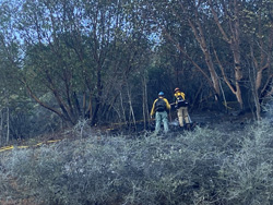 the dryness of the vegetation, the wind and topography, it spread beyond control. The landowner called 911 to report it, and then used their excavator to begin lining the fire. When firefighters arrived, they were able to build on that work and quickly stop the forward spread of the fire.
This is a great example of how to handle an escaped debris burn; the landowner had a water source at the ready, did what they could, and reported it by calling 911 right away. With the current lack of substantial rain, fuels are dry and ready to burn.

If you have debris burning to do, consider the following:
Only burn on a burn day. Call your county’s burn line to ensure you’re not breaking the law and starting an illegal burn pile.
Check the weather. If it’s warm, sunny and windy, consider putting off your debris burn until the next cloudy or rainy day- even if it’s a scheduled burn day.
Make sure you have any needed permits from your local fire department or district, and know the regulations associated with it.
Clear the area directly around your pile and make sure there isn’t any dry vegetation nearby that could cause it to spread.
Keep a water source nearby, such as a charged hose.
Never leave your burn pile unattended.
When you’re finished, extinguish your burn pile with water and dirt until you can’t feel any heat in the area. Check for heat with the back of your hand.
Monitor your prior debris burns. Extinguished piles can reignite months later in warm, windy conditions weeks after your burn.
No one thinks their debris burn will be the one that starts a fire. Please be aware of the current conditions and monitor your piles - it could mean one less wildfire in our valley this spring.
Additional information is also available online on our website, www.swofire.com, our Facebook page, @ODFSouthwest and our Twitter account, @swofire.
Thank you,
Natalie Weber
Public Information Officer
Oregon Department of Forestry
Southwest Oregon District
[contact phone withheld by request of ODF]
Online: www.swofire.com | Facebook: @ODFSouthwest | Twitter: @swofire
2/25/22 - "Study: Chance of extreme autumn fire weather up 40%"
Article by Vickie Aldous - Published Feb. 25, 2022, in the Medford Mail Tribune. An excerpt follows:
"Climate change [is] making falls hotter, drier: The likelihood of hot, dry autumn weather that can set the stage for severe fires in California and Oreon has increased 40% due to human-caused climate change, according to new computer modeling led by an Oregon State University researcher.
"The study looked at four areas in Oregon and California that suffered catastrophic wind-driven wildfires.
"Researchers found climate change actually decreased the risk of strong, dry winds in the fall during the two-year study period, but higher temperatures and dried-out fuels caused an overall jump in fire risk. [ . . . ]"
View article: https://www.mailtribune.com/top-stories/2022/02/25/study-chance-of-extreme-autumn-fire-weather-up-40/
COLDER TEMPERATURES PROMPT REMINDER TO BE FIRE SAFE WHEN HEATING YOUR HOME
News Release from Oregon State Fire Marshal - December 14th, 2021
SALEM, Ore. – With the cold months of winter upon the state of Oregon, the Oregon Office of State Fire Marshal would like to remind people to be safe when it comes to keeping warm and heating their homes.
In 2020, heating was the number two cause of home structure fires in Oregon. Firefighters across the state responded to 487 home structure fires or 17% of all fires where the cause was determined to be from heating
“As the temperatures drop and winter weather encourages us to spend more time inside it is important to heat your home safely,” Assistant Chief Deputy Claire McGrew said. “Every winter across the state we see house fires that could have been prevented. We want to remind Oregonians of simple home heating tips to protect themselves and their families this winter.”
When heating your home, the OSFM offers the following tips:
All Heating Types
Use heating equipment that has the label of a recognized testing laboratory.
Keep things that burn, such as paper, curtains, bedding, or furniture, at least three feet away from all heating equipment, including fireplaces, wood stoves, and pellet stoves.
Keep a three-foot “kid and pet-free zone” around all heating equipment.
Heaters
Use newer, portable space heaters with an automatic shut-off so they will shut off if they’re tipped over.
Clean them each year before using them and check for product recalls.
Unplug portable space heaters when not in use, before going to bed, or leaving the room.
Make sure fuel-burning heaters are designed for indoor use and are properly ventilated. Heaters not designed for indoor use pose a carbon monoxide risk.
Plug portable heaters directly into wall outlets, never into a power strip or extension cord.
Wood and Pellet-Burning Heating Equipment (fireplaces, wood stoves, pellet stoves)
Maintain heating equipment and chimneys by having them cleaned and inspected at least once a year by a qualified professional.
With wood stoves and fireplaces, burn only dry, seasoned wood. In pellet stoves, burn only dry, seasoned pellets.
Make sure the fireplace has a sturdy screen to stop sparks from escaping.
Place ashes in a metal container, soak with water and keep them at least 10 feet away from the home or anything that can burn. Dispose of the ash only after it is cool.
Another item OSFM asks Oregonians to do is check their smoke and carbon monoxide alarms monthly. These alarms should be installed on every level of your home (including the basement), inside each bedroom, and in the hallway outside each bedroom. Working smoke and carbon monoxide alarms save lives.
For more information about home heating safety visit OSFM’s Home Heating Safety Page.
FIRE SAFETY IN THE KITCHEN Posted 11/20/21
 Cooking is the leading cause (49%) of reported home fires and home fire injuries (42%) and the second leading cause (20%) of home fire deaths.
Unattended cooking is a contributing factor in 31% of home fires related to cooking equipment, 53% of the associated deaths and 44% of the associated injuries.
Thanksgiving is the peak day for home cooking fires involving cooking equipment, with more than 3 times the average number, followed by Christmas Day and Christmas Eve.
Do you know what to do if you have a cooking fire? What can you do to prevent one? Do you know the key dangers of frying a turkey, and how to avoid a turkey fryer fire? To learn more, visit:
The National Fire Protection Association - Public Eduction page: Cooking
The U.S. Fire Administration - Prevention: Cooking Fire Safety Outreach Materials
Meanwhile, practice fire safety in the kitchen, and "keep an eye on what you fry."
 Posted 11/7/21
Smoke Alarms
Some Statistics from the U.S. Fire Administration:
Three out of five home fire deaths result from fires in properties without working smoke alarms
More than one-third (38 percent) of home fire deaths result from fires in which no smoke alarms are present.
The risk of dying in a home fire is cut in half in homes with working smoke alarms.
Learn more: https://www.usfa.fema.gov/prevention/outreach/smoke_alarms.html
Which type of smoke alarm is preferable?
Because both ionization and photoelectric smoke alarms are better at detecting distinctly different yet potentially fatal fires, and because no one can predict what type of fire might start in a home, the USFA recommends that every home and place where people sleep be equipped with either (a) both ionization and photoelectric smoke alarms, or (b) dual sensor smoke alarms (which contain both ionization and photoelectric smoke sensors).
The location of a smoke alarm within a home may be more important than the type of smoke alarm present, depending on the location of a fire.
Learn more: https://www.usfa.fema.gov/about/smoke_alarms_position.html
Smoke alarms save lives. Smoke alarms that are properly installed and maintained play a vital role in reducing fire deaths and injuries.
If there is a fire in your home, smoke spreads fast and you need smoke alarms to give you time to get out.
A closed door may slow the spread of smoke, heat and fire. Install smoke alarms in every sleeping room and outside each separate sleeping area. Install alarms on every level of the home.
Smoke alarms should be interconnected. When one sounds, they all sound. Most homes do not have this level of protection.
Large homes may need extra smoke alarms.
Test your smoke alarms at least once a month. Press the test button to be sure the alarm is working.
Today’s smoke alarms will be more technologically advanced to respond to a multitude of fire conditions, yet mitigate false alarms.
People who are hard-of-hearing or deaf can use special alarms. These alarms have strobe lights and bed shakers.
When a smoke alarm sounds, get outside and stay outside.
Replace all smoke alarms in your home every 10 years.
More about installation and maintenance of home smoke alarms: https://www.nfpa.org/Public-Education/Staying-safe/Safety-equipment/Smoke-alarms.

The 2021 fire season is over
as of Wed. October 20th, at 9:00 am.
All restrictions on the public use of regulated equipment have been lifted.
Open burning is now allowed; remember to check with Jackson County's Burn line to make sure it's a burn day before you conduct a burn, at 541-776-7007.
The ODF also states that: "While fire season is officially over, fire prevention must continue. Please be vigilant while burning debris, ensuring that a burn pile is never left unattended. Also, please use caution while using machinery that could produce a spark. Fall weather in Southern Oregon can vary greatly. This region is extremely prone to fire, and for that reason, fire knows no season; please be aware that fires can still spread in fall and winter conditions." ODF's news release is posted on our Current Fire Restrictions page.
OREGON OFFICE OF EMERGENCY MANAGEMENT TO HOLD PUBLIC WEBINAR ON EARTHQUAKE AND TSUNAMI PREPAREDNESS
News Release from Oregon Office of Emergency Management - October 8th, 2021
What:
In advance of the Great Oregon ShakeOut drill on Oct. 21, the Oregon Office of Emergency Management is holding a public webinar on how to prepare for earthquakes and tsunamis in Oregon. OEM’s Geologic Hazards Program Coordinator Althea Rizzo will discuss the types of earthquakes that occur in Oregon; what to expect during a Cascadia subduction zone event; and what to do during an earthquake. The presentation will be followed by a Q&A session.
When:
10:30-11:30 a.m. on Oct. 14, 2021
Where: Zoom: shorturl.at/vBKMU
Or telephone +1 253 215 8782
Meeting ID: 873 8281 4594
Passcode: 088648
The webinar will be simultaneously aired live on OEM’s Facebook page and later shared on YouTube.
About the Great Oregon ShakeOut:
ShakeOut is a global event encouraging people to prepare for and practice how to be safer during an earthquake. This year’s official ShakeOut drill is scheduled for 10:21 a.m. on Oct. 21. At that time, wherever you are at that moment, you should drop, cover and hold on as if there were a major earthquake occurring and stay in that position for at least 60 seconds. You can also choose to hold your own ShakeOut drill: Pick another date and include people in multiple locations -- like home, work or school -- through video conferencing. Participating in the Great Oregon ShakeOut helps Oregonians reduce their risk in the event of a Cascadia earthquake and tsunami. The event also serves as a reminder to review and update emergency preparedness plans and supplies. More than 500,000 Oregonians have signed up for this year’s ShakeOut.
Public Contact: Public.Info@state.or.us
OCTOBER IS FIRE PREVENTION MONTH IN OREGON
News Release from Oregon State Fire Marshal
Posted on FlashAlert: October 1st, 2021
Nationally and in Oregon, firefighters respond each year to structure fires that injure or kill people where the smoke alarm is not functioning or is missing altogether. Residents understanding the sounds their smoke alarms make and what actions they can take to protect themselves can make all the difference. Smoke and Carbon Monoxide Alarms make different beeps and chirping noises to let us know that maintenance is needed. Everyone needs to know what each noise means and what actions you should take to keep your alarms in safe working order.
According to the ten-year data collected from the Oregon Fire Service for the National Fire Reporting System, 250 people have died, and more than 1,400 have been injured in structure fires. In addition, out of the structure fires reported since 2011, over 1,400 incidents reported smoke alarms missing, without adequate power, or disabled. Statistics from the past year show a working smoke alarm in 42% of the structures fires across the state, and 14% of the incidents report no smoke alarm at all.
Fire and Carbon Monoxide Alarms are good at telling us what they need. We just have to listen.
One chirp or beep means there is an issue with the alarm getting power.
Recurring beeps or three beeps in a row is the smoke alarm telling you it needs to be replaced.
If you noticed your smoke alarm is only activated when you’re cooking or using your shower, it might need to be moved to a better location.
If your smoke alarm is beeping continuously, get low, use your family escape route, and call 911 from a safe place outside.
“This year to mark Fire Prevention Month, the Oregon Office of the State Fire Marshal asks Oregonians to learn the sounds of their alarms,” says State Fire Marshal Mariana Ruiz-Temple. “Knowing the different sounds of your smoke alarm and what to do when it makes a certain sound is the key to saving lives; working smoke alarms save lives.”
On Monday, October 3rd, 2021, the OSFM and its fire service partners will be launching a four-week social media campaign #KnowYourBeepingAlarm to illustrate the importance of knowing what your smoke and carbon monoxide alarms are saying. Each week takes an in-depth look at the sound and what actions people can take.
The OSFM has also put together a smoke and carbon monoxide installation guide, which is available in six different languages and can be found on OSFM’s website.
For more information on the sounds smoke and carbon monoxide alarms make and proper installation, please visit the OSFM’s website. To get help installing a smoke alarm, contact OSFM at oregonsfm@osp.oregon.gov.
-###-
posted 10/1/21
Smoke Alarm Statistics, Tips and Other Alarming Info:
Three out of five home fire deaths result from fires in properties without working smoke alarms.
More than one-third (38 percent) of home fire deaths result from fires in which no smoke alarms are present.
The risk of dying in a home fire is cut in half in homes with working smoke alarms.
Choose interconnected smoke alarms, so when one sounds, they all sound.
Put smoke alarms inside and outside each bedroom and sleeping area. Put alarms on every level of the home.
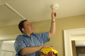
Make sure your smoke alarms work. Your family is not safe if they can’t hear the smoke alarms.
Test smoke alarms every month and replace 9-volt smoke alarm batteries at least once every year.
Smoke alarms do not last forever. Get new smoke alarms every 10 years.
When you hear a smoke alarm, you may have less than 2 minutes to get everyone outside and safe.
High-frequency tone smoke alarms are not effective in waking sleeping pre-teenage children:
Caregivers in your community need to know that pre-teenage children may not wake up to a high-frequency tone smoke alarm. Smoke alarms manufactured specifically to awaken pre-teenage children are not commercially available. When caregivers create their home fire escape plans, they need to consider this and make sure someone is assigned to wake pre-teen children.
Research from Nationwide Children's Hospital indicates high-frequency tone smoke alarms awaken only 56% of children and prompt 55% to “escape” from the bedroom.
Children sleep longer than adults and spend more time in slow-wave sleep, a sleep stage that requires the loudest noise to wake someone. This is especially problematic because data show that 31% of people killed in home fires are sleeping at the time of the fire.
Information from the U.S. Fire Administration. To learn more, see: https://www.usfa.fema.gov/blog/ci-093021.html
posted 9/28/21
Our new firefighting resources: Water tanks
Lisa Buttrey, CRFD's Emergency Preparedness Committee Coordinator, recently sent a letter, the 9/18/21 "Updater," to our residents informing everyone about our new water supply tanks project within the valley, in order to develop our firefighting resources. As her Updater explains, we also are looking for community donations to help support this project:
CRFD Updater 20210918

(Image from the Oregon State Fire Marshal's Office)
STATE AGENCIES URGE PROACTIVE ACTIONS AS EXCESSIVE HEAT WATCH ISSUED
News Release from Oregon Office of Emergency Management
Posted on FlashAlert Newswire: August 9th, 2021 3:59 PM
SALEM, Ore. -- The National Weather Service has issued an excessive heat watch for many parts of Oregon from August 10-14; dangerously hot conditions with triple-digit temperatures and minimal overnight cooling are possible throughout the state.
The Office of Emergency Management (OEM), Oregon Health Authority (OHA) and Oregon Department of Human Services (ODHS) urge the public to take proactive actions to help reduce the risk of heat-related illnesses that can lead to heat exhaustion and heat stroke. These lead agencies continue to coordinate statewide needs and resources and assess impacts to meet the needs of Oregonians. They are collectively sharing and amplifying heat-related messages to the public, encouraging Oregonians to stay safe and drink plenty of fluids, stay in air-conditioned rooms, take advantage of cooling centers, remain out of the sun, and check in on neighbors, friends and loved ones.
"We know excessive heat conditions can be extremely dangerous and must be taken seriously," said OEM Director Andrew Phelps. “We are asking Oregonians to pull together and prepare for the inevitable effects of high temperatures. Take time now to make a plan to stay cool as temperatures rise – make sure your plan includes connecting with friends, family or neighbors who may be susceptible to extreme heat and offering to help them access the resources they need. The simplest act to help can save lives.”
ODHS encourages people who need relief from the high temperatures to connect with 211 for information on cooling center locations, hours and transportation to the centers. Dial 211 and wait for the prompt to find hot weather-related resources, including a list of cooling centers by county. The 211 service will keep its prompt operating 24/7 for the rest of summer. Cooling center information is also available at 211info.org.
Oregonians should stay informed on the heat index and conditions when planning activities and find ways to stay cool and hydrated; the heat index measures how hot it feels outside when factoring in humidity with the actual air temperature. Individuals should also learn how to prevent, recognize and treat heat-related illnesses.
OHA provides several easily accessible resources for members of the public, local health departments and other organizations to assist ongoing outreach efforts to those most vulnerable to extreme heat events. The agency urges people to contact their primary care provider or visit an urgent care facility if they begin to experience heat-related illnesses such as heat exhaustion, heat cramps, sunburn, heat rash or other non-emergent medical care needs.
People over the age of 65 and those with a chronic medical condition, such as heart disease, high blood pressure, diabetes, cancer or kidney disease, may be less likely to sense and respond to changes in temperature. Also, they may be taking medications that can worsen the impact of extreme heat. People in this category should be closely monitored to make sure they’re drinking enough water, have access to air conditioning and know how to keep cool. Those who exercise in extreme heat or work outdoors are more likely to become dehydrated and get heat-related illnesses and should pay particular attention to staying as cool and hydrated as possible.
For more information, visit:
Preventing Heat-related Illnesses (OHA): https://www.oregon.gov/oha/ph/Preparedness/Prepare/Pages/PrepareForExtremeHeat.aspx
Extreme Heat (CDC): https://www.cdc.gov/disasters/extremeheat/index.html
Warning Signs and Symptoms of Heat-related Illness (CDC): https://www.cdc.gov/disasters/extremeheat/warning.html
# # #
You can get this document in other languages, large print, braille, or a format you prefer. View in Other Languages For assistance, call 971-719-1183 or email language@oem.or.us. We accept all relay calls, or you can dial 711.
ALERT: The Oregon Dept. of Forestry is asking anyone who sees smoke in the aftermath of the recent lightning storms to report it immediately to 9-1-1: "...new fires will likely emerge throughout the day as temperatures heat up. Residents in areas where lightning struck should report any smoke by calling 911."
ODF's 8/2/21 news release "Nearly 50 Fires Reported on ODF-Protected Land From Sunday Thunderstorm in the Southwest Oregon District" is available at: www.swofire.com.
8/3/21 update: "... Smoke from wildfires burning in Northern California remains in the air over Jackson and Josephine Counties. Information on general smoke reports can be found online at https://fire.airnow.gov/." (See ODF's website for complete update info.)
On Saturday, June 12th at approx. 12:00 pm, our Emergency Preparedness leaders conducted a TEST of our emergency notification text-alert system. Text-alerts went out to all neighborhood block leaders within our district, and from there, to all neighborhood block members who have agreed to participate in our text-alert emergency notification system.
If you are a district member not currently connected to a neighborhood block unit and wish to be included in our emergency preparedness system and receive emergency notifications, please contact our Emergency Preparedness Committee Coordinator, Lisa Buttrey (see the following post, "Emergency Preparedness," and the "Updater" letter for further information).
Emergency Preparedness
posted 4/22/21
Last September (9/28/20), Lisa Buttrey, CRFD's Emergency Preparedness Committee Coordinator, sent a letter ("Updater") to our residents summarizing CRFD's community emergency preparedness procedures.
This includes our Public Information Officer dedicated phone, social media information channels, neighborhood blocks and leaders, and our emergency preparedness phone tree and text alert systems.
We urge you to read (or to re-read) this letter - it is full of critical information that will help you to become better prepared and to know how to access local, real-time information in the event of a fire or other significant emergency.
The 9/28/20 Updater (pdf) is available on our Emergency Preparedness page.
Interdependent factors can influence WUI (Wildland Urban Interface) fire home survivability
"The WUI is the zone of transition between unoccupied land and human development. It is the line, area or zone where structures and other human development meet or intermingle with undeveloped wildland or vegetative fuels. Communities adjacent to and surrounded by wildland are at varying degrees of risk from wildfires."
"Learn how factors such as weather, terrain, building materials and property layout play a role in WUI fire home survival and the actionable steps that communities can take to reduce wildfire-related loss."
"What they [researchers] have found so far is that it is important to emphasize to community residents that there is not just one individual factor that can determine whether a home survives a wildfire; it is the relationship between everything on the landscape surrounding the home that can make a difference in whether a home survives or not."
Read the article: https://www.usfa.fema.gov/current_events/021021.html
For more, see https://www.usfa.fema.gov/wui/what-is-the-wui.html
For further information, visit the U.S. Fire Administration & Federal Emergency Management Agency online at: https://www.usfa.fema.gov/index.html.
WILDFIRE AWARENESS MONTH: HAVE A PLAN, BUILD A KIT AND BE READY TO EVACUATE (PHOTO)
News Release from Oregon Office of Emergency Management
Posted: May 24th, 2021
Downloadable file: wam-grabngo-anim.gif
Downloadable file: wam_2021_-_spanall-1200.jpg
Downloadable file: wam_2021_-_eng_all-1200.jpg
As Oregon continues to recover from the historic and destructive 2020 wildfire season, abnormally dry conditions and pre-season fires on the landscape are causing concern for the 2021 wildfire season. Now is the time for Oregonians to prepare themselves, their families and their homes for wildfire.
May is Wildfire Awareness Month, and the Oregon Office of Emergency Management (OEM) and partners are engaged in a month-long campaign to encourage, empower and inform Oregonians to help prevent and prepare for wildfire.
Being prepared starts with an emergency plan. As simple as a list of important contacts and knowing where to go in case of evacuation, emergency plans are more effective when they are practiced with household members.
Building an emergency kit or go bag that can be grabbed in a hurry is another way to prepare for disaster. “These are challenging times, and as we continue to rebuild after last year’s wildfires, it is more important than ever to prepare ourselves, our families and our communities against the threat of wildfire,” said OEM Director Andrew Phelps. “Gathering important documents to add to your go bag, talking about your emergency plan with your family, and signing up for local alerts are all small steps you can take now. These actions can make all the difference when disaster strikes and in the days that follow.”
It is also important to be familiar with “Ready, Set, Go” – a statewide evacuation system used to notify communities facing a threat, or potential threat, to lives and property. Oregonians can sign up for emergency alerts in their county to receive real-time evacuation notifications.
The “Ready, Set, Go” evacuation levels are as follows:
• Level 1 Evacuation means “BE READY” for potential evacuation. Community members should be aware of the danger that exists in their area and monitor emergency services websites and local media outlets for information. This is the time for preparation and precautionary movement of persons with special needs, and in some cases, pets and livestock.
• Level 2 Evacuation means “BE SET” to evacuate. Oregonians should be ready to leave at a moment’s notice, as this level indicates there is significant danger to the area. The public should be prepared to voluntarily relocate to a shelter or with family or friends outside of the affected area. They may have time to gather necessary items but doing so is at their own risk.
• Level 3 Evacuation means “GO.” Leave immediately! Danger to the area is current or imminent. If a person chooses to ignore this advisement, emergency services may not be available to offer further assistance. People should not stop to gather any belongings or make efforts to protect their home or shelter.
“Emergencies happen – Oregonians have certainly seen more than our fair share of them the past few years. But even as we continue to rise to the challenge, it’s critical that we prepare ourselves and our families for the next bad day. Prevention is key but being ready for wildfires we can’t prevent is a way we can reduce risk and help one another to be disaster survivors rather than disaster victims,” Phelps added.
OEM has an array of preparedness materials to help people plan for disasters, which are available through local county emergency management offices. One of these is “My Pocket Plan,” a mini booklet that provides a convenient place to store personal emergency information like work and school phone numbers, insurance information, medical contacts and prescription details. OEM’s My Pocket Plan also contains a list of basic emergency kit items and links to other disaster preparedness resources.
For information on what to include in an emergency evacuation bag, visit Redcross.org/get-help/how-to-prepare-for-emergencies/survival-kit-supplies.html.
OEM encourages people to prepare for all emergencies and be prepared to be on their own for a minimum of two weeks. For more information on how to be 2 Weeks Ready and other personal preparedness resources, visit Oregon.gov/oem/2WeeksReady.
For information on how to prevent and prepare for wildfire visit Keeporegongreen.org.
To learn more about how to receive local alerts in your area, contact your county emergency manager.
###
You can get this document in other languages, large print, braille, or a format you prefer. For assistance, call 971-719-1183 or email language@oem.or.us. We accept all relay calls, or you can dial 711.
YOU CAN MAKE A DIFFERENCE DURING WILDFIRE AWARENESS MONTH
News Release from Oregon State Fire Marshal - Posted May 3rd, 2021
The Office of State Fire Marshal wants to remind Oregonians that YOU are the greatest resource in protecting homes and neighborhoods. With some simple steps, you can protect your home and community from wildfire. Now is the time to prepare your home and your property for the 2021 fire season.
Remember to keep your defensible space defined, keep grass and weeds cut low and always be prepared to respond to wildfire. With this in mind, the Office of State Fire Marshal urges you to take a look around your property in the "home ignition zone," where glowing embers can ignite spot fires and vulnerable areas like decks, patios, and fences that can spread flames to your home. The most significant risk of structures catching fire during a wildland fire event is from the advancing ember shower that can reach your property long before an actual flame front.
Good defensible space can not only prevent ember ignition of your home, but it can also prevent the flames from reaching your home at all. We can reduce the vegetation within 30 feet of home and eliminate flammable plants from touching our home.
"Wildfire safety starts with all of us and our property. Now is the time to take action to prepare our homes, families, and communities for wildfires by starting on our property before there is smoke on the horizon," says Mariana Ruiz-Temple, State Fire Marshal.
To address the risk of wildfire, the Office of State Fire Marshal recommends the following steps that people can take right now to help protect themselves against the upcoming fire season:
Clear roofs and gutters of dead leaves, debris, and pine needles that could catch embers
Ensure your roof is in good repair
Move any flammable material away from exterior walls, i.e., mulch, flammable plants, leaves and needles, firewood piles
Remove anything stored underneath decks or porches
Give your home a non-combustible area where a fire in the landscape can't reach your home, strive for a 5-foot perimeter
Keep lawns and native grasses mowed to a height of four inches.
Remove ladder fuels (vegetation under trees) so a surface fire cannot reach the crowns. Prune trees up to six to ten feet from the ground; shorter trees do not exceed 1/3 of the overall tree height.
With firefighting resources doing their best to tackle large wildfires, communities that focus on neighborhood-wide Firewise ideals can not only increase an individual home's survival but the whole neighborhood's.
"A neighborhood-wide approach can increase the chances of homes surviving a wildfire. By taking a neighborhood approach to defensible space and community preparedness, you are also protecting our firefighters," Ruiz-Temple explains. "Ultimately, individuals taking the right steps on their property before fire season make firefighters safer and more effective," she adds.
Creating whole neighborhoods that are holistically preparing for wildfire is a large piece of Fire Adapted Communities. A fire-adapted community acknowledges and takes responsibility for its wildfire risk by taking actions to address resident safety, homes, neighborhoods, businesses and infrastructure, forests, parks, and open spaces all Oregonians enjoy.
For more defensible space tips, visit: https://www.oregon.gov/osp/programs/sfm/Pages/Wildland-Urban-Interface.aspx
During May, a new wildfire prevention topic will be introduced each week to help homeowners and recreationists learn how to prevent their outdoor activities from sparking the next wildfire. For more wildfire preparedness and prevention information, visit the websites for Keep Oregon Green at https://keeporegongreen.org/, the Oregon Department of Forestry's restrictions map https://www.oregon.gov/odf/fire/Pages/fireprevention.aspx, OSU's new Fire Program at https://extension.oregonstate.edu/fire-program and OSU's Oregon Wildfire Risk Explorer tool: https://oregonexplorer.info/topics/wildfire-risk?ptopic=62
####
First Saturday in May, 2021 - Wildfire Community Preparedness Day
The National Fire Protection Association's Public Education Campaign:
Missed May 1st? You can still make your home more resilient in the event of a wildfire:
"Wildfires across the United States have cost more than 100 lives and more than $25 billion in property losses in just the last two years. That’s why it’s so important to take steps to improve the wildfire safety of your home and community.
"PUT SAFETY FIRST. ON THE FIRST SATURDAY IN MAY. Take the first step by participating in Wildfire Community Preparedness Day on Saturday, May 1, 2021. There are simple things you can do in an afternoon or over a weekend that research shows will help your home survive a wildfire.
"Since in-person gatherings are limited or on-hold in many places, this year’s Prep Day is focused on what residents can do on and around their home to help protect against the threat of wildfires."
"PLAN YOUR PROJECT WITH THIS TOOLKIT." (Explains how to defend the Home Ignitiion Zone; includes a map of the successive ignition zones around an example home.)
For more information about preparing for wildfire and more, see https://www.nfpa.org.
3/28/21 - The Klamath-Siskiyou Wildlands Center, or KS Wild, has released a new guide entitled the "Forest and Fire Toolkit: Rural Living in the Siskiyou Mountains." This 28-page publication, free to download from kswild.org/forest-fire-toolkit, allocates the final section (Part 3) to "Preparing for Wildfire."
Part 3 covers: Fire in the Siskiyous, Living with Smoke, How to Prepare Your Home for Wildfire, Defensible Space, Home Hardening, Fire-Resistant Landscaping, Working on Your Land, Permits and Procedural Steps to Burning on Your Property, Emergency Preparedness ("plan and be ready for a wildfire emergency and evacuation"); Insurance, Post-Fire Checklist and Financial Assistance, and Funding Opportunities Aimed to Reduce Fire Risk and Hazard.
Other sections include "a resource directory of national forest districts, fire districts and more," how to "engage in public and industry forest decision-making," and other similar topics.
Without endorsing any particular land or forest management strategy, we encourage all landowners and residents to ensure defensible space around homes, outbuildings, etc., and to reduce fuels on woodland and/or forest properties. The guide provides up-to-date resources and information that can assist with these goals.
The Mail Tribune published a review of KS Wild's Forest and Fire Toolkit ("New guide offers tips for dealing with fire danger: Residents can take action before start of season" by Vickie Aldous) in the Fri. 3/26/21 print edition; an online version of the same ("Guide offers fire preparation tips," published Thurs. 3/25/21) is available at: https://www.mailtribune.com/environment/2021/03/25/guide-offers-fire-preparation-tips/.
2/28/21 - A video from a unique perspective, “Saving the Ranch: Wildfire Preparedness Tips from a Firefighter, Veterinarian and Ranch Owner,” is available on YouTube. This is very informative for anyone who lives rurally, as well as for animal owners. It's 30 minutes in length, and is very clear and coherent. It may seem too early for thinking about this, but planning ahead is what it’s all about: https://www.youtube.com/watch?v=31-QCHnmkYE&feature=youtu.be
CRFD Fire Chief Steve Avgeris receives the Oregon State Fire Marshal's 'Golden Sparky' Award

Our Fire Chief, Steve Avgeris, was recently recognized by the Oregon State Fire Marshal's Office with the very special Golden Sparky Award.
The Sparky Dog is the OSFM's mascot emblem.
This award is given to only one person each year among fire service personnel "for outstanding achievement in fire prevention or public fire safety education," and contributions to preventing fires and fire losses in Oregon.
Although the actual submission for Steve's nomination for the award had to come from a single individual, our entire Board of Directors unanimously recommended that Steve be nominated.
The nomination letter we sent accompanying the nomination form explaining Steve's qualifications for this award (as requested) is available here: Letter Nominating Chief Steve Avgeris for Golden Sparky Award, 8-15-2020 (pdf).
Photo (above, left): Steve with Sparky, Dec. 2020. The Golden Sparky Award plaque says:
2020 GOLDEN SPARKY AWARD
Presented to
CHIEF STEVE AVGERIS
Colestin Rural Fire District
For outstanding achievement in fire prevention
for the Citizens of Oregon
by
State Fire Marshal
October, 2020
Shortly after we were informed by the State Fire Marshal's Office of Steve's selection to receive the Golden Sparky Award, John Darling of the Ashland Daily Tidings interviewed Steve and wrote an article published as "Colestine [sic] fire chief receives honor"' in the print edition on Monday, November 30th, 2020; the article reads in part:
"Steve Avgeris has fought many a blaze in his 39 years as chief of the remote Colestin Rural Fire District, and now he just got the supreme honor for it, the Golden Sparky Award.
"The accolade, from the State Fire Marshal, honors all-volunteer fire organizations and is awarded to only one person a year in Oregon. It honors his whole career, since 1981, when he started the Colestin unit and began training an on-call force.
"Colestin Rural Fire District Board Chair Peggy Moore says the highly competitive award 'celebrates an amazing, selfless man who has devoted himself to the safety of our valley as fire chief [. . .].'"
The online version of the same article, "Colestin fire chief gets Golden Sparky Award," published Friday, Nov. 27th, 2020, is accessible at the following link:
https://ashlandtidings.com/news/top-stories/colestine-fire-chief-gets-golden-sparky-award
Note: A misprint in the article states that Steve "got his inspiration for backcountry firefighting from the 1981 Tunnel 13 fire near the Mount Ashland Interstate 5 exit, when he was 12." The Colestin Fire occurred in 1981; the Tunnel 13 fire happened in September, 1963, when Steve was 12 years old.
For those interested, a further look into Steve's background and the fire chief's responsibilities, originally published in the Winter 1999-Spring (April) 2000 edition of our CRFD Newsletter, is now available here: CRFD Fire Chief Steve Avgeris - and Fire Chief's Responsibilities (sidebar).
To learn more about the Colestin Fire that led to the formation of the Colestin Rural Fire District, see "The August 10th, 1981, Colestin Fire: A Retrospective" (below).
Fire regulations on outdoor burning increase throughout Jackson County
Posted 12/9/20: Jackson County has increased the fire regulations on outdoor burning. The increased regulations are in effect, and will remain in effect, until further notice:
Now, even though we are technically out of fire season, due to the air quality throughout the greater portion of the county, all residents wishing to conduct open burning or use burn barrels MUST contact Jackson County.
The number to call is 541-776-7007 where callers will receive a recording telling them whether or not they can burn that day.
This only affects burn barrels and open (outdoor) burning of slash or debris. It does not involve wood stoves, fireplaces, or any other indoor heating devices that utilze burning.
Fire Chief Steve Avgeris is required to enforce the regulations. If there are any questions, call Steve at: 541-488-1768 or (cell#) 541-821-8339.
11/18/20 - SHOUTIN' OUT: A special thanks to Kirby Rooker for helping our Chief, Steve Avgeris, determine the problem with the water pump on one of our fire trucks recently. Kirby is a master mechanic, amongst many other skills. He and Steve were able to fix the water pump, saving the District from having to purchase a new one. Thank you, Kirby, for your time and expertise, and for saving the District a lot of money!
ROGUE VALLEY/SOUTHERN OREGON FIRES:
9/18/20: The Almeda (Drive) Fire: Sweeping northward from Ashland through Talent and Phoenix on Tues. 9/8, this fire burned a total of 3,200 acres. As of Tues. 9/15, it was declared 100 percent contained. Thus far, the Jackson County Sheriff's Office has determined that three people died in the fire. 2,800-plus residential structures have burned, and 57 more were damaged; at least 100 businesses were also destroyed or damaged. (Structures include homes, businesses, outbuildings, and other structures; the exact numbers of each haven't yet been determined.) Estimates as of 9/17 are that at least 2,000 homes burned. One person has been arrested for starting a second fire near Medford that contributed to the blaze. The fire's origin near Ashland is thought to be human-caused; an investigation is continuing.
9/18/20: The South Obenchain Fire: Burning in northern Jackson County (east of Eagle Point near Butte Falls to Shady Cove), this fire has consumed 32,833 acres and is 35 percent contained. No human deaths have been reported, but 153 structures have been lost. Evacuation levels continue to be slowly downgraded as cooler weather has allowed firefighters to reinforce control lines on several sides, except for the east side which is in steep, rugged terrain where it is very difficult to operate heavy equipment. The fire's cause, while still under investigation, is considered "not suspicious."
9/18/20: The Slater Fire (from Happy Camp, CA to near Cave Junction along Hwy 199 in OR): Currently estimated at 143,092 total acres - 41,395 acres in Oregon - with 10 percent containment. To date, an estimated 150 structures have been lost near Happy Camp, CA.; no structures have been lost in Oregon.
9/18/20: For a summary of current Oregon fires and acreage burned, see KTVL News 10's article at: https://ktvl.com/news/more-than-1m-acres-have-burned-in-oregon-nearly-double-the-10-year-average-odf-says.
"Record-breaking heat in September combined with a rare wind event created the perfect storm for fast-moving fires in Southern Oregon and elsewhere in the state." (The Mail Tribune, 9/11/20, Numbers, A2)
The Almeda Fire: For anyone looking for fire recovery resources, or wishing to contribute to recovery resources, the City of "Ashland is coordinating local and regional resources, volunteers and donations with the regional emergency response network through roguevalley.recovers.org. Rogue Valley Recovers is the centralized site for needs, donations, and volunteers." For more information: https://www.ashland.or.us/Page.asp?NavID=18041
From KDRV TV, Medford - Sat. 9/12, 7:30 pm:
Air quality in our region, from Ashland down to Yreka, and encompassing much of the Rogue Valley, is now classified as 'Hazardous.' "The wildfires smoke is and will continue to impact air quality through the weekend. Air quality could be very bad at times in the days ahead. [. . .] For more, see https://www.kdrv.com/.
From the Mail Tribune, Medford, Thurs. 9/10:
"FEMA estimates 600 homes burned from Almeda Fire" and other fire news; see https://mailtribune.com/.
From Klamath National Forest, via Rogue River - Siskiyou NF, Supervisor's Office, Thurs. 9/10, 10:55 am: [file name says August, should say September (this is how tired and taxed resources are)]:
"This morning’s update from the CA IMT 10" (So. OR/no. CA fire southwest of Cave Junction down to Happy Camp; includes map - 2 MB): 2020 August 10--Slater Fire Morning Update_FINAL.pdf
From ODF, Wed. 9/9, 10:36 pm:
Update: South Obenchain Fire 9.09.2020
"EAGLE POINT, ORE. – The South Obenchain Fire, located north of Eagle Point and extending east towards Butte Falls, is estimated at 20,500 acres. The fire is primarily mountainous-forestland, but structures are threatened. Oregon Department of Forestry – Southwest Oregon District’s (ODF – SWO) day operations started a dozer line on the south end heel of the fire with efforts from 120 firefighters, 7 helicopters, and 1 large air tanker. Dry southeast winds pushed the fire towards Shady Cove resulting in the evacuation of 5000 residents. A spot fire that ignited near Reese Creek on Tuesday night has merged with the main South Obenchain Fire.
" Night operations will continue work on the south-end dozer line and begin a line towards Butte Falls Road. There are numerous Level 3 Evacuations for areas closest to the fire.. Verify evacuation levels: https://jcgis.maps.arcgis.com/apps/webappviewer/index.html?id=3caa39804db54631a61007180d-5ef415 or call the Jackson County Emergency Management Call Center 541-776-7338."
Winds remain strong, at 94-96.
From KTVL News 10, Medford:
As of 1:30 pm Wed. 9/9, "the South Obenchain Fire is now estimated at between 25,000 and 30,000 acres; all of Shady Cove is under evacuation Level 3" (Go immediately). [Other news sources report this fire at around 20,000 acres.] For more: https://ktvl.com/.
From KOBI5 NBC News, Medford:
11:18 am: "MEDFORD, Ore. – As traffic alert was issued by Medford Police Wednesday morning for Interstate 5. Police say the freeway is being shut down intermittently for retardant drops. Police say there is also a significant traffic back up on arterial routes, as people try to find a way around Highway 99, which remained closed Wednesday morning.
"Drivers are urged to find a different route to the east of I-5 or wait until the freeway reopens." For more: https://kobi5.com/.
From Rep. Pam Marsh, Oregon House Dist. 5 - Southern Jackson County, Wed. 9/9, 10:32 am:
"Advising Talent and Phoenix residents not to return yet:
"My heart goes out to each and every one of you who are impacted by this fire event and grappling with what to do next. As the morning rises on this tremendous devastation, we are all seeking information and news, but are unable to find many answers yet. I will do my best to share helpful resources and details as I learn more.
"For now, I am sending this message to advise that residents of Talent and Phoenix do not attempt to return home. The situation is still very dangerous. Water and power are down. Some roads are still closed. Please find a safe place to hunker down out of harm’s way.
"Please be safe and take care of each other."
From ODF Southwest Dist. Public Affairs Officer Kyle Novy-Riley, Wed. 9/9, 10:15 am:
South Obenchain Fire 9.09.2020
"JACKSON COUNTY, ORE. – At 1:52 p.m. the Oregon Department of Forestry – Southwest Oregon District (ODF – SWO) detected smoke six (6) miles East of Eagle Point. Due to yesterday’s east wind event, in addition to Southwest Oregon’s ongoing high-heat and low humidity, the South Obenchain Fire quickly grew to 8000 acres. The strong wind gusts carried embers near Reese Creek, where a 1000-acre spot fire ignited. Structures are threatened, and a structural task force is on scene. The Jackson County’s Sheriff’s Office issued Level 2 and Level 3 evacuations.
Verify your evacuation level at https://jcgis.maps.arcgis.com/apps/webappviewer/index.html?id=3caa39804db54631a61007180d5ef415
"At 6 a.m., ODF – SWO begun [sic] its day operations with approximately 120 firefighters, 7 helicopters, and 1 large air tanker; additional resources are expected. The team aims to draw a dozer line on the south face of the fire, and has established points of protections for a concentration of houses near highway 62."
[The above-referenced map also shows evacuation zones for the Ashland-Medford area.]
From the Oregon State Fire Marshal, Tues. 9/8, 10:22 pm:
"Gov. Kate Brown has declared the Alameda Fire in Jackson County a Conflagration.
"The Alameda Fire is currently threatening lives, structures and property in Jackson County, impacting the communities of Talent, Phoenix and Medford.
"The invocation of the Conflagration Act by Gov. Brown cleared the way for the State Fire Marshal to mobilize firefighters and equipment to assist local resources battling the fires.
The Office of State Marshal’s Blue Incident Management Team has been mobilized and will be leaving tonight for Jackson County.
"The deployment follows the deployment earlier today of the OSFM’s Green Incident Management Team to what is now called the Santiam Fire, in Marion County, and what is now called the Holiday Farm Fire, in Lane County, with the Red Team.
"Evacuation orders in Jackson County have been issue by the Jackson County Sheriff’s Office.
Currently, the state is seeing multiple fire starts. Strong winds and extremely dry conditions helped accelerate the growth of multiple new and existing fires in the last 24 hours statewide, impacting the Oregon fire service and state and federal wildland firefighting agencies throughout the state.
"Calls for assistance from impacted fire districts continue to be managed through the Oregon Fire Mutual Aid System.
"Additional updates for the incident may be accessed on the Oregon State Fire Marshal Facebook page: www.facebook.com/OregonStateFireMarshal/.
"Evacuation information in Jackson County can be found on the Jackson County Sheriff’s Facebook page: https://www.facebook.com/pg/JacksonCountySheriff/.
"To learn more about wildfire evacuation readiness, go to: www.oregon.gov/osp/programs/sfm/Pages/Wildland-Urban-Interface.aspx#evacuation."
From the Jackson County Sheriff via the Jackson and Josephine County Emergency Notification System, Tues. 9/8, 4:03 pm:
"Per the Jackson County Sheriff, all residents are asked to please stay home unless under an evacuation order. Avoid South County including Ashland, Talent and Phoenix. There are multiple fire operations and many first responder vehicles. Public traffic is creating dangerous impacts. Please stay home and avoid all active fire scenes. Thank you."
 GENERAL NOTICE: We are NOT hosting our annual Community Picnic this September due to the coronavirus public health pandemic and the continuing requirements to limit group gatherings, along with the need to practice social distancing and wear masks to keep everyone safe. While the Hilt Church is a wonderful venue for this event, there is no effective way to ensure the 6-foot minimum for social distancing, particularly during a barbeque lunch buffet with indoor table seating.
While we will miss seeing and visiting with our community members this September, rather than risk exposing anyone in our community to COVID-19, even inadvertently, we will instead look forward to seeing everyone at next year's event, once state health authorities have said that it is safe to do so.
Rogue Valley Emergency Resource Fair - Sat. Sept. 19th:
Jackson County Library Services will host the 6th annual Rogue Valley Emergency Resource Fair virtually, via Zoom and Facebook Live streaming, from 2 to 3:30 pm. Saturday, Sept. 19th. This all-ages event is free to attend. Learn how to keep yourself and your loved ones safe during a natural disaster or other emergency. Topics will cover:
Pet Safety and Evacuation - Linda Bacon from Southern Oregon Emergency Aid
First Aid - Mercy Flights Explorer Post 131
Earthquakes - professor Eric Dittmer, Southern Oregon University
Fire safety - Samantha Matheny, Medford Fire District No. 3
"Go-Bags" and emergency checklists - Stacey Belt, Jackson County Get Ready Rogue
To register, see https://jcls.libcal.com/calendar/jcls_event/EmergencyFair or call 541-774-8689. Zoom access is limited to the first 100 participants; log-in details will be provided upon registration. Registered participants will receive a free starter go-bag that they can pick up at the Medford, Eagle Point, Rogue River, or Ashland libraries in the week leading up to the event.
ALERT: The fire danger level is EXTREME as of Friday, July 31st, with a total shutdown on the public use of regulated equipment. "Triple-digit temperatures recently have increased the wildfire danger in forests and wildland areas..." See Current Fire Restrictions for details.
This year's fire season began on May 1st, a month earlier than normal. Fire managers
across our region anticipate a potentially serious (explosive?)
season. We are already in declared drought emergency status due to low rain and snowpack this past year, and long-range regional forecasts are indicating hotter than normal temperatures and lower than average rain through September. (See the National Interagency Fire Center's Predictive Services most recent "National Significant Wildland Fire Potential Outlook," released July 1st.) We are also in a state of emergency due to the COVID-19 threat.
Given these conditions, adhering to regulations is crucial this year. We can't control lightning strikes, but we can
each make a difference in limiting human-caused fires by being very vigilant and very careful
in all that we do, with the steady goal of getting through this season safely. Thank you for participating in fire safety and prevention.
Some key fire season resources:
“Before
Wildfire Strikes! A Handbook for Homeowners and Communities in Southwest
Oregon” is an excellent guide for
helping us all to prepare for and survive wildfire. See full post below.
What it means to 'harden your home' and how this can help protect you against wildfire. Full post below.
Posted 6/17/19, Re-posted 5/13/20 - CRFD member Lisa Buttrey shared the following article with us, documenting some key pointers about preparing for wildfire, evacuating, and recovering. The information is from another Colestin resident who got it from a gentleman who lost his family home in the Santa Rosa fire. These tips are the voice of experience that we can all afford a few minutes to benefit from.
Are you connected to CRFD's information channels? We have numerous ways you can receive local information including emergency incident updates (see the left-hand sidebar). Choose how you want to be contacted so you can stay informed. Learn more about our Public Information Officer and our emergency phone tree below.
EMPOWERMENT TIPS FOR WILDFIRE SEASON
News Release from Oregon Office of Emergency Management
Posted: June 1st, 2020
As Oregon heads into the 2020 wildfire season, there are actions each of us can do to prepare ourselves, our families and our homes.
Preparing your family in advance of an emergency is important. Oregon Office of Emergency Management encourages individuals and families to be 2 Weeks Ready - a tangible action that creates self-sufficiency for at least 14 days in the midst or in the aftermath of an emergency or disaster. Have a “go kit,” make an action plan and communicate the plan with your family.
In addition, be familiar with “Ready, Set, Go” emergency evacuation levels and sign up for emergency alerts in your county to receive evacuation notifications.
“We can all do our part when it comes to prevention and knowing what to do when wildfire threatens our home and our community,” said OEM Director Andrew Phelps. “In spite of the countless ways COVID-19 has changed our lives, these steps can help heighten levels of certainty and empowerment when it comes to personal safety.
The statewide evacuation system is used to notify communities facing a threat, or potential threat, to lives and property. Evacuation levels are as follows:
• Level 1 Evacuation means “BE READY” for potential evacuation. Residents should be aware of the danger that exists in their area, monitor emergency services websites and local media outlets for information. This is the time for preparation and precautionary movement of persons with special needs, and in some cases, pets and livestock.
• Level 2 Evacuation means “BE SET” to evacuate. You should be ready to leave at a moment’s notice as this level indicates there is significant danger to your area. Residents should be prepared to voluntarily relocate to a shelter or with family/friends outside of the affected area. Residents may have time to gather necessary items, but doing so is at their own risk.
• Level 3 Evacuation means “GO.” Leave immediately! Danger to your area is current or imminent. If you choose to ignore this advisement, emergency services may not be available to assist you further. Do not delay leaving to gather any belongings or make efforts to protect your home.
Each year, OEM partners with the Department of Forestry, the Office of the State Fire Marshal, Keep Oregon Green and other state agencies to promote wildfire awareness and preparedness. For more information on how to be 2 Weeks Ready, or other personal preparedness resources, visit www.oregon.gov/oem/2WeeksReady.
# # #
Posted: 19 May 2020
REMINDER:
"KS Wild is pleased to work alongside fire experts, restoration professionals, and indigenous eco-cultural specialists to bring you the Fire & Climate Summit - Webinar Series. We have two more important webinars remaining in the month of May. Please join us for both!
"The peoples native to southern Oregon and northern California have been using fire as an ecological caretaking tool since time immemorial. This next panel explores topics including the cultural landscape of the Klamath-Siskiyou ecoregion, fire ecology, indigenous stewardship practices, colonialism and its impact on the land and people, and climate change impacts. We have partnered with Lomakatsi Restoration Project who will be leading this upcoming webinar:
The First, Best Stewards: Aboriginal Fire and the Klamath Siskiyous
Wednesday, May 20th, 6:00-7:30 PM
"The rate of development in forested and fire prone landscapes has left homes and communities vulnerable—but you can protect your home from wildfire. In this final webinar of the summit we focus on defensible space and available resources to help landowners minimize fire threats to their homes and communities. We have partnered with Fairbanks Forest Management, Firesmart Merlin and the Natural Resources Conservation Service (NRCS) on this webinar. Tune in to learn how to access public resources to help protect your home from wildfire:"
Reducing Fire Hazards in the Wildland Urban Interface
Thursday, May 28, 7:00 - 8:00 PM
Webinars are being held using the online platform Zoom; panelists are professionals and recognized authorities in the subject area.
To learn more and to register, visit https://www.kswild.org/fire-climate-summit. Previous webinars from this Summit series are also available as audio recordings.
The Fire & Climate Summit was developed in collaboration with the following:
Lomakatsi Restoration Project, Southern Oregon Climate Action Now, Jackson County Fuel Committee, Northwest Forest Worker Center, Red Earth Descendants, Southern Oregon Land Conservancy, Vesper Meadow, Fairbanks Forest Management, KS Wild, and many partners with local, state, and federal fire and land management agencies.
ERA OF MEGAFIRES: "How do you want your fire? How do you want your smoke?"
Dr. Paul Hessburg's live in-person mixed-media presentation with North 40 Productions, hosted by a collective of fire and forest agencies in May, 2018 in Medford and Grants Pass, is available to view as a film at: https://www.north40productions.com/eom-home (2h 40m) or https://vimeo.com/137188036 (2h 59m). North 40 describes the film:
"What is the era of megafires? The rise of highly destructive megafires -- wildfires over 100,000 acres -- has become one of today's most pressing and complex problems. Our communities, homes, businesses and even our very way of life are threatened by them. Facing the reality of this issue can be nothing short of daunting. But like all wicked problems, through education we can change the way fire comes to our forests and communities.
"The Era of Megafires (EOM) is a multi-media presentation that combines the research of Dr. Paul Hessburg (Pacific Northwest Research Station, U.S. Forest Service) with the visual storytelling of award-winning film company, North 40 Productions. Utilizing animations, graphics and video vignettes, this presentation is designed to engage and inspire audiences, as well as provide an effective educational tool for organizations who are working tirelessly to improve the wildfire situation."
Watch the film trailer (2m 40s) at: https://www.youtube.com/watch?v=QtkmJ8h4E6g or https://vimeo.com/248070355.
An edited educational version (60m) of Era of Megafires is also available for purchase (download) at: https://educate.tugg.com/titles/era-of-megafires, which also hosts the film trailer (2m 41s). Tugg.com's film synopsis states:
". . . Join Dr. Hessburg as he tackles a variety of topics including fire's historical role on landscape, how forest management has led to significant ecological changes in our forests, the role of climate change, the rapidly expanding wildland urban interface (WUI) and a cohesive strategy for helping our forests become fire-resilient again."
Hessburg's TED talk (14:11), "Why wildfires have gotten worse -- and what we can do about it," is also available online at: https://www.ted.com/speakers/paul_hessburg. TED.com states that:
"Hessburg ... works for the USDA, Forest Service, at the Pacific Northwest Research Station, where he is stationed at a field laboratory in Wenatchee, WA, US. That's located about five blocks just east of heaven, he says. He has a doctorate in Forest Pathology from Oregon State University, and he has been working in forestry for 40 years. He's also an Affiliate Professor at the University of Washington, Seattle . . . Over the last two years, Paul has traveled and spoken to over 100 western US communities about the new era of megafires and what we can do about it."
WILDFIRE AWARENESS MONTH FOCUSES ON MAKING HOMES SAFE FROM WILDFIRE
News Release from Oregon State Fire Marshal
Posted on FlashAlert: May 4th, 2020 7:30 AM
May is Wildfire Awareness Month in Oregon, and federal, state and firefighting agencies are encouraging Oregonians to make sure their homes and property are protected from wildfire.
The Oregon Department of Forestry, Oregon Office of State Fire Marshal and Keep Oregon Green, in collaboration with Oregon forest protective associations, the Office of Emergency Management and federal wildland agencies, are taking this opportunity to promote defensible space around homes before fire strikes this summer. With many Oregonians spending more time at home because of statewide efforts to control the spread of COVID-19, residents can use the coming weeks to reduce risks and make their homes and communities safer.
“The roof is one of the most critical parts of the house when it comes to wildfire protection,” says Oregon State Fire Marshal Jim Walker. “Embers can collect and ignite on the roof, in gutters and enter unscreened openings around the house. Non-combustible roofing material is preferred. Regardless of the construction, please keep your roofs, gutters and eaves clear of all leaves, pine needles and other flammable debris.”
To reduce the risk, fire officials suggest removing dead vegetation a minimum of 30 feet around homes and other structures. In most cases, trees and healthy plants do not need to be removed. However, trees should be pruned and grass kept short and green to keep fire on the ground and more manageable by fire crews. Maintain a five-foot fire-free area closest to the home using nonflammable landscaping material and fire resistant plants.
“Defensible space is a property’s first line of defense against wildfire,” says Oregon Department of Forestry Fire Prevention Coordinator Tom Fields. “Creating and maintaining defensible space around homes can improve your property’s likelihood of surviving a wildfire. Having defensible space also makes it safer for firefighters who may have to defend someone’s home.”
Homeowners should also consider access issues for large fire trucks. Long driveways should be at least 12 feet wide, have 10 feet of vegetation clearance from the centerline out, and about 14 feet overhead. Large vehicle turnaround areas are critical for your safety as well as firefighter safety.
Should a fire occur near a community, Oregon Office of Emergency Management Director Andrew Phelps encourages residents to be prepared if an evacuation is necessary. “Wildfires can come without warning and move quickly, so residents need to prepare now in case they have to leave their home,” Phelps said. “Make sure to put together a ‘Go Kit,’ register for emergency notification systems in your community and make a plan where your family will go and how you will stay in contact if evacuated.”
It is the homeowner’s responsibility to protect their homes by building defensible space. For more information, visit the websites for the Office of State Fire Marshal, the Office of Emergency Management, Keep Oregon Green and the Oregon Department of Forestry, or call your nearest ODF or forest protective association office.
Additional information on preparing for wildfires can be found on the Ready.gov website.
-###-
Posted: 3 May 2020: Bridge work will occur on Spaulding Creek Rd. (off of lower Colestin Rd.) this month - those needing access can find more information on our Community Forum page.
FYI: I-5 EXIT 6 BRIDGE WORK
STARTS NEXT MONDAY (4/27/20)
From Gary Leaming, ODOT, News Release - 4/20/20
View ODOT's MAP of I-5 Exit 6 Bridge Work with lane closures and traffic routes during construction.
ASHLAND – I-5 Exit 6 bridge work begins next Monday south of Ashland, which will close the Old Siskiyou Highway (Oregon 273) for one week under the interstate bridges.
Beginning Monday, April 27 through May 3, ODOT contractor Carter and Company will remove the concrete deck on the northbound I-5 Exit 6 bridge. The old highway under the bridge will be closed for one week while the deck is removed, affecting local traffic. Associated closures will include the I-5 northbound off-ramp and the intermittent closure of the I-5 on-ramp.
After May 3, travel on the old Siskiyou Highway under the bridges will be controlled by flaggers as the contractor rebuilds the bridge deck.
Local traffic, including residents who live on Mt. Ashland Ski Road, Colestin Road and old Siskiyou Highway, will need to budget extra time due to out-of-direction travel. Depending on the closure, that might include driving south to Hilt to access I-5 or use Old Siskiyou Highway to drive into Ashland.
Once the bridge work is complete in mid-August, the contractor will repair the southbound I-5 travel lanes from milepost 6.5 to milepost 9. This work, which was originally scheduled for this spring but postponed due to the public health emergency, will be the main focus of construction until Oct. 15, when the project shuts down for winter.
Next year, the contractor will be back at Exit 6 to replace the bridge deck on the southbound lanes.
Interstate 5 traffic between MP 4.5 and 6.5 will see single lane traffic and delays during this work through mid-August. Speed limit in the work zone will be posted at 40 mph.
Work zone camera and cell phone technology will be in used to help drivers determine delays. That will be available at Tripcheck.com.
All work on the $26 million project is expected to be completed by the fall of 2021.
###ODOT###
For further details and background on this I-5 renovation project, see our Nov. 2019 article below, or see ODOT's Projects page for "I-5 California Stateline to Ashland Paving."
ALERT: FIRE SEASON COULD START IN EARLY MAY DUE TO ALREADY VERY DRY CONDITIONS
Posted: 4/22/20
While fire authorities across southern Oregon have been anticipating an earlier start to fire season, the Oregon Dept. of Forestry tipped its hand to the Jackson County Board of Commissioners, reported by the Mail Tribune* on Tues. 4/21/20, the same day that the Commissioners declared a local state of drought. They will next request Gov. Kate Brown to declare a "state drought emergency" for all of Jackson County.
In the article, County Administrator Danny Jordan states that "The area has received only about 65% of
its average precipitation and 75% of its average snowpack for the water
year, which starts in October..." Additionally, "the extended weather forecast for Jackson County projects higher
than normal temperatures and below average precipitation."
Jackson County Commissioner Colleen Roberts is also quoted, saying
that "county officials learned from the Oregon Department of Forestry
that the fire danger has already hit levels not normally seen until
summer... 'We're in mid-June conditions,' she said. ODF could
declare the start of the fire season as early as May 1, she said."
The article also points out what we wish we didn't already know so well: "Droughts lead to lower moisture levels in flammable vegetation like grass, bushes and trees, the early onset of fire danger and longer, more intense wildfire seasons."
Practicing fire safety, pro-actively creating or renewing defensible space, and maintaining vigilance, all with an eye to preventing fires before they can begin, will be extremely important this fire season.
These last few days before fire season is officially declared is time to take stock and prioritize anything you can do (without open burning) to minimize your exposure and vulnerability to wildfire, and to make plans for how you will respond to a wildfire event if it happens. Preparation now is everything.
*The article is available on the Mail Tribune's website as "Drought Declaration: A disaster on top of a disaster," by Vickie Aldous; however, it was not in the print version of the
paper on Tuesday.
ALERT: A ban on any form of outdoor burning is now in effect as of 12:01 AM Monday, 4/20/20 within the Colestin Rural Fire District.
Until 4/20/20, a regional burn ban was voluntary; for some districts, it may remain voluntary for now, based on local conditions, resources, and call volume. Other districts, including ours, are already very dry and functioning with a bare-bones crew; increasing temperatures will only increase our challenges.
Escaped burns are notorious in a season such as we are facing; an open burning ban ahead of the official start of fire season is an effective mitigating tool under these circumstances. A burn ban will help limit the number and scale of potential incidents we must respond to, as well as protecting anyone who may be fighting COVID-19 from additional respiratory issues.
Thank you for observing this regulation during the next several months, and for helping all those living here in our district to be as safe as possible.
NEWS RELEASE - from the OREGON OFFICE OF EMERGENCY MANAGEMENT
Posted: April 3rd, 2020
For more recent informtion, see the Burn Ban post above.
STATE AGENCIES ASK OREGONIANS TO VOLUNTARILY REFRAIN FROM OUTDOOR BURNING WHILE COMMUNITIES RESPOND TO COVID-19
"(SALEM, Ore.) — In response to the "Stay Home, Save Lives" Executive Order to reduce the effects of the COVID-19 virus, a coalition of Oregon state agencies are asking Oregonians to voluntarily refrain from conducting outdoor burning. [ . . . ]
Read the full news release: multi_agency_release_04032020.pdf
3/15/20 UPDATE:
FIREFIGHTER TRAINING HAS BEEN CANCELLED FOR NOW
Training was slated to start on Friday, March 20th and run every other week through spring into fire season. However, concerns about the spread of the coronavirus (COVID 19), as well as Influenza Type A and Type B (both are currently prevalent in Ashland), have forced public service agencies to cancel group events that could hasten the spread of these viruses; a recent fire interagency meeting has specifically advised against holding firefighter trainings. Accordingly, as of 3/15/20, CRFD's Firefighter Training has been cancelled.
We don't know at this time if it will be possible to convene training sessions later in the spring, or not. What is known is that the coronavirus curve of the number of identified cases has not peaked yet, and even when it does, social distancing and other containment measures will likely be in place for some time, to help prevent a resurgence. We will post any updates to this information if and when the situation changes.
For now, we are all advised to follow good basic hygiene practices, avoid touching the eyes, nose and mouth, clean and disinfect frequently touched surfaces, practice social distancing, and stay informed.
About the Coronavirus (COVID-19):
UPDATE - 3/24/20:
On Mon., March 23rd, Oregon Governor Kate Brown issued Executive Order 20-12, "Stay Home, Save Lives." The OFDDA (Oregon Fire District Director's Assn.) explains this Order in an email on 3/24/20:
"Governor Kate Brown has issued statewide Executive Order No. 20-12 "Stay Home, Save Lives" to help combat the impacts of COVID-19. This order directs residents to stay home to the greatest extent possible and comply with the social distancing guidance issued by the Oregon Health Authority. It expands the list of required business closures and prohibits shopping at specific categories of businesses for which close personal contact is difficult to avoid, such as arcades, barber shops, hair salons, gyms and fitness studios, skating rinks, theaters, yoga studios and others. It also closes any other retail businesses unless the business designates an employee or officer to establish, implement and enforce social distancing policies in order to remain open.
"The order also defines further workspace restrictions. All businesses with offices in Oregon shall facilitate telework and work-at-home by employees when possible. When telework and work-at-home options are not available, businesses and non-profits must designate an employee or officer to establish, implement, and enforce social distancing policies consistent with guidance from the Oregon Health Authority. Such policies must also address how businesses or non-profits will maintain social distancing protocols for business-critical visitors. Included below are links to the news release from Governor Kate Brown's office and a link to the most recent executive order. Also included are helpful links to state and federal resources.
"The Oregon State Police have issued a FAQ regarding enforcement of the Governor's Executive Order.
"Please remember to follow all local health authority, state health authority and CDC guidance on safe practices, social distancing and awareness for keeping yourself, your employees, the public and your families safe."
3/23/2020 - Governor Kate Brown Press Release - Executive Order No. 20-12
Note the mention at the top of page 2 regarding non-urgent health care procedures:
"On March 19, 2020, I ordered the postponement of non-urgent health care procedures, in order to preserve personal protective equipment and hospital beds for the state's COVID-19 emergency response efforts . . . "
Some resource links listed by the OFDDA (site or page links different than those at end of this post):
State of Oregon Resources
Oregon Coronavirus Information & Resources
Oregon Health Authority COVID-19 Updates
OHA Social Distancing Guidance
Guidance for Employers on COVID-19
Oregon Office of Emergency Management (OEM)
Federal Resources
Centers for Disease Control COVID-19
CDC Resources for Business and Employers
SBA Disaster Assistance
SBA Coronavirus (COVID-19): Small Business Guidance & Loan Resources
CORONAVIRUS (COVID-19) BASIC INFORMATION:
OHSU's Chief Medical Officer states that:
"The virus is most likely spread like other respiratory viruses, so the care that you would normally take to avoid catching the flu is a good start for preventing the spread of COVID-19. The best way for all of us to prevent the spread of the new virus is to practice good hand hygiene by washing your hands frequently, covering your cough or sneeze in your elbow and not your hands, and staying home when ill.
"If you have symptoms such as cough, runny nose, and fever, and your symptoms are mild, we recommend that you stay at home. Remember that it is cold and flu season, so there are many possible causes of these symptoms. If your symptoms are more concerning, please call your primary health care provider or [. . .] specialist (e.g., oncologist, cardiologist, etc.) before coming into a clinic, urgent care center or emergency room. Your primary care provider is your best resource for screening."
If you are experiencing possible symptoms, call your health care provider.
If you are experiencing a medical emergency, call 9-1-1.
ADDITIONAL SOURCES FOR RELIABLE NEWS & INFORMATION:
Jackson County Health & Human Services - News & Information: COVID-19:
https://jacksoncountyor.org/hhs/General/News-Information/category/covid-19
The Oregon Health Authority - Coronavirus (COVID-19):
https://www.oregon.gov/oha/PH/DISEASESCONDITIONS/DISEASESAZ/Pages/emerging-respiratory-infections.aspx or call 2-1-1 from a mobile phone, 503-222-5555 from a land line, or email help@211.com for general information
Oregon Office of Emergency Management - Oregon COVID-19 Response - Tools and Resources for Oregonians: https://storymaps.arcgis.com/stories/6c96b225a8424992b56e59400a30dab4
Oregon Health & Science University -Coronavirus and COVID-19 Resources for Oregon: https://www.ohsu.edu/health/coronavirus-resources
The Johns Hopkins Center for Health Security:
http://www.centerforhealthsecurity.org/resources/COVID-19/
Consumer Reports' Guide to the Coronavirus:
https://www.consumerreports.org/issue/coronavirus-covid-19
The Centers for Disease Control and Prevention: https://www.cdc.gov/ or call (800-232-4636)
The White House, CDC & FEMA joint website: https://www.coronavirus.gov/
The World Health Organization (WHO) - Coronavirus disease (COVID-19) Pandemic: (Incl. Protect yourself, Q&A on Coronaviruses (COVID-19), and Daily situation reports):
https://www.who.int/emergencies/diseases/novel-coronavirus-2019
FYI: ODOT plans I-5 road work in 2020 at Exit 6 (at Mt. Ashland Road and Old Hwy 99 near Callahan's restaurant):
The upcoming road work, recently announced by the Oregon Dept. of Transportation, includes replacing the aging I-5 bridge decks of both the northbound and the southbound lanes at Exit 6, where I-5 intersects the Mt. Ashland Ski Road and Old Hwy 99 on the other side near Callahan's Restaurant.
The bridge deck replacement is scheduled to occur in several stages this coming year, with travel during construction restricted to one lane only in each direction. This is one of many bridge replacement projects in the works statewide.
The road work done on I-5 south of Ashland in 2019 was only the first of three seasons of planned upgrades on the section between Ashland and the OR/CA border; the section from milepost 11 to 9 now has new reinforcing steel and concrete that replaced the worn and damaged concrete installed over 30 years ago.
The next phase is a major renovation to the bridges at Exit 6 that pass over the Old Siskiyou Highway: both bridge decks will be completely replaced, including new concrete and steel reinforcing bar, with new decks from the horizontal beams up.
Because this is in the snow zone, construction is limited to late spring through fall. The impact to travel during construction will be similar to the first phase last year, with one-lane travel each way.
Specifically: "that means both directions of traffic will be moved onto one bridge. With two lanes of traffic running head-to-head, separated by a concrete barrier, precautions are being made for trucks with loads wider than 12 feet.
" 'A temporary on-ramp will be constructed from old Siskiyou Highway as a way for over-wide southbound trucks to bypass the narrow bridge width,' said [ODOT Consultant Project Manager Chris] Hunter. ... Those oversized loads will divert onto the Exit 6 southbound ramp and then back on at the temporary ramp. Traffic coming north on Old Siskiyou Highway will need to stop for that traffic.
"During bridge demolition, traffic under the bridge will be closed temporarily for safety. That will result in some out-of-direction travel for residents living on both sides of Interstate 5 near the summit. Residents east of I-5 may need to use Old Siskiyou Highway to Oregon 66 for a time to travel north. Those on the west side of the interstate may need to drive south to Hilt, California and back north toward Ashland."
For further details, see I-5 CA Border/Ashland Paving at ODOT online at: https://odotmovingahead.com/2019/11/i-5-ca-border-ashland-paving/
or see ODOT's November 2019 Moving Ahead printed edition (pages 24-27, with graphics) online at: https://issuu.com/southernoregonmediagroup/docs/1115od00a00/24?mode=window.
Local fire history presentation: 1/8/20 in Ashland, 1/15 in Medford:
"Chris Chambers will kick off the 11th year of Windows in Time local history presentations with “Fire History: Indigenous Burning to Recent Wildfires, What Have We Learned?” on Wednesday, January 8 at the Ashland Library [in the Gresham Room], 410 Siskiyou Boulevard and Wednesday, January 15 at the Medford Library, 205 South Central Avenue, from 12 noon–1:00 p.m. at both locations. [ . . . ]
"Chris Chambers of Ashland Fire & Rescue will present a look at the state of wildfires and forests, exploring how we got here and what we need to learn from traditional ecological knowledge of indigenous tribes of the area along with recent science to help us chart a new path to resiliency in a changing climate."
The hour-long presentation is free and open to the public. For more, call 541-774-8679 or see jcls.org; for complete event information, see https://jcls.libcal.com/event/5799958.
POST-FIRE SEASON NO OPEN BURNING RESTRICTION LIFTED:
The 2019 fire season ended October 1st. All remaining fire season restrictions were lifted at that time. However, due to the significantly long period of recent dry weather, a ban on open burning was reinstated within the Colestin district on Oct. 31st.
The post-fire season ban was lifted as of 8:00 am on Wednesday, Nov. 20th. Our new "OK to burn" green signs have replaced the red "No Open Burning" signs that were previously up.
Recent weather conditions coupled with lower temperatures have lowered the fire danger level sufficiently to allow for our Fire Chief, Steve Avgeris, to lift the ban earlier this week. While the recent weather system did not drop much rain, moisture at this time of the year does not dry out as easily; shorter days and lower temperatures help to lessen fire activity and out-of-control fires.
Since we are still experiencing some dry weather, please continue to use caution in all activities where there may be a fire risk, particularly with any open burning.
Please also bear in mind that, although we appear slated for a more typical wet pattern in the weeks ahead, that isn't guaranteed. Any time during the off-season that weather and fire danger conditions render it necessary, the No Open Burning signs could go back up. Any such changes will always be posted here on our website.
Thank you for observing and abiding by the recent post-fire season restriction, and for your continued participation in fire prevention. See current fire danger restrictions for additional information.
Lightning Fires Updates:
[9/6/19] - ODF Crews Continue to Extinguish Lightning-Caused Fires
"Multiple new fire starts have been discovered following a thunderstorm that passed over the Rogue Valley early Thursday morning. In Jackson County, crews have been dispatched to 27 reports of lightning-caused fires, and 19 in Josephine County. Of the 46 total, 26 are extinguished, and crews are responding to three and actively mopping up six. The additional reports of fire were either unable to be located, or on lands not protected by the Southwest Oregon District; in these cases, crews worked on the fire until the appropriate agency arrived on scene to take over.
"While this storm produced numerous fire starts, crews were able to catch them all quickly, resulting in approximately 25 acres burned across both counties.
"On Friday, crews will remain engaged on the few active fires, with a focus on the largest, the Bunker Creek Fire in northwest Josephine County, at an estimated 20 acres.
"While temperatures are predicted to be cooler in the next few days, fires originally sparked by lightning may ignite and flare up in the coming days and weeks. Reconnaissance flights will be conducted every day until crews fly three consistent days free of reports of smoke or fires.
"The public can also play a role in helping keep our area fire-free; Any smoke seen around the valley should be reported to an ODF office or 911 in an emergency. Updates are available on our website: www.swofire.com and our Facebook page: @ODFSouthwest.
[Photo included with this news release is not shown here; see ODF's blog.]
[9/5/19] - Overnight Thunderstorms Spark Numerous Small Fires
"Oregon Department of Forestry Southwest Oregon District firefighters have been responding to several reports of small lightning-sparked fires as a result of overnight thunderstorms in Southern Oregon. Between Jackson and Josephine Counties, more than 30 reports of potential fires have been received by our dispatch centers, and crews have confirmed 18 fires, extinguishing five. Another six reports have not been confirmed, and crews will be dispatched to those potential incidents when current assignments are wrapped up.
"In Jackson County, the majority of fires are reported on the east side, ranging from the California-Oregon border to Grizzly Peak and Butte Falls. In Josephine County, fires range from the Applegate Valley to Deer Creek, Sexton Mountain and Wolf Creek. The largest is south of Butte Falls, estimated to be ¾ of an acre.
"More than 100 firefighters between both counties are available and responding to these reported fires. Resources available include engines, crews, and aircraft. All staff will remain engaged into this evening, when another system may bring additional thunderstorms through the Rogue Valley. As the weather begins to warm up, fire starts from lightning have the potential to flare up in the heat, and new starts may materialize. All staff at the Oregon Department of Forestry Southwest Oregon District are prepared to respond to these reports.
"Updates are available on our website: www.swofire.com and our Facebook page: @ODFSouthwest."
###
Multiple lightning-sparked fires are also burning on The Rogue River Siskiyou National Forest:
[Sat. 9/7/19 8:08 AM] RRSNF Update on Fires from September 5 Lightning Storm
SW Oregon, September 7, 2019 7:30 a.m.--This is an update on small initial attack fires as reported earlier on September 6.
A new update on the Gopher Fire will be released after today’s briefing. Current acreage is 230 acres and fire personnel continue to employ full suppression strategies.
Updated information on previously-reported fires:
Middle Fire in the High Cascades Ranger District's Sky Lakes Wilderness, located approximately 2 miles northwest of Red Lake. This fire is 100% contained with heat in the interior.
Needle Fire on the High Cascades RD is 1/10 of an acre in size, and is located approximately 1 mile south of Jim Creek Campground. This fire is mopped up, controlled and will be in patrol status.
Buck Peak Fire on the Wild Rivers RD is 1/10 of an acre in size, and is located near the north boundary of the Oregon Caves National Monument and Preserve. This fire is showing no smoke and is in mop-up status.
Elder Fire on the Wild Rivers RD is ½ acre in size, is currently in mop-up status and contained.
Ramsey Creek Fire on the Wild Rivers RD is 1/10 of an acre in size, and is approximately 2 miles from the Forest Boundary, east of Slate Creek Road. This fire is controlled and in patrol status.
Lake Mountain Fire on the Siskiyou Mountains RD is ½ an acre in size, and is in the mop-up phase with patrols monitoring for interior smokes. The fire is located on the eastern edge of the Oregon Caves National Monument and Preserve boundary.
Flumet Fire on the Siskiyou Mountains RD is ½ an acre in size, and located approximately ½ mile south of Little Grayback Peak. The fire is showing no smoke and is controlled.
Rogue Valley Interagency Dispatchers continue to move resources across the Forest to assist with smoke checks, mop-up, patrols and suppression efforts where needed. There are currently 176 firefighters working across the Forest doing protection.
###
[9/6/19] "SW Oregon, September 6, 2019 – The RRSNF continues its initial attack response to various fires across the Wild Rivers, Siskiyou Mountains, and High Cascades Ranger Districts. Thus far, there have been 18 starts or smokes reported across those three districts, with all but one (the Gopher Fire) measuring less than 1/2 an acre. Additionally, those 18 all have resources that have responded, or are on their way. [ . . . ]
"The RRSNF wants to remind the public that, at this time, there are no closures in place that would pose issues for those wishing to recreate on the National Forest this weekend. However, conditions can change, and the public are encouraged to follow the RRSNF on Facebook for updates, or to check the RRSNF website for alerts and closures prior to venturing out.
"Smoke may be visible in areas near fires. Additionally, winds may push smoke from fires in Northern California into southwest Oregon. Public can track air quality through the Oregon Smoke Blog. [ . . . ]
###
[9/5/19] RRSNF Continues Initial Attack Response Following Most Recent Lightning Strikes
"SW Oregon, September 5, 2019 – Resources continue to respond to new fire starts following the storm that brought with it nearly 800 lightning strikes across the Medford Weather Service's forecast area.
"On the RRSNF, there have been 7 confirmed fires thus far, all of which are staffed and less than 0.5 acre. Those seven fires include [ . . . ]
For updates and to read the full news releases excerpted above, see the RRSNF's News & Events web page.
###
Please watch for smoke as well as possible fires during the next few days. Remember that fires do not always become visible right away, especially following rain; "sleepers" may take several days after igniting to grow into active fires. Report all fires and suspicious smoke to 9-1-1.
Posted 6/17/19 - CRFD member Lisa Buttrey shared the following article with us, documenting some key pointers about preparing for wildfire, evacuating, and recovering. The information is from another Colestin resident who got it from a gentleman who lost his family home in the Santa Rosa fire. These tips are the voice of experience that we can all afford a few minutes to benefit from.
[NOTE: FIREWORKS ARE ENTIRELY PROHIBITED WITHIN OUR DISTRICT. THE USE OF FIREWORKS AS DESCRIBED IN THE FOLLOWING ARTICLE ASSUMES THAT THE USE IS OCCURRING IN TOWN AT A FRIEND'S OR OTHER PLACE WHERE USE IS SAFE AND PERMISSIBLE.]
 Click here for a fireworks safety graphic from the U.S. Fire Administration.
Reminders:
* The best way to stay safe from fireworks is to not use them. Instead, attend a public fireworks display put on by professionals.
* Fireworks are dangerous to people and pets. Using them puts your property at risk.
* Hand-held sparklers burn at 1,200 F. Remember, wood ignites at 356 F and burns at 575 F.
HELPING OREGONIANS KEEP IT LEGAL AND KEEP IT SAFE WITH FIREWORKS
News Release from Oregon State Fire Marshal
Posted on FlashAlert: May 31st, 2019 4:33 PM
The Office of State Fire Marshal, Oregon Fire Service, natural resource agencies, Oregon licensed fireworks wholesalers, and safety experts encourage Oregonians to “Keep it Legal and Keep it Safe” when using fireworks.
The 2019 Oregon fireworks retail sales season opens June 23 and runs through July 6.
“To help inform Oregonians about the safe and legal use of fireworks in Oregon before legal fireworks sales begin, our office has prepared fireworks safety and education materials,” said Mark Johnston, assistant chief deputy fire marshal. “The downloadable items will help Oregonians understand what fireworks are legal to use in Oregon without a permit, where they are permitted to be used, and the important safety steps to take when using fireworks. We want Oregonians to share this information with their friends, families, and neighbors.”
The OSFM will also reach out to its fire service and other partners to share the information on their social media sites. OSFM’s fireworks materials can be found on its website.
The OSFM encourages everyone to use the four BEs of safe fireworks use:
* Be prepared before lighting fireworks: keep water available by using a garden hose or bucket.
* Be safe when lighting fireworks: keep children and pets away from fireworks.
* Be responsible after lighting fireworks: never relight a dud. Wait 15 to 20 minutes then soak it
in a bucket of water before disposal.
* Be aware: use only legal fireworks and use them only in legal places.
The OSFM website also features FAQs for commonly answered questions about the sale and legal use of consumer fireworks, permits for the retail sale of fireworks, and state rules for their use and enforcement activities.
Remember, officials may seize illegal fireworks and charge offenders with a class B misdemeanor, which could result in a fine of up to $2,500 per violation and a civil penalty of up to $500. Those who misuse fireworks or allow fireworks to cause damage are liable and may be required to pay fire suppression costs or other damage. Parents are also liable for fireworks damage caused by their children.
Despite their regulated sale and use, fireworks in Oregon represent a public safety and health threat every year. For the last reported five years through 2018, there were 1,264 reported fireworks-related fires in Oregon, resulting in more than $3.5 million in property damage. During that same period, fires resulting from fireworks resulted [in] one death and 26 injuries.
-###-
5/17/19 - Rogue Valley Citizen Alert Test Scheduled For Wednesday, May 22nd:
"This is an annual test of our Emergency Notification System. The test is scheduled to begin at 10 a.m.
"... Signing up for Citizen Alert enables you to receive timely notifications wherever you are. Jackson and Josephine County Emergency Management will not share your information with anyone. Your information is only used to send you emergency information, and (if you choose) important community alerts.
"To sign up for Citizen Alert, visit Rogue Valley Emergency Management at www.RVEM.org."
To learn more about the alert system, view RVEM's 5/17/19 news release.
WILDFIRE AWARENESS MONTH PUTS SPOTLIGHT ON MAKING HOMES SAFE FROM WILDFIRE (VIEW PHOTO OF A HOME WITH DEFENSIBLE SPACE)
News Release from Oregon State Fire Marshal
Posted on FlashAlert: May 6th, 2019 8:26 AM
May is Wildfire Awareness Month in Oregon, and federal, state and firefighting agencies are encouraging homeowners to make sure their homes are protected from wildfire.
The Oregon Department of Forestry, Oregon Office of State Fire Marshal and Keep Oregon Green, in collaboration with Oregon forest protective associations, the Office of Emergency Management and federal wildland agencies, are taking this opportunity to promote defensible space around homes before fire strikes this summer.
“The roof is the most critical part of the house when it comes to wildfire protection,” says Oregon State Fire Marshal Jim Walker. “Embers can collect and ignite on the roof, in gutters and enter unscreened openings around the house. Although non-combustible roofing material is preferred, regardless of the construction, keep roofs, gutters and eaves clear of all leaves, pine needles and other flammable debris.”
To reduce the risk, fire officials suggest removing dead vegetation a minimum of 30 feet around your house and other structures. In most cases, trees and healthy plants do not need to be removed. However, trees should be pruned and grass kept short and green to keep fire on the ground and more manageable by fire crews. Maintain a five-foot fire-free area closest to the home using nonflammable landscaping material and fire resistant plants.
“Defensible space is a property’s first line of defense against wildfire,” says Oregon Department of Forestry Fire Prevention Coordinator Tom Fields. “Creating and maintaining defensible space around homes can improve your property’s likelihood of surviving a wildfire. Having defensible space also makes it safer for firefighters who may have to defend someone’s home.”
Homeowners should also consider access issues for large fire trucks. Long driveways should be at least 12 feet wide, have 10 feet of vegetation clearance from the centerline out, and about 14 feet overhead. Large vehicle turnaround areas are critical for your safety as well as firefighter safety.
Should a fire occur near a community, Oregon Office of Emergency Management Director Andrew Phelps encourages residents to be prepared if an evacuation is necessary. “Wildfires can come without warning and move quickly, so residents need to prepare now in case they have to leave their home,” Phelps said. “Make sure to put together a ‘Go Kit,’ register for emergency notification systems in your community, and make a plan where your family will go and how you will stay in contact if evacuated.”
It is the homeowner’s responsibility to protect their homes by building defensible space. For more information, visit the websites for the Office of State Fire Marshal, the Office of Emergency Management, Keep Oregon Green and the Oregon Department of Forestry, or call your nearest ODF or forest protective association office.
Additional information on preparing for wildfires can be found on the Ready.gov website.
-----------------
CRFD'S NEW EMERGENCY INCIDENT PUBLIC INFORMATION OFFICER
The following letter was recently written and mailed out to our community residents by Lisa Buttrey, CRFD's Emergency Preparedness Committee Coordinator (amongst several other hats) announcing our new emergency incident Public Information Officer position and related information channels now available to the public during a fire incident or other emergency:
Colestin Rural Fire District
UPDATER
March 4, 2019
Dear Colestin Rural Fire District Residents,
In the months since the Klamathon fire, many CRFD volunteers and community members have been
hard at work improving our readiness in case of emergency.
One major focus has been to improve communication with District residents. We are happy to
introduce the new post of CRFD Public Information Officer (PIO). Perhaps some of you have been on
the email list of the PIO for Oregon Department of Forestry. If so, you know how valuable this service
is to keep the public in the loop as events unfold. The CRFD PIO will work with public agencies and
leadership on the fire to pass official information to three main outlets for the Fire District. The PIO
will also be available to residents during an emergency. The phone number is 541-880-8350.
Please make a note of this PIO phone number, add it to your contacts now - in case of emergency!
In the event of an emergency, the fire district website www.crfd.org will be updated with all new
information coming from the PIO. We now offer social media outlets as well: Facebook page
Colestin Rural Fire District and find us on Twitter @ColestinD. All three outlets will be posting official
information only and as such will be the go-to for the latest facts.
Please make a note of these information outlets, visit them now, book mark them - in case of emergency!
Lastly, with the help of dozens of leaders and co-leaders, our 13 “neighborhood blocks” have been
getting more and more organized and the District-wide emergency phone tree is nearly complete. The
13 neighborhoods were established some years ago as a way to promote household and
neighborhood emergency preparedness, including an emergency phone tree. If you are not aware of
your neighborhood block leader, please contact Lisa at 541-821-5479. Participation is voluntary
but if you want to be notified of emergency by the PIO in an alert text and be part of your
neighborhood alerts and activities, we need your info.
Without a doubt, we are very fortunate as a Fire District to have so many community members who
are willing to volunteer their time in so many different capacities - to help protect our lives and homes
and to prepare for emergency, hoping our preparations are never tested.
As ever, we need and welcome volunteers and there are many ways to serve!
To an uneventful fire season!
_______________________
Some additional background: Our new PIO position is partly in response to the communications gaps experienced by many of our community members during the July 2018 Klamathon Fire that came harrowingly close to decimating our district, and the need to more effectively get accurate, up to the minute information out to our community in a variety of ways, as well as a way for residents to contact us for information where the action is actually happening. The PIO will also function as the liaison to general public media outlets when necessary, following the media liaison "best practices" of ODF, CalFire and similar fire agencies.
Board member Tod Davies has been appointed by the Board as our PIO, with Board member Pam Haunschild and Lisa Buttrey as back-ups. This structure is intended to ensure an informational liaison with the community and with outside agencies during any emergency incident that will get and communicate immediate on-the-scene information directly from our fire incident command (Fire Chief Steve Avgeris) without requiring the incident command's involvement in these communications, allowing the Chief to focus on his job without distraction (and without having to take calls on his cell phone) while the PIO relays information from and for him to the community and to our media outlets. The PIO office will never pass along any information that has not been vetted by either Steve or by another fire agency involved in the incident response, ensuring that the information remains accurate and reliable.
As described in the above letter, the PIO's outlets also include Twitter and Facebook, managed by our social media team: Karen Dwyer, Sherrie Bolin, and Tod Davies in our district, and Melissa Cano, previously ODF's PIO, currently the City of Medford's Emergency Manager. The public is not able to post on these social media accounts, in order to keep the chain of information accurate ("clean") and undistorted.
Stacy Belt, the Jackson County Emergency Manager, and Melissa Cano have both stressed to our PIO members who met with them that "we are a volunteer operation, and that their [community members'] safety is primarily their responsibility--no one should wait for word from us to take action on their own behalf if an emergency situation occurs." In other words, as a volunteer fire district, we will not be initiating contact with our community members; that is the purpose of the community emergency response phone tree. We will be providing emergency incident information through these new channels; it is up to everyone within our district to check them for information whenever an emergency situation occurs.
UPDATE: YOUR FIRE INSURANCE and CRFD'S NEW ISO UPGRADE
25 Jan. 2019
A word from our Board Chair:
"Chief Steve Avgeris just received a formal notification from the ISO that CRFD is now a Class 8 B rather than a Class 9. What this means to all residents of both the Colestin Rural Fire District and the Hilt Fire Company is that all insurance premiums will be reduced by your insurance company.
"A copy of the letter from the ISO is attached so that you may copy it and present it to your insurance carrier so that your reduction in premiums can go into effect.
"This is a HUGE DEAL. We originally were a Class 10 which is like having no insurance and when we were able to move to a class 9 years ago, it resulted in less premiums and the community was very excited. Moving to an 8B is even better.
"The CRFD Board will be reviewing this information at its next meeting to be sure that we can meet the personnel requirement for responses to structure fires. There is a minimum that is required by the ISO for maintaining an 8B which if not met can result in our loosing that status which would be almost impossible to ever achieve again.
"The Board wants to be sure the residents are willing to step up and train and respond to calls in order to continue to qualify for this rating level. If we don’t believe we can do this, we will not accept the new rating.
"So while this is EXCELLENT NEWS and will benefit all insurance carrying residents in the Valley and in Hilt, we need to do our part in keeping the agreement that accompanies this classification.
"A HUGE thanks to Chief Avgeris whose work with the ISO to make this happen is much appreciated. Without the diligence of Steve and the care from the Board of purchasing necessary equipment to meet the requirements this would not happen.
"More information to come. Please keep checking the website where relevant information will be posted."
Peggy Moore
Board Chair
The letter to our Fire District from ISO Manager Alex Shubert formally notifying us of the upgrade from a Class 9 ISO rating to a Class 8B is available immediately below (a 2-page document in two pdf pages).
This letter can be provided as verification of the ISO upgrade to your insurance carrier:
ISO PAGE ONE ISO PAGE TWO
2019 Living on Your Land - Short Course:
OSU's new eight-week course for land stewards starts Thurs. April 26th (6-9 pm) and includes two Saturday Field classes (June 1 & 29, 9-4pm) and weekly online self-paced lessons. This year's program will be held at the Southern Oregon Research & Extension Center at 569 Hanley Rd., Central Point.
Topics will include: "wildfire risk reduction*, woodland management, encouraging and controlling wildlife, stream ecology, pasture management, growing healthy soils, rural infrastructure, economics and enterprise, stewardship planning & more." [*emphasis added]
"Through the online materials and in-person sessions, you will develop property management and planning skills, see real-life examples of land stewardship in action, network with other landowners, and meet natural resource professionals and learn how they can support you."
The Early Bird cost is $150.00 until April 15th, and then $200.00. Registration Deadline is April 22.
For more information and to register, see the OSU Extension Service's Land Steward Short Course Events page (https://extension.oregonstate.edu/sorec/events/land-steward-short-course) and the 2019 Land Steward Short Course brochure (the Events page also has a brochure link).
Note: The full Land Steward program will be held in September in Central Point on eleven consecutive afternoons. Dates will be posted soon; check back on OSU's Land Steward Events listings page.
 Are you prepared for an earth-shaking event?
Is your home built to current codes for seismic resilience, or if it was built after codes were upgraded in 1994 in Oregon, has it been retroactively reinforced for seismic resiliency? Are large items in your house anchored, to prevent them from crushing you or your family members, and to prevent loss and damage? Are other items of value anchored, protected, or kept in places least likely to add to the damage or loss that a quake can cause? Do your water lines have flexible fittings? Do you know how and where to shut off your gas or other fuel supply? In the event of a significant seismic event, do you know what you will do? How and where you will get in touch and meet up with other family members? What to do, and what you should not do, when you first feel an earthquake? What you need to do once the shaking stops?
If there is significant widespread damage to transportation routes and you cannot get into town for any supplies, are you prepared to shelter in place and survive in isolation, for at least several weeks on your own? Do you have a 2-3 week supply of drinkable water (one gallon per person or pet per day minimum) and non-perishable food at your home, along with other basic supplies you will need? How do you plan to communicate with family members who may not be where you are, and how will you receive vital information from authorities? If your home is too damaged to remain in, are you ready to evacuate with grab-and-go packs ("go kits") for your car or on foot, and do you have a plan for where you will go? Does everyone in your household know what to do? What about your animals?
These and many more questions need to be answered in order to be as prepared as possible for a major seismic event. The list of considerations is often staggering, and can seem overwhelming; a common response is to simply shut out the thought of a disastrous earthquake occurring, and to postpone or avoid taking action to prepare, altogether. But while this may allay the uneasiness and fear that contemplating a significant or major disaster can provoke, it does not help anyone to better survive such an event. Being more prepared, however, does.
January 26th is the calendar anniversary of the last great mega-quake in the Pacific Northwest, now known as a Cascadian Subduction Zone earthquake. Research on this subject has revealed that the last great Cascadian quake, estimated to have been between magnitude 8.7 and 9.2, and in a subsequent study, "approximately 9.0," occurred on the evening of January 26th, 1700, when the North American tectonic plate lurched westward while the Juan de Fuca plate out in the Pacific ocean slid eastward, underneath the continent, in a sudden, violent release of pent-up tension built up over hundreds of years.
The timing has been able to be determined by the tsunami caused by the earthquake, which rolled across the Pacific ocean hitting Japan ten hours later, where it flooded coastal villages and was recorded at the time by Japanese officials. This tsunami was known for nearly 300 years as the "orphan tsunami" because of its mysterious origin, since no earthquake associated with it had occurred in Japan; then, beginning in 1996 and 1997, with the use of computer-simulated Cascadian earthquakes and of the tsunami itself, coupled with cedar tree ring dating, the North American origin of the tsunami was confirmed and the timeframe of the earthquake was narrowed; evidence in Japanese records in the months preceeding the earthquake and tsunami then revealed the exact date and approximate time.
Jackson County's 2017 Hazards Analysis, which rates 12 known hazards on a point system for various criteria (History, Vulnerability, Maximum Threat, and Probability), ranks a Cascadian Earthquake as the highest hazard we face.
Second is Emerging Infectious Disease; Wildfire is third.
The remaining hazards, in order of rating, are Winter Storm, Flood, Hazardous Materials/Transportation, Drought, Windstorm, Terrorism, Landslide, Crustal Earthquake, and Volcano.
Source: Jackson County Hazard Analysis Matrix table (4/20/17), Vol. II, Appendix C - Hazard Analysis pg. 4, Jackson County Multi-Jurisdictional Natural Hazard Mitigation Plan, Dec. 2017. Available online at Jackson County Emergency Management --> County Plans --> NHMP (https://jacksoncountyor.org/emergency/County-Plans/NHMP).
Other more recent research on Cascadian earthquakes has shown that while the timing of these mega-quakes is approximately 300 years on average, a variance exists of from 200 to 800 years. In other words, not only are we "overdue" for a mega-quake based on the average time cycle, but even though we might not experience another such earthquake for another couple hundred years, it could have occurred as early as 1900 - meaning that we may also be more than 100 years overdue.
A 2016 analysis co-authored by Oregon State University concluded that the chance of another Cascadian SZ quake occurring off of the Oregon coast within the next 50 years is "15 to 20 percent." And while that might seem like acceptable odds that we won't be affected anytime soon by a mega-quake, that 15 to 20 percent is slowly, incrementally increasing, while the tension between the two tectonic plates closest to Oregon continues to build pressure.
At any time, this portion of the Cascadian Zone, where the plates are locked in their current position, pressing against one another in opposing directions, can suddenly give way: the result will be a mega-quake of magnitude 8.0 to 9.0 or even greater - similar to the great Alaskan 9.2 mega-quake in 1964 - a scale of disaster that is unprecedented in our lifetimes, and that will be far more damaging than similar past events, because of increased population levels and infrastructure development since then.
In addition to expecting "the Big One," we now know that the Pacific Northwest also has its own history of more moderate seismic events, which are typically crustal fault and deep fault earthquakes. (In fact, according to local folklore, one translation of the name "Siskiyou" that derives from Native American tradition is "moving mountain.") These quakes include the two September, 1993, Klamath Falls quakes (magnitude 5.9 and 6.0), which were felt here in our district. Moreover, although there were no official reports of damage in this area, some of our residents experienced damage immediately following these quakes, including to tiled areas, cement block walls, a cement foundation (shifting and cracking of over a half-inch in some places) and a cement septic tank.
Contrary to popular misconception, smaller quakes do not release the tension building up toward mega-quakes; this is because the magnitude scale used for measuring earthquake force is logarithmic, making each unit of increase exponentially greater. (According to the Cascadia Region Earthquake Workgroup's 2013 Update, "each increase of one unit signifies that the waves radiated by the earthquake are 10-times larger and 32-times more energetic: This means that a M9.0 quake releases 1,995 times more energy than a M6.8."). Smaller or more moderate earthquakes do, however, unfortunately weaken structural resilience, making them more vulnerable to future seismic events.
Emergency management officials are currently partnering with numerous other agencies across Oregon and throughout the Northwest to prepare our region to be as resilient as possible when the next mega-quake strikes; this includes improving early-warning systems throughout the Cascadian region. But while early warnings can provide crucial extra moments to respond to an earthquake that has already begun, allowing people to quickly protect themselves using Drop, Cover and Hold On, the precious few moments before serious shaking occurs is no time to think about strapping your hot water heater, refrigerator, or tall bookcases to the walls or adding bracing to the cripple (short) walls of your home's understory for sheer strenth (diagonal support). These measures and other such preparations need to be done ahead of time.
One positive aspect of investing the time to prepare for a major or mega-thrust earthquake is that being prepared for this kind of event will also help to prepare you for many other kinds of unexpected emergencies or disasters, in one way or another. And the time and effort to become more resilient on an individual and household level will also make our community more resilient as well, so that our volunteer fire district and any other agencies that are needed and able to respond to serious emergency situations here in our rural, isolated valley will be able to concentrate on those most in need, instead of having to divert human and other resources to handle crises that could have been prevented to begin with simply by taking steps to be prepared.

You can start by making sure you are part of our Fire District's Emergency Preparedness plan, which includes being connected to your immediate local neighborhood Emergency Response group. First organized by our Emergency Preparedness Committee several years ago, these groups are meant to provide neighbors within close proximity to one another a plan-and-support system in the event of any kind of significant emergency. Participation is voluntary and ranges from simply knowing who your neighbors are and how to contact one another if a need arises, to knowing the various types of support and/or resources you or they might be able to provide in an emergency or disaster event.
If you are a Colestin Rural Fire District resident and you aren't sure which local neighborhood Emergency Responsegroup you're in, or if you're new and not in a group yet, please contact us so we can put you in touch with Lisa Buttrey, our Emergency Preparedness Committee Coordinator, and get you connected with your local group. This way, you'll also receive locally distributed emergency response information through our Emergency Response Plan phone trees (based on how you elect to be contacted - phone, text, email, etc.), as well as having the reaassurance that someone else nearby will know to check on you in the event of an emergency or disaster, when it will be impossible for the Fire District to respond immediately to everyone who may need help.
We encourage you to check out the following links, as well as the information available on our Emergency Preparedness page, which has resources to much more information on all aspects of becoming more prepared and resilient. And we urge you to take action: even doing one thing to become better prepared improves your preparedness, and therefore your ability to survive and remain resilient in and after an actual significant or major disaster event.
"Things you'll wish you'd done before the Big One," by John Darling for the Mail Tribune, Sat. January 12, 2019
(http://mailtribune.com/news/top-stories/things-you-will-wish-you-did-before-the-big-one).
The story includes a link to a 21-min. You Tube video clip, "Cascadia Presentation," produced by DOGAMI (Oregon’s Department of Geology and Mineral Industries) "that explains the geologically dramatic but quake-prone area we live in." (https://bit.ly/2RAt6c1)
An excerpt from the news article follows:
"Area governments aren't required to prepare for giant earthquakes and wildfires and they can't legally force anyone else to get ready, but we should be keenly aware that the Cascadia Subduction quake is going to be a whopper, lasting five minutes ... - and you'll need two weeks worth of food on hand, not the 72-hours worth we've always been told to stockpile. // "That was the word Sunday from Ashland Fire & Rescue's Terry Eubanks..."
Originally published as "EMERGENCY PREPAREDNESS: Things you'll wish you'd done fefore: Simple steps now can make life easier during and after a major emergency," by John Darling for the Mail Tribune, p. A3 & A5, Sat. Jan. 12, 2019.
--> You can also read the full printed article on our top and south-district kiosks.
" 'Do One Thing' to prepare for the next big disaster," by Matt Jordan, KOBI-TV NBC5 / KOTI-TV NBC2, January 25, 2019, Local News. Story includes a video (1:20) interview with Medford Emergency Manager Melissa Cano.
(https://kobi5.com/news/local-news/do-one-thing-to-prepare-for-the-next-big-disaster-94552/)
Governor Kate Brown Proclaims First Cascadia Preparedness Day, in recognition of the anniversary of the Jan. 26, 1700, 9.0 Cascadia Subduction Zone earthquake and of Oregon's lack of preparedness and the need to be better prepared for the next Cascadia SZ mega-quake. (18 Jan. 2019);
(https://www.oregon.gov/newsroom/Pages/NewsDetail.aspx?newsid=3115.)
See Oregon Dept. of Geology and Mineral Industries (DOGAMI) to learn more about the Cascadia Subduction Zone (https://www.oregongeology.org) and the U.S. Geological Survey's website for its publication (authored by Brian F. Atwater, et al) "The Orphan Tsunami of 1700: Japanese Clues to a Parent Earthquake in North America," the tsunami that led to the discovery of the CSZ 9.0 earthquake on Jan. 26, 1700.
(https://pubs.usgs.gov/pp/pp1707/pp1707.pdf)
See the Oregon Office of Emergency Management's 2 Weeks Ready page for more on the Cascadia Subduction Zone, emergency preparedness, and becoming "2 Weeks Ready" ; also check out https://www.facebook.com/2WeeksReady/ and the OEM's publication "Living on Shaky Ground: How to Survive Earthquakes and Tsunamis in Oregon."
(https://www.oregon.gov/oem/hazardsprep/Pages/2-Weeks-Ready.aspx)
 GET YOUR KIT TOGETHER.
The Shake Out website has specific information on what to do if an earthquake hits, including the key recommended practice, "Drop, Cover and Hold On."
(https://www.shakeout.org/index.html)
https://www.ready.gov has preparedness information on all types of major disasters; https://www.ready.gov/earthquakes covers lots of good basic information on what to do before, during and after earthquakes, with links to further aspects of preparation.
Jackson County Emergency Management's Jackson County Family Emergency Preparedness Handbook (see Preparedness --> Personal & Family; under Additional Resources as "JCES 2016 Book -Online") has comprehensive information on preparing for all types of emergencies, including ideas to consider when putting together an emergency supply kit, sheltering in place, family contact cards, and information about the Citizen Alert Notification System.
(http://jacksoncountyor.org/emergency/Preparedness/Personal-Family)
The American Red Cross site provides preparedness information for all kinds of emergencies, including what to include in your planning and what you need in a survival kit; the Earthquake page has more detailed "before, during and after" information.
(https://www.redcross.org/get-help/how-to-prepare-for-emergencies.html)
The Cascadia Region Earthquake Workgroup (CREW) also has information about the Great 1700 Cascadia Subduction Zone Earthquake, preparing for Cascadian SZ earthquakes, earthquake early warning systems, and more (https://crew.org/). The citation above about earthquake magnitude comes from CREW's Cascadia Subduction Zone Earthquakes: A Magnitude 9.0 Earthquake Scenario, Update 2013
(https://crew.org/wp-content/uploads/2016/04/cascadia_subduction_scenario_2013.pdf).
CREW's site also has a link (on the home page; scroll down) to an online video of the documentary "Will We Be Ready for the Mega-Quake in Oregon?," a "year-long radio, television and online campaign ... series [that] examined the state of Oregon’s preparedness for a Cascadia Earthquake," produced by Oregon Public Broadcasting.
(https://www.opb.org/news/article/watch-opbs-unprepared-documentary-teaser/; https://www.opb.org/news/series/unprepared/)
The Pacific Northwest Seismic Network (PNSN) has more on the earthquake history of the Cascadia region.
(https://pnsn.org)
OEM Waves - A You Tube video (7:03) for anyone who visits, as well as lives near, the Oregon coast: "The Oregon Office of Emergency Management (OEM) has developed this educational video to inform visitors to the Oregon coast about tsunami safety." Simple, fun yet effective.
(https://www.youtube.com/watch?v=adSVWaDmbHE&feature=youtu.be)
News Release from Oregon Dept. of Geology and Mineral Industries
Posted on FlashAlert: January 28th, 2019 1:24 PM
TSUNAMI EVACUATION MAPS FROM YOUR SMARTPHONE
Newport, OR— A redesigned, free smartphone app showing Pacific Northwest tsunami evacuation zones is available from the Northwest Association of Networked Ocean Observing Systems (NANOOS) in partnership with the Oregon Department of Geology and Mineral Industries (DOGAMI).
The NANOOS Visualization System (NVS) Tsunami Evacuation smartphone app provides an at-a-glance view of tsunami hazard zones along the coasts of Oregon and Washington. Users can locate their current location on the map to see if they are in a tsunami evacuation zone, plan their own evacuation routes, download published evacuation brochures for the region and, now, print and save customized evacuation brochures centered on an area of interest.
"This app is great for homeowners on the coast as well as visitors who are planning trips," says Jon Allan, DOGAMI coastal scientist and one of the app developers. "Knowing where you are in the tsunami zone means you will be better prepared should a tsunami occur. You can bookmark places and save or print a unique evacuation map centered on your home, work place, hotel or even camp site. Users can then determine their nearest point of high ground outside the evacuation zone and develop a plan for how to get there."
The free NVS Tsunami Evacuation app is available from the iTunes App Store and Google Play:
• iPhone:
https://itunes.apple.com/us/app/nvs-tsunami-evacuation/id478984841?ls=1&mt=8
• Android:
https://play.google.com/store/apps/details?id=tsunami_evac.nvs.nanoos.org.nvs_tsunami_android
Customized tsunami evacuation brochures can also be printed from the NANOOS interactive online portal (http://nvs.nanoos.org/TsunamiEvac). Learn more about tsunami preparedness at http://www.oregontsunami.org.
The coasts of Oregon, Washington, and Northern California are exposed to tsunamis from distant earthquakes (such as the March 11, 2011, T?hoku, Japan tsunami) and local earthquake events. The greatest risk to Northwest coastal communities is from very large, locally generated tsunamis produced by an earthquake (magnitude 8-9+) occurring offshore the coast of Oregon and Washington on the Cascadia subduction zone. DOGAMI and the Washington Geological Survey have mapped the zones that would be inundated by a tsunami. The collaborative effort between NANOOS and DOGAMI will serve as an important tool to assist the public with preparing for a potentially catastrophic tsunami event along the Pacific Northwest coast.
The smartphone app was funded by NANOOS through a grant from the U.S. Integrated Ocean Observing System of the National Oceanic and Atmospheric Administration (NOAA), while the custom brochure tool was developed with funding from DOGAMI via the National Tsunami Hazard Mitigation Program of NOAA – National Weather Service.
The Oregon Department of Geology and Mineral Industries provides earth science information and regulation to make Oregon safe and prosperous. Learn more at https://www.oregongeology.org
###
The 2018 fire season is officially over. The Oregon Dept. of Forestry declared the end of the 2018 fire season at 9 AM, Mon., October 29th. The ODF's news release "2018 Fire Season Ends" is posted on our Current Fire Restrictions page.
Open burning is now allowed. All local burn restrictions within our own district have also been removed, due to the recent wet weather pattern and sufficient local rainfall.
We do not require burning permits for open burning within our district. However, we do urge residents who plan to engage in outdoor burning to review and follow safe open burning procedures posted here on our website.
After five months (151 days total since fire season began June 1st), two months of which were predominantly smoky from the many large regional fires that occurred from July onward, we are all thankful for the end of the fire season, and for the respite of the "wet" season.
A huge thank you to all of our residents for participating in fire safety and prevention, and for helping us all to safely survive the very challenging 2018 fire season. It is largely because of the pro-active participation of our residents in wildfire prevention and cooperation with fire season regulations, and this year, with evacuation orders, that we have been able to avoid becoming part of the horrific, increasing numbers of people in the West who have lost their homes and in some cases, their lives, to major wildfires.
Those of us who experienced the Klamathon Fire that threatened our district this past July will remember it for the rest of our lives, with continued gratitude for the savvy leadership of our Fire Chief, Steve Avgeris, and his small but effective dozer crew, whose timely action cut off the fire's advance just below Hilt - and just as crucially, the all-in fully committed response of our volunteer firefighters who worked tirelessly for days and nights on end to ensure the safety and protection of our district.
We are hopeful that the learning experiences spurred on by the challenges of this past fire season, and the Klamathon Fire in particular, will result in more effective planning and preparation within our community ahead of future fire seasons, as well as more effective (and less stressful) responsiveness during actual fire incidents.
Other seasonal notes:
Remember to test your smoke alarms every month, and to replace batteries as needed; also check the dates on the back and replace any smoke alarm that is over 10 years old. This small time investment can help save lives in the event of a fire, and is one of the most important things you can do to keep yourself and your family safe.
If you heat with wood, clean your stove pipe or chimney before use this fall and periodically during the winter to avoid creosote build-up. This is crucial: creosote build-up can cause a sudden, extremely hot fire, threatening lives and property. Cleaning maintenance and safely operating wood-burning appliances are key elements of home fire safety.
Especially as we get into later fall and winter, remember to stay stocked up with food, water, any necessary medications, and other basic essentials: prepare for emergencies by having enough supplies to last for at least several weeks. Arrange emergency contacts ahead of time, and discuss plans with family members. You can also sign up online for Emergency Alerts (Jackson County’s Citizen Alert!) to get emergency information quickly using any method you choose (phone, mobile phone, text, and/or email) at: www.jacksoncounty.org/alert.
Finally, please drive safely and within posted speed limits. The roads in our district were not designed for high-volume, high-speed travel and are mostly non-paved surfaces with many blind turns and narrow sections. Avoidable accidents is a sad way to have to use our resources.
More information on home fire safety, safe slash burning, emergency preparation and much more is available at our website at www.crfd.org. If you have any questions or concerns, you can always call us at 541-488-1768.
Thank you for continuing to practice fire safety and for being a part of our volunteer fire district’s fire prevention efforts. Have a pleasant and safe fall.
###
HOW DRY IS IT?
On Wed., Nov. 7th, a fire occurred within our district, estimated at approx. 13 acres, located about mid-way up our valley and near to I-5.
We responded to it, as did several other agencies including ODF and CalFire; ODF remained at the scene that night and for several days more, conducting mop-up. The cause of the fire remains under investigation at this time.
Many of you noticed the smoke and called us. Thank you for your vigilance in doing that.
This was a strong reminder of the extremely dry conditions and highly flammable fuels that have continued here in our district, despite the official end of fire season and the cooler temperatures.
Nov. 2018 - Much of the west has remained unseasonally dry this fall and is still highly flammable. As those following the news are aware, fire activity more usually associated with mid- to later fire season has continued into this fall.
An all-too-close, unspeakably horrific case in point is the Butte County Camp Fire that began Nov. 8th, wiping out the town of Paradise east of Chico, northern California: it was finally fully contained by Nov. 25th at 153,336 acres in size. During the course of the fire including attempted evacuations, 85 civilians lost their lives; 13,696 single residences, 276 multiple residences, 528 commercial buildings and nearly 4,300 other minor structures were destroyed; and over 500 other buildings were damaged.
Thousands of people without homes to return to remain displaced in local and regional evacuation shelters. For further information, see: https://buttecountyrecovers.org/; to help those affected by this fire, see: https://buttecountyrecovers.org/distribution-sites-and-holiday-donation-considerations/.
Two other major fires during this time include the 96,949-acre Woolsey Fire in Los Angeles and Ventura counties in southern California that killed 3 people, destroyed 1,500 structures and damaged 341 more, and forced approx. 250,000 people to evacuate; it is now being called "the worst wildfire in modern Los Angeles County history." The Hill Fire in Ventura County also burned 4,531 acres.
For more about these fires, see the Nov. 10th headline story in the New York Times: " 'Paradise Is Gone': California Fires Devastate Communities."
For updates/final reports on these fires, see CalFire's Incident Information page.
Thurs. 25 October 2018
FYI: The Rogue River-Siskiyou National Forest has announced that the RRSNF will begin scheduled prescribed burning operations across the Forest, including in the nearby Ashland Watershed (as part of the Ashland Forest Resiliency Project). "The RRSNF will be looking for opportunities to conduct prescribed burns throughout the fall, winter and spring seasons, as conditions allow."
For details with further information links, view the RRSNF's 10/25/18 news release (pdf).
NOTE: While non-ODF fire danger level designations do not affect most of our district, we do have some Rogue River-Siskiyou National Forest lands within, as well as near, our boundaries. Please observe these fire safety regulations if/when you go onto the forest:
Date: October 4, 2018
"Rogue River-Siskiyou National Forest Will Decrease Fire Danger and Lifts Public Use Restrictions"
"SW Oregon – As cooler temperatures and wetting trends continue over southwest Oregon, the RRSNF is reducing fire danger and fire restrictions.
"Effective at 12:01 a.m. on October 5, 2018, fire danger across the Rogue River-Siskiyou National Forest will lower to Moderate. Additionally, the Industrial Fire Precaution Level will also decrease to a Level 1 across the entirety of the RRSNF. All Public Use Restrictions will also be lifted, meaning that campfires will be permitted across most of the Forest.
"Some fire restrictions on campfires remain in effect year-round: fires along the Illinois River Road are permitted only in Forest Service-constructed fire rings, and camping or campfires are always prohibited in the Ashland Watershed.
"Please continue to be cautious with any activity that may ignite a wildfire. Always extinguish campfires completely, and only use campfires in areas void of flammable vegetation. Avoid driving and smoking in or near dry grasses and fuels.
"Visitors should contact the nearest National Forest Office with questions pertaining to fire restrictions and fire danger.
"All RRSNF fire prevention regulations are posted online, and are updated accordingly."
Contact:
Chamise Kramer, Public Affairs Specialist (541) 618-2051
Rob Budge, Deputy Fire Staff—Fuels (541) 618-2102
Chamise Kramer
Public Affairs Specialist
Forest Service
Rogue River-Siskiyou National Forest, Supervisor's Office
p: 541-618-2051
chamisekramer@fs.fed.us
3040 Biddle Road
Medford, OR 97504
www.fs.fed.us
"Caring for the land and serving people"
For more about fire danger, current fires and current campfire restrictions on the Rogue River-Siskiyou National Forest, see the RRSNF’s Fire Management page. For more on RRSNF area closures, see the RRSNF Alerts and Notices page.
What: CRFD Annual Community Picnic-BBQ
When: Sunday, September 23rd, 2018, from Noon – 2 pm
Where: the Hilt Church
UPDATE: A huge thanks to everyone who attended our annual picnic this year, including many long-time fire district residents and supporters as well as some folks new to the valley. It was a pleasure to see all of the familiar faces, and great to meet and get to know our new residents. We hope that some of you will consider participating in the fire district in some capacity at some point: we are always in need of more volunteers. If you have any questions about the district, volunteering and/or firefighting, or your own fire safety, please contact one of our Board members or our Fire Chief, Steve Avgeris.
And a hearty shout-out to our volunteer fire district members who helped make the picnic happen, including those who brought food dishes and helped with set-up, clean-up and other assistance. Particular thanks go to Frankie and Jeannie Marin who manned the barbeque (as they do every year). And lastly, special thanks to our picnic organizer, Board member Cindy Warzin, for all of her work preparing and coordinating all of the necessities for this event, making it a success for everyone.
A sincere thank you to all those who attended our community meeting for local residents last Saturday, July 28th from 9:00 to 10:30 am at the Hilt Church.
The purpose of the meeting was to debrief and discuss the Klamathon Fire situation and to address issues of concern that arose during the fire. Key topics focused on Fire Safety & Prevention, and Communications, with a Q and A session afterwards. Many good questions and important points were raised that will help us all to better prepare for future fire and emergency evacuation situations.
A huge thanks to those who have signed up to volunteer as fire information assistants during fire emergencies, which will enhance our ability to keep residents and the media better informed. Thanks also to all those who expressed interest in participating in various other support capacities. Thirdly, as Chief Steve Avgeris mentioned, we are always in serious need of more trained firefighters: Anyone interested should contact Steve directly.
Finally, a sincere thanks to all of our community residents who have taken steps to create defensible space around your homes, and to 'harden' your homes against wind-driven burning embers: it is because we as a community remain mindful and pro-active about fire prevention that we have been able to avoid so many potentially disastrous fires over the past 37 years.
Let's keep that up, with each of us doing our own part - and let's get through the rest of this already very disastrous and extremely dangerous fire season safely.
We all owe a debt of gratitude for the outstanding job done by all of our firefighters in fighting the Klamathon Fire, as well as the astute thinking and decisive leadership of our Fire Chief, Steve Avgeris.
While the cooperation of numerous agencies and resources resulted in effective containment and control of this fire, the rapid initial attack and effective action our own firefighters and Chief in the area just below our district cut off the fire’s advance northward into our valley, preventing what would have become a major conflagration throughout our district, and certain disaster for our entire community.
We are extremely thankful for their dedication and hard work, and very proud of the accomplishments of our volunteer firefighters.
KLAMATHON FIRE INFORMATION:
Klamathon Fire - Final Statistics
Started: |
July 5th, 2018, 12:31 PM |
Cause: |
Under Investigation |
Cost: |
$ 31,034,000 (known as of 7/23/18)) |
Total Size: |
38,008 acres - 100% contained |
Structures Destroyed: |
82 destroyed, 12 damaged |
Injuries: |
3 injuries and 1 civilian fatality |
ODF Update (Mon. 7/16/18): "The portion of the Klamathon Fire in Oregon [near Pilot Rock] is now being managed as a separate fire." See ODF's news release: North Klamathon Fire 7-16-18. [Last official update from ODF.]
LOCAL EVACUATIONS:
All areas in Oregon [previously under evacuation of any level] remain at Level 1 (green) "Be Ready" status. The Jackson County Sheriff's Office issued the following information (received Mon. July 9th, 6:17 PM and Tues. July 10th, 6:02 PM, resp.): "Due to favorable weather conditions and decreased fire activity in your neighborhood, the Jackson County Sheriff's Office is lowering the evacuation level for Mt. Ashland Ski Road and for the Colestin Valley to a Level 1 "Be Ready." A Level 1 "Be Ready" means that residents should be aware of the danger that exists in your area, monitor emergency service websites and local media outlets for updated information."
All evacuation orders/warnings were lifted for Hilt, CA., Tues. 7/10/18, 7:00 PM, as per CalFire's 7/10/18, 7:00 PM news release.
LOCAL ROAD CLOSURES: All local road closures have been lifted.
FINAL FIRE INFORMATION:
CalFire: http://www.fire.ca.gov/current_incidents/incidentdetails/Index/2108
 September is National Preparedness Month.
"National Preparedness Month (NPM), recognized each September, provides an opportunity to remind us that we all must prepare ourselves and our families now and throughout the year. This NPM will focus on planning, with an overarching theme: Disasters Happen. Prepare Now. Learn How.
"Take time to learn lifesaving skills − such as CPR and first aid, check your insurance policies and coverage for the hazards you may face, such as flood, earthquakes, and tornados. Make sure to consider the costs associated with disasters and save for an emergency. Also, know how to take practical safety steps like shutting off water and gas.
"The devastating hurricanes and wildfires of 2017 reminded the nation of the importance of preparing for disasters. Often, we will be the first ones in our communities to take action after a disaster strikes and before first responders arrive, so it is important to prepare in advance to help yourself and your community."
Learn more about what you can do to be better prepared for emergencies and disasters by visiting
https://www.ready.gov/september.
The above material comes from the Dept. of Homeland Security's www.ready.gov website.
NEW FIRES:
Hugo Road Fire final update (ODF news release, Thurs. 9/6/18, 8:10 AM)
HUGO ROAD FIRE DECLARED A CONFLAGRATION
News Release from Oregon State Fire Marshal
Posted on FlashAlert: September 3rd, 2018 8:07 AM
"Governor Kate Brown has declared the Hugo Road Fire, burning near Grants Pass, a conflagration just before midnight on September 2, 2018. The declaration cleared the way for the state fire marshal to mobilize firefighters and equipment to assist local resources battling the fire.
"The Office of State Marshal’s Red Incident Management Team and four structural task forces from Marion, Lane, Linn, and Klamath will arrived today and began working to protect structures.
"A Level 3 evacuation was put in place for Oxyoke Road from Three Pines Road to Hugo Road, Hugo Road from Oxyoke Road to Three Pines Road, Three Pines Road from Hugo Road to Oxyoke Road, Monterico and all secondary roads off of Monterico, Hitching Post Road, Hasis Road, Trevor Lane, Dakota Lane, Templin Avenue, and Wilson LaneOxyoke Road from Three Pines Road to Hugo Road, Hugo Road from Oxyoke Road to Three Pines Road, Three Pines Road from Hugo Road to Oxyoke Road, Monterico and all secondary roads off of Monterico, Hitching Post Road, Hasis Road, Trevor Lane, Dakota Lane, Templin Avenue and Wilson Lane
"A Level 2 evacuation was issued for Three Pines Road to Monument Drive, and Monument Drive to the Interstate 5 at Milepost 66 interchange.
"Oregon’s conflagration may be invoked only by the Governor and allows the State Fire Marshal to dispatch structural firefighters and equipment.
"More information on evacuations is available at Josephine County Emergency Management page and Josephine County Sheriff's Office Facebook:
https://www.co.josephine.or.us/SectionIndex.asp?SectionID=138
https://www.facebook.com/jcsosheriff/"
Hugo Road Fire morning update 9/3/18 (ODF news release, Mon. 9/3/18, 7:50 AM)
Hugo Road Fire update (a new start burning west of Interstate 5 off exit 66) 9/3/18 (ODF news release, Mon. 9/3/18, 12:15 AM)
")
FINAL Ramsey Canyon Fire Update for 08/31/18 (ODF news release, Fri. 8/31/18, 8:27 AM)
The I-5 MP 54 Fire [near Grants Pass] 8-31-18 (ODF news release, Fri. 8/31/18, 8:22 PM)
For WAGNER CREEK, GARNER COMPLEX and other fire updates, see ODF's Southwest Oregon District page and ODF's blog.
For more on local/regional fires, see the Southwest Oregon Joint Information Center weblog.
Further information is also available online at InciWeb - Incident Information System.
The ODF reported "approx. 1,000" lightning-caused fire starts across the Southwest Oregon district resulting from the T-storms of Sun., July 15th, including 55 confirmed fires.
The largest fires burning in Jackson and Josephine counties, dubbed the Wagner Creek and Garner Complex, started approx. 9:00 am Sun. on BLM and private lands; ODF has issued the following reports on this and other fires:
Firefighter Efforts Continue to Boost Containment on Garner Complex (ODF, Thurs. 8/9/18, FINAL UPDATE)
Garner Complex Morning Update 7-31-18 (ODF, Tues. 7/31/18, 11:00 AM)
Garner Complex Morning Update 7-29-18 (ODF, Sun. 7/29/18, 8:00 AM)
"GARNER COMPLEX FIRE UPDATE JULY 28, 2018 12:00 PM"
News Release from Oregon State Fire Marshal
Posted on FlashAlert: July 28th, 2018 12:21 PM
"Members of the public have a chance today to get information firsthand at a public meeting. The meeting is at 3 p.m. Saturday at North Valley High School, 6741 Monument Drive, Grants Pass.
"Volatile, erratic fire activity continues, particularly on the Taylor Creek Fire. The hot, dry weather conditions in the region promote fire growth and make it harder for firefighters to suppress the fire. Fire managers say there is active fire behavior on just about every area of the fire, particularly around the perimeter.
"Taylor Fire: Oregon State Fire Marshal’s structure task forces and wildland firefighters are working together, especially in the following road areas: Limpy Cr. Rd, Shan Cr. Rd, W. Pickett Rd, Pickett Rd., Galice Rd, and Taylor Cr. Rd. areas where the fire is nearing structure protection areas. To date, no structures have been damaged or lost. In the southwest corner, the Unmanned Air System (drone) located a 10’ x 10’ spot that firefighters were able to contain.
"Grave Creek Fire: The fire was active along the south end of the fire perimeter. Firefighters continue today to establish control lines in that area. Other areas are stable. Firefighters are involved in mopping-up operations, up to 100 feet inside the perimeter.
" 'Ready, Set, Go!' (Levels 1-3) evacuation levels are changing daily. To check the status of a particular residence or address, call the Southwest Oregon Joint Information Center at 541-474-5305 (hours: 7 a.m. to 11 p.m., with a recorded message for after hour calls). The Red Cross evacuation center is at Grants Pass High School, 830 NE Ninth Street.
"The estimate containment is 27% and 29,039 acres.
"Resources: Engines: 114, Dozers: 32, Water Tenders: 44, Assigned Aircraft: 35, OSFM Structure Task Forces: 11."
Garner Complex Morning Update 7-28-18 (ODF, Sat. 7/28/18, 9:30 AM)
Garner Complex Evening Update 7-27-18 (ODF, Fri. 7/27/18, 10:30 PM)
Garner Complex Afternoon Update 7-27-18 (ODF, Fri. 7/27/18, 6:00 PM)
"GARNER COMPLEX FIRE UPDATE JULY 27, 2018 11:00 AM"
News Release from Oregon State Fire Marshal
Posted on FlashAlert: July 27th, 2018 10:39 AM
"Fire activity was heavy around the perimeter of the Taylor Creek Fire overnight and into this morning. The column grew to an estimated height of 8-10,000 feet, exceeding the top of the ridge. Last night the fire was most active in the Shan Creek area. Some primary control lines were crossed, but secondary control lines held the fire.
"The Taylor Creek Fire is expanding on several fronts. Fire fighters are gathering intel on the fire perimeter and scouting for future containment lines. Fire managers are constantly evaluating current information and making contingency plans.
"The unstable nature of the fire is requiring careful reconnaissance and evaluation before firefighters engage. The Oregon State Fire Marshal’s structure protection task forces have a heavy presence in the area and have been planning with wildland resources should the fire move through residential areas. The State Fire Marshal’s Office is mobilizing two more task forces this afternoon from Linn and Lane Counties.
"Weather conditions are likely to be favorable for using planes and helicopters in support of on the ground firefighters. However, high demand from other wildland fires may limit availability to the Garner Complex.
"On the positive side, the Grave Creek Fire on the eastern side of the Garner Complex is doing well. Perimeter lines are holding and firefighters are predominately doing mop-up work on that fire, up to 100 ft in some places. A structure protection task force will be supporting a burnout operation today on the south end of the fire."
Garner Complex Morning Update 7-27-18 (ODF, Fri. 7/27/18, 9:00 AM)
"GARNER COMPLEX FIRE UPDATE JULY 26, 2018 10:00 AM"
News Release from Oregon State Fire Marshal
Posted on FlashAlert: July 26th, 2018 10:10 AM
"A “red flag” weather warning means conditions will be prime for rapid fire growth today. Firefighters were cautioned at this morning’s briefing that with gusty winds in the forecast, high temperatures and low humidity, conditions call for a high level of vigilance. In addition, much of the smoke that has been trapped over the fires has cleared out. “The fire will be getting a breath of fresh air today” said Incident Meteorologist Tom Wright, which could produce large columns of smoke.
"The clear air will help the visibility of helicopters and airplanes used on the fire, and they will be operated as needed to help maintain our control lines. They will be used, as needed, to help maintain our control lines. And, if conditions are right, aerial ignitions are planned to remove unburned fuels between the active fire and the over 70 miles of firelines. Today, firefighters will patrol, strengthen and “mop up” the lines on the Grave Creek portion the Garner Complex.
"Last night, a spot fire did threaten the line in the Shan Creek area on the Taylor Fire but firefighters worked to contain it all night and into this morning. A top priority today will be to make sure that portion of the line stays secure.
"Oregon Governor Kate Brown, along with other state and local elected officials, are planning a visit to the Garner Complex this morning. Also today, the United States Forest Service became part of the unified command, joining the Oregon Department of Forestry and the Oregon Office of State Fire Marshal. Much of the Taylor Creek Fire is burning on and threatening forest service lands. Finally, firefighters will be taking a “tactical pause” today to review the things needed to keep them safe, such as communications, escape routes and safety zones, and medical emergency procedures.
"The estimated containment is 19% and 21,443 acres."
Garner Complex Afternoon Update 7-25-18 (ODF, Wed. 7/25/18, 4:00 PM)
"GARNER COMPLEX FIRE UPDATE JULY 25, 2018 11:00 AM"
News Release from Oregon State Fire Marshal
Posted on FlashAlert: July 25th, 2018 10:47 AM
"Last night, specially trained Hotshot crews were able to use burnout operations to remove fuels ahead of the Taylor Creek fire.Individual tree torching was visible throughout the night. However, the whole fire remains within the control lines due to the efforts of both wildland and the Office of State Fire Marshal’s structural fire fighters who worked through the night.
"All day today burnout operations will be conducted on the south and east sides of the Taylor Creek Fire and the south side of the Grave Creek Fire. The public will see more active fire and smoke in these areas. These burnout operations are critical for widening the control firelines that are strategically placed to control the fire.
"The total current acres on each fire:
Taylor Creek 11,831
Grave Creek/Ditch Creek 7,047
Pleasant Creek 832
Spencer Creek 228
King Mountain 6
"Air quality in the region remains in the unhealthy range due to smoke from the multiple fires in the area. More air quality information can be found at https://oregonsmoke.blogspot.com/.
"Percent contained: 18%
Fire size: 19,944 acres
OSFM Structural Task Forces: 9"
Garner Complex Morning Update 7-25-18 (via ODF, Wed. 7/25/18, 9:00 AM)
"GARNER COMPLEX FIRE UPDATE JULY 24, 2018 4:00 PM"
News Release from Oregon State Fire Marshal
Posted on FlashAlert: July 24th, 2018 4:02 PM
"The Grave Creek Fire is at 6,546 acres. Much of the northern half of the fire has dozer lines, hand lines, or roads holding the fire in check. Today, fire fighters will work on completing construction of hand and dozer lines in mostly the southern and southeastern portions of the fire. Securing, holding, and patrolling containment lines are on-going around much of the fire. Assigned resources are: 37 crews, 27 engines, 21 heavy equipment, and overhead.
"The Pleasant Fire is at 784 acres. Yesterday, the fire crossed over the containment line and burned a 30-40 acre area near Battle Mountain. Crews are working today to put a fire line around it and bring that portion back inside the fire line perimeter. Aircraft are planned to be active in this area. Most of the fire perimeter is secured by roads or dozer lines. In areas where there are unburned fuels between the fire perimeter and control lines or roads, Hot Shot crews are performing burnouts. Last night, an unmanned drone flew the fire and detected a new fire start. Crews were able to immediately react and put it out. Assigned resources are: 4 crews, 5 engines, 6 heavy equipment, and overhead.
"The Taylor Fire is at 9,624 acres and still very active, however progressing slowly. It has burned south to the Shan Creek. Due to the topography, fire managers have taken a more indirect approach. There are primary and secondary control lines being built around the entire fire. The fire is burning towards those lines. Once lines are constructed, and the lines are reduced of excessive fuels, and plumbed with hose and fittings ahead of planned burn out operations. There was very little spread last night. Assigned resources are: 23 crews, 13 engines, 13 heavy equipment, and overhead.
"The Ditch Creek Fire is at 169 acres. This fire is relatively unchanged. It is secured with a fire line all the way around the perimeter. Assigned resources are: 5 crews, 4 engines, 7 heavy equipment, and overhead.
"The Spencer Fire is at 228 acres and has a secured fire line around the entire perimeter. There is one engine assigned to patrol and monitor.
"The Oregon Office of State Fire Marshal Task Forces of structural engines have triaged and prepped over 500 structures. To date, no structures have been lost. Currently, there are nine OSFM Task Forces at the Taylor and Pleasant Creek Fires."
Garner Complex Afternoon Update 7-24-18 (via ODF, Tues. 7/24/18, 2:00 PM)
"GARNER COMPLEX FIRE UPDATE JULY 24, 2018 11:00 AM"
News Release from Oregon State Fire Marshal -Posted on FlashAlert: July 24th, 2018 11:40 AM
"Overnight, firefighters continued to make great progress on containing the Garner Complex Fire. Today’s day shift will continue to secure and hold control lines by strengthening hand-built and dozer lines, placing water hoses, and continuing mop-up operations. Firefighters will also be setting fire inside the control lines to consume fuel between the fireline and actively burning areas of the fire, weather permitting. The Office of State Fire Marshal’s structural crews continue to assess and create defensible spaces around homes and other structures on the Grave and Taylor Creek Fires.
"The fire continues to slowly burn within the interior of those lines, leading to a growth of 2,075 acres. As smoke conditions allow, air support will be dropping water and retardant on the south and west sides of the Taylor, Pleasant, and Graves Fires. Spencer Creek Fire is holding within control lines and mop-up continues.
"The weather forecast projects continued hot and dry conditions. Winds will have a west-northwesterly flow at 5 to 10 miles per hour. Smoke will be gradually lifting today, resulting in increasing temperatures and lowering of humidity. As a result, firefighters will likely see elevated fire activity.
"The estimated containment is 15% and 17,369 acres.
"Acreages by fire: Grave Creek/Sec.14 6,546; Pleasant Creek 784; Ditch Creek 169; Taylor Creek 9,642; Spencer Creek 228.
"A public meeting will be held in Wimer today, July 24 at 6:00 P.M., located at Ev-ans Valley Education and Community Center, 8205 East Evans Creek."
Garner Complex Morning Update 7-24-18 (ODF, Tues. 7/24/18, 9:00 AM)
Garner Complex Morning Update 7-23-18 (ODF, Mon. 7/23/18, 9:00 AM)
"GARNER COMPLEX FIRE UPDATE JULY 23, 2018"
News Release from Oregon State Fire Marshal -Posted on FlashAlert: July 23rd, 2018 8:57 AM
"Public Meetings: Plans are set for two public meetings for the local communities that are being most effected by the Garner Complex fires. The first meeting will be Monday July 23, 2018 at 6:00 P.M. at the North Valley High School, 6741 Monument Drive, Grant Pass, OR. Another meeting is set for Wimer on Tuesday July 24, 2018 at 6:00 P.M. at Evans Valley Education and Community Center, 8205 East Evans Creek.
"Today 50 Oregon National Guard personnel arrived to staff ten road blocks around the clock. Supporting traffic control check points help the public avoid entering active fire areas.
"Construction of direct and indirect control lines continues on the Graves fires. Much of the fire is holding within the lines on the north and west flanks, and hose-lays are in place in these areas. Crews worked down each side of the fire tying in reopened roads, hand and dozer lines. Much of the focus on the Grave Fire was to create a fire line across the southern edge to tie in line between the Ditch Fire and the Pleasant Creek fire. The Spencer Fires are subdued with few visible smokes. On the Taylor Fire, because of challenging fire behavior and topography, indirect control line is being built around the much of the fire, by a combination of hand crews and dozers. Some existing roads and old firelines from previous fires will also be utilized. The smoke inversion kept aircraft grounded most of the day.
"OSFM Structure Taskforces were busy today doing triage, assessment, and protec-tion of homes in the evacuation areas. Resources on the fire today are: 70 Hand crews, 26 Aircraft, 100 Engines, 25 Dozer, 38 Water tenders and 2162 personnel. The estimated containment is 14% and 11,564 acres.
"For most current evacuation information, please contact the Joint Information Center at 541-474-5305 (8 AM—8 PM). A Red Cross Shelter is set up at the Grants Pass High School at 830 NE 9th Street in Grants Pass. 541-474-5710."
Garner Complex Morning Update 7-22-18 (ODF, Sun. 7/22/18, 8:00 AM)
Garner Complex Morning Update 7-21-18 (ODF, Sat. 7/21/18, 8:30 AM)
"GARNER COMPLEX DECLARED A CONFLAGRATION"
News Release from Oregon State Fire Marshal - Posted on FlashAlert: July 21st, 2018 11:24 AM
"Governor Kate Brown has declared the Garner Complex Fire conflagration. The Garner Complex Fire is composed of several fires in Jackson and Josephine County and has burned 6,382 acres and is 8% contained. The declaration cleared the way for the state fire marshal to mobilize firefighters and equipment to assist local resources battling the fire.
"The Office of State Marshal’s Blue Incident Management Team, four structural task forces from Rogue Valley, Klamath, Lane, and Linn counties will arrive morning and began working to protect structures. Two more structural task forces will be mobilized this evening.
"Additional resources may be accessed at:
- Oregon State Fire Marshal Facebook
https://www.facebook.com/OregonStateFireMarshal/
ODF Southwest Fire Update 071918 (Wagner Creek Complex fires in Jackson County), 7/19/18, 7:00 PM)
Garner Complex Evening Update 7-18-18 (Wed. 7/18/18, 11:08 PM).
Taylor Creek Fire evacuation notices (Josephine County Sheriff's Office, via ODF, Wed. 7/18/18, 4:58 PM)
Garner Complex Prompts Evacuations North of Wimer (via ODF, Wed. 7/18/18, 4:43 PM)
News Release from Jackson Co. Sheriff's Office - Posted on FlashAlert: July 18th, 2018 4:23 PM
"ROGUE RIVER, Ore. – The Jackson County Sheriff’s Office (JCSO) is issuing evacuation notices to 58 addresses due to a fire in the Garner Complex north of Wimer. On the afternoon of July 18, 2018, U.S. Forest Service officials notified JCSO that community notifications were advised based on changes in fire behavior.
"JCSO deputies and search and rescue personnel will conduct door-to-door notifications to provide information. Jackson County Emergency Management will send a notification to affected addresses using the Citizen Alert system.
"The following evacuation zones are now in effect: [. . .] Please refer to the map for reference [Pleasant Creek Fire evacuation map] . [See the Garner Complex Fire incident page link below.]
"To sign up for Citizen Alert, visit www.jacksoncounty.org/alert. More information about evacuation levels and preparedness can be found at http://www.rvem.org/.
"For more information on the Garner Complex Fire, visit the fire information page at https://inciweb.nwcg.gov/incident/5935/. Public information is also available by phone at 541-474-3152."
###
Wagner Creek Complex Update 071818 AM (Wed. 7/18/18, 9:43 AM)
ODF Note: "This is not the fire burning near Wagner Butte, but fires on ODF protected lands in Jackson and Josephine counties."
Garner Complex Morning Update 071818 (Wed. 7/18/18, 8:55 AM)
Wagner Creek Complex Update 071718 PM (Tues. 7/17/18, 9:10 PM)
Wagner Creek & Garner Complex Update 071718 AM (Tues. 7/17/18, 10:03 AM)
Wagner Creek & Garner Complex Update 071618 PM (Mon. 7/16/18, 11:23 PM)
Wagner Creek & Garner Complex Update 071618 (Mon. 7/16/18, 10:38 AM)
Note: For updates on the Hendrix Fire and the Ashland Watershed Fire, see:
The Oregon Dept. of Forestry's Blog (https://wildfireoregondeptofforestry.blogspot.com/) and
The U.S.F.S.'s Rogue River - Siskiyou National Forest blog: https://www.facebook.com/R6RRSNF.
Hendrix and Watershed Fire Update for July 16, 2018
News Release from the U.S. Forest Service's Rogue River - Siskiyou National Forest Supervisor's Office:
"The Hendrix Fire, which started from a lightning strike during yesterday’s weather pattern that moved through southwest Oregon, is currently estimated to be at 170 acres (as of 3:00 p.m.). Located approximately 3 air miles southwest of Wagner Gap, it is burning in heavy timber on the RRSNF and logging slash on privately owned timber lands.
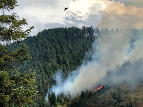
Bucket drops - 7/15/18
"The fire was reported on July 15th at 9:30 a.m. by the Dutchman Lookout and was initially attacked by Oregon Department of Forestry and their resources. Those resources included one Type 1 and one Type 2 helicopters, one engine, one hand crew, and one overhead.
"Also yesterday, air tankers dropped an estimated 10,000 gallons of retardant on the fire, but it was determined that the bucket drops from helicopters were proving to be more effective at this time. “Dense canopies were not allowing the retardant to reach the ground, where it could be most effective in helping ground crews with suppression efforts,” said Rob Marshall, Siskiyou Mountains Ranger District Fire Management Officer. As the fire suppression efforts continue, air tankers will be considered as a tool where they will be most effective.
View the Hendrix Fire Point of Origin Map (jpg image).
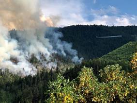
Ashland Watershed Fire - 7/15/18
"Current resources assigned to the fire include one hotshot crew, and two Type 2 Initial Attack crews. Resources on order include air tankers, one heavy helicopter, dozers, engines, and additional crews.
A Type 2 Incident Management Team will be arriving this evening to assume command of the fire, and will be utilizing the RRSNF’s Facebook page for the Hendrix Fire. The public are encouraged to follow this page for regular updates.
"A second fire that is visible in this area is the Watershed Fire, which is burning in the south end of the Ashland Watershed. It is approximately 3-5 acres in size, and is currently staffed with rappellers, smokejumpers, one engine, and a Type 2 helicopter. An additional 20-person hand crew is on order.
"For more information on current fire restrictions, call (541) 618-2200 or the nearest Ranger District. People are encouraged to follow the RRSNF on Facebook and Twitter for the most up-to-date fire danger information."

Chamise Kramer
Public Affairs Specialist
Forest Service
Rogue River-Siskiyou National Forest, Supervisor's Office
p: 541-618-2051
chamisekramer@fs.fed.us
3040 Biddle Road
Medford, OR 97504
www.fs.fed.us
"SUBSTATION FIRE UPDATE"
News Release from Oregon State Fire Marshal - Posted on FlashAlert: July 22nd, 2018 10:13 AM
MORO, OR
"More accurate mapping shows that the Substation Fire covered 79,121 acres. Containment reached 82% by Saturday evening. Fire behavior was minimal, with some smoldering in hotspots in Deschutes River corridor and Eight-Mile Canyon. The Oregon State Fire Marshall Red Team is demobilizing today.
"The Wasco County Sheriff’s Office and the Sherman County Sheriff's Office have reduced the evacuation levels for all areas to Level 1. More information about the Ready, Set, Go preparation program can be found at http://www.wildlandfirersg.org
"Crews will continue their work to reinforce and overhaul containment lines as they ensure areas are cool to the touch for a distance of 150 feet from the fire edge or any structures. Within the perimeter of the fire, and especially in the burned area in the Deschutes River Canyon, smoke in the interior of the burn may be present and visible for multiple days.
"Access to the Deschutes River is open. However, boaters should use caution [ . . . ] Black areas may still have hot spots, dangerous stump holes or rolling material. Use caution when setting up camp. Avoid standing trees and snags in recently burned areas that may be weakened by the fire and are at risk of falling.
"It is extremely dry across the region – just one spark can start a major fire. Avoid parking in dry grass, discard cigarette butts in closed containers and be aware of local restrictions on campfires or fire use. Sparks from vehicles and other mechanical and motorized equipment (dragging chains and tie-downs, failed bearings, flat tires, catalytic converter failure, worn brake pads, hot exhaust systems) are a leading cause of human-caused wildfires.
"Percent contained: 82%
"Total personnel: 263 firefighters
"Fire size: 79,121 acres
"For additional information:
http://www.centraloregonfire.org/;
https://inciweb.nwcg.gov/5963/
www.facebook.com/substationfire2018"
"SUBSTATION FIRE COMMUNITY MEETING TODAY AT 3:00"
News Release from Oregon State Fire Marshal, Posted on FlashAlert: July 21st, 2018 9:49 AM
"... MORO, OR – July 21, 2018 -- Progress on containment of the Substation Fire reached 44% by Friday evening. Now 80,763 acres, fire behavior was reduced to creeping and smoldering. Winds were not as strong throughout the day, although gusts of 20-25mph kept firefighters alert for potential hotspots.
"Crews are now actively engaged with suppression repair activities and are continuing with evaluation of fire impacts and cataloging of any damaged structures and outbuildings. Mop-up and patrol with reinforcement of containment lines will continue.
"The Wasco County Sheriff’s Office and the Sherman County Sheriff's Office have reduced the evacuation levels for all level 3 areas to level 2. This includes areas along the Deschutes River [ . . .]
All residents and persons planning to travel to the area should check for the latest information regarding possible closures of roads and other areas (www.tripcheck.com).
"Across the region, fuels are extremely dry. Avoid parking in dry grass, discard cigarette butts in closed containers and be aware of local restrictions on campfires or fire use.
"Percent contained: 44% Total personnel: 307 firefighters Fire size: 80,763 acres."
SUBSTATION FIRE NOW NUMBER ONE FIRE IN THE NATION; ADDITIONAL RESOURCES ADDED
News Release from Oregon State Fire Marshal, via FlashAlert: July 19th, 2018 6:53 PM
"MORO, OR – Day 3 of the Substation Fire brought high winds, with gusts up to 35-40 mph, making it a challenging day for firefighters.
"The winds gave way to growth at the south end of the fire, near Deschutes river canyon, impacting both agricultural and wildland areas. Significant air assets continue to be used throughout the incident, in addition to dozers that helped firefighters make progress towards containment.
"The Substation Fire is now considered the number one fire in the nation. Additional resources arrived Thursday afternoon in the form of a Pacific Northwest incident management team. These 60 team members add greater depth to the operational forces currently employed on the fire and will assist in managing all aspects of the fire. The additional resources complement the 217 firefighters, who represent 73 fire agencies across the state, currently assigned to the fire.
"The Oregon National Guard has been activated to assist the Oregon Department of Forestry with wildfire suppression efforts following Governor Kate Brown’s statewide wildfire emergency declaration on July 18, 2018. These assets include two CH-47 Chinook helicopters and two HH-60M Black Hawk helicopters equipped with Bambi water buckets.
"Other air tankers known as “Super Scoopers” and “Fire Bosses” that can drop hundreds and thousands of gallons of water continue to be used, as well as single-engine air tankers that can disperse fire retardant. Aircraft in this fuel type are very useful; they can provide heavy drops on canyon ridges and precision attacks in steeper terrain.
"Evacuation levels have been very fluid. Law enforcement and fire officials appreciate the community’s understanding and responsiveness regarding evacuations. Fire officials are working closely with the Wasco County Sheriff’s Office and Sherman County Sheriff’s Office to continually evaluate the risk to communities. Level 3 (“Go”) evacuations continue to be in place for Moro and Grass Valley.The communities of Wasco and Kent remain under Level 2 evacuation. Area residents are urged to heed local emergency notifications as well as check the local sheriff’s office Facebook page and the Substation Fire Facebook page (www.facebook.com/substationfire2018) for updates.
"Segments 3 and 4 of the lower Deschutes River remain closed.
"The American Red Cross shelter at The Dalles Middle School at 1100 E. 12th St remains available to residents impacted by the fire. In addition to sleeping accommodations, the shelter is a resource for meals, community updates, and a cool place to get out of the heat and smokey conditions.
"Locally, smoke is in the moderate to unhealthy range. Sensitive groups, such as those with asthma, chronic respiratory disease or cardio vascular disease, are encouraged to avoid smoke exposure, reduce time spent outdoors and avoid strenuous activity during smoky conditions."
STATE FIRE MARSHAL URGES VIGILANCE AND EXTREME CARE AGAINST WILDFIRES
News Release from Oregon State Fire Marshal
Posted on FlashAlert: July 12th, 2018 9:22 AM
[text is reproduced here in full, verbatim:]
Oregon State Fire Marshal Jim Walker is encouraging Oregonians to use extreme caution as intense heat and dry thunderstorms are predicted for areas around the state for the next few days.
If your summer plans include camping, Chief Walker reminds you to check for any campfire restrictions in the area you will be visiting, as campfires may be prohibited outside maintained campgrounds with fire pits. Build your campfire only where authorized and never leave your campfire unattended. When putting out your campfire be sure you drown the coals with water, stir with a shovel and drown again until it is cool to the touch.
Fire season requires residents to be at a heightened awareness for the dangers of wildfire. Be prepared to act to keep you, your family, and pets safe. Follow these Ready, Set Go! tips:
- Be Ready – Plan escape routes, and make sure all the residents within the home know the plan of action. Be ready to evacuate any pets as well as family members.
- Get Set – Pack your emergency items such as a battery powered radio, spare batteries, emergency contact numbers, and ample drinking water. Stay aware of the latest news and information on the fire in your area from local media, your local fire department and public safety.
- Go! – If a fire impacts your community and you are asked to leave, follow your personal wildland fire action plan. Doing so will not only support your safety, but will allow firefighters to best maneuver resources to combat the fire.
" It's everyone's responsibility to help prevent human-caused wildfires," said Chief Walker. "Please be aware of weather conditions and fire restrictions in your area."
Residents are strongly encouraged to contact their local fire protection agencies for additional burning information and regulations.
For more information, visit the websites for OSFM Wildland Urban Interface, Keep Oregon Green, or Oregon Department of Forestry.
ODF News - Issued Tues. 7/10/18: [We have bolded some of ODF's text here for emphasis.]
"Let's Help Our Community by Reducing Fire Starts"
"Yesterday, was the first of many challenging days we anticipate on ODF Southwest Oregon District. While all of yesterday’s starts are still under investigation, they have all been deemed human-caused. Therefore, we are urging every member of our community to use extra caution when outdoors. It is going to take all of us working together to reduce the amount of wildfires this season.
"In addition, the anticipated forecast for the end of this week is priming the District to enter into an Extreme (Red) Fire Danger Level. While there is no date set in stone currently, it is important for everyone to be aware of the upcoming changes and stay informed. If you are not already, please monitor are public Facebook page for the most up-to-date information. We, at ODF Southwest, want to take every step necessary to keep you, your families, and our firefighters safe.
"Here is a quick recap of what our firefighters across Jackson and Josephine counties faced yesterday:
"The Truck Road 399 Fire was discovered in the early morning hours July 9 near Butte Falls. Firefighters were able to knock down the fire at roughly a 0.5 acre; however, the heavy timber made mop up a lengthy process. This kept crews tied to the fire for several hours.
"Later that morning, firefighters were able to make another amazing catch. The Beacon Hill Fire near I-5 milepost 55 was called in around 10:30 a.m. ODF Southwest and several mutual aid resources were able to make a quick stop on this 0.37 acre fire a mere 20 minutes later. This is a testament of our coordinated firefighting system we have throughout Jackson and Josephine Counties.
"Just after 1:00 p.m., ODF Southwest assisted our partners, U.S. Forest Service Rogue River-Siskiyou National Forest, on a fire up near Butcherknife Creek NE of Selma. Although the terrain proved to be difficult, the teamwork thrived. The fire was wrapped up at approximately 10 acres.
"By the afternoon, the Red Flag Warning issued by our local National Weather Service came to fruition on the fire line. Another report of a grass fire came in just after 4:30 p.m. roughly seven miles west of Grants Pass. The gusty winds and dry conditions posed a challenge to the several firefighters on the ground from ODF Southwest, Rural Metro Fire, and Grants Pass Fire. However, the collaboration of firefighting efforts on the ground and in the air paid off. The final fire size of the Riverbanks Road Fire is 7.9 acres.
"In addition to these fires, we also provided mutual aid to several of our partner agencies including Medford Fire-Rescue (Chevy Way Fire - pictured below) and Illinois Valley Fire District (Redwood Highway Fire – details @IVFD), and other smaller incidents.
"Thank you, as always, to our outstanding partners and their diligent work to keep our communities safe this Fire Season.
(Please see attachments [displayed below] for some imagery of the different fires.)
Melissa Rae Cano
Public Information Officer
Oregon Department of Forestry
View ODF News "Let's Help Our Community by Reducing Fire Starts" 7-10-18 (original pdf).
(click images for larger view)
The Truck Road 399 Fire
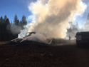
The Beacon Hill Fire
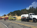
The Chevy Way Fire

The Riverbanks Road Fire
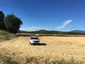
About Fireworks - Information from the Oregon State Fire Marshal:
[Media Advisory, Posted on FlashAlert: June 19th, 2018 3:03 PM]
June 23 opens the season for fireworks sales in Oregon. Legal fireworks may be purchased only from Oregon permitted fireworks retailers and stands. The Office of State Fire Marshal has issued approximately 722 retail fireworks permits, and 138 display permits. Oregon law prohibits possession, use, or sale of any firework that flies into the air, explodes, or travels more than 12 feet horizontally on the ground, without a permit issued by the OSFM. Fireworks commonly called bottle rockets, Roman candles, and firecrackers are ILLEGAL in Oregon without a permit.
All fireworks are prohibited on all Oregon beaches, in parks, and campgrounds, and on all federal public lands.
Illegal fireworks can be expensive. Officials may seize illegal fireworks and charge offenders with a class B misdemeanor which could result in a fine of up to $2,500 per violation and a civil fine of up to $500. Those who misuse fireworks or allow fireworks to cause damage are liable and may be required to pay fire suppression costs or other damage. Parents are also liable for fireworks damage caused by their children.
REMINDER: ALL FIREWORKS ARE PROHIBITED WITHIN THE COLESTIN RURAL FIRE DISTRICT.
2018 FIREFIGHTER TRAINING continues through July.
ALERT: WE NEED MORE VOLUNTEERS TO JOIN IN. See Firefighter Training for details.

FIRE SEASON REMINDERS:
Some of the key actions you can take to prepare for wildfire:
CREATE and/or RENEW FUEL BREAKS (cleared areas, or continuous perimeters without any flammable fuels) around your home and other structures;
'Harden' your home against wind-driven flaming embers that can breach fuel breaks;
Eliminate fuels in the 100-200-foot primary ignition zone around your home; reduce fuels in the secondary zone;
Mow down tall weeds, which become flash fuels;
take out dead trees; remove leaves, needles, dead shrubs & ladder fuels that fire can use to climb;
relocate wood piles & items stored under porches and decks, and
screen or box-in areas under decks/porches.
This is essential to making your home and property more defensible. Time to prepare will lessen as fire danger increases, so do all that you can NOW.
Do any work involving the use of motorized equipment or any equipment that could cause sparks, arcs or flames as early in the day as possible, in cooler temperatures and higher relative humidity.
Observe the 10:00 AM to 8:00 PM curfew for regulated activities now in effect as of Tues. July 3rd, with the rise to 'HIGH' fire danger.
And remember that common sense in all things is a safety factor for all of us.
This fire season is expected to be another challenging one, starting with significantly lower snowpack and rainfall amounts - approximately one-third less than usual in both categories - and higher than usual temperatures accompanied by fuels that are drying out at an accelerated rate.
A great resource for fire season preparation is the booklet "Before Wildfire Strikes" (available below).
Thank you for participating in wildfire preparedness and prevention.
“Before
Wildfire Strikes! A Handbook for Homeowners and Communities in Southwest
Oregon” is an excellent guide for
helping us all to prepare for and survive wildfire.
Written by Kara Baylog and Max Bennett of Jackson and Josephine County
Emergency Management in collaboration with numerous other local agencies,
it offers very usable information on topics essential to successful
wildfire prevention and survival:
Do you know what it takes to survive a wildfire?
What are Firewise and Fire-Adapted Communities?
The Elements of a Fire-Adapted Community
Fire is natural to southwest Oregon’s environment
Southwest Oregon’s forests today
Community Protection
Emergency Access
The Home Ignition Zone
Creating an Effective Defensible Space
Working with your neighbors
Conservation landscaping concepts
Evacuation
Notification
When a fire threatens
Evacuating
Be Ready, Be Set, GO!
"This is a manual that helps homeowners and neighborhoods prepare their areas
and their homes for wildfire. A fire-adapted community is a community
located in a fire-prone area that requires little assistance from firefighters
during a wildfire. Residents of these communities accept responsibility
for living in a high fire-hazard area. They possess the knowledge and
skills to prepare their homes and property to survive wildfire; evacuate
early, safely and effectively; and survive, if trapped by wildfire."
[Quote from the OSU
Extension Service's website.]
We encourage you to take advantage of this informational resource in your planning and activities
as you prepare for wildfire by renewing and/or expanding your fuel
breaks and reducing fuel loads around your home this fire season.
'Hardening' your home against wildfire - what it means and what you can do:
The National Fire Protection Association explains this concept on its page "Preparing homes for wildfire":
"What are the primary threats to homes during a wildfire?
"Research around home destruction vs. home survival in wildfires point to embers and small flames as the main way that the majority of homes ignite in wildfires. Embers are burning pieces of airborne wood and/or vegetation that can be carried more than a mile through the wind can cause spot fires and ignite homes, debris and other objects.
"There are methods for homeowners to prepare their homes to withstand ember attacks and minimize the likelihood of flames or surface fire touching the home or any attachments. Experiments, models and post-fire studies have shown homes ignite due to the condition of the home and everything around it, up to 200’ from the foundation. This is called the Home Ignition Zone (HIZ)."
The Texas A&M Forest Service's web page "Prepare for Wildfires: Protect Your Home" section on "Hardening Your Home with Fire Resistant Material" further clarifies this:
"Embers (PDF, 1MB) pose the greatest threat to a home. These fiery little pieces of wood shoot off from the main fire and get carried to other areas by fast-moving air currents. A high-intensity fire can produce a virtual blizzard of embers. Some can travel more than a mile before landing. They can get into the smallest places and easily start a fire that can burn down an entire home."
Learn more:
The NFPA: "Preparing homes for wildfire"
Texas A & M Forest Service: "Prepare for Wildfires: Protect Your Home" section on "Hardening Your Home with Fire Resistant Material" (excellent resource - categorical and concise)
Other useful resources on this aspect of making your home more wildfire-resistant:
The California Chaparral Institute: "Protecting your home from fire"
Energy Design Tools - Murray Milne, UCLA: "Designing Your Home to Survive Wildfires"
The San Diego Wildfires Education Project: "How fire burns"
Washington Dept. of Natural Resources Ear to the Ground blog articles:
"Wildfire Awareness Month: Are You Ember-Aware?"
"Fire Resistant Homes" (video)
"Spring Cleaning? Time for Defensible Space 101" (defensible space basics)
Moonshine Ink: "FIRE! How to prepare for the worst" (Review of Linda Masterson's "Surviving Wildfire: Get Prepared, Stay Alive, Rebuild Your Life:
A Handbook for Homeowners"
Mother Earth News: "Preparing for Wildland Fire on Your Homestead" (one family's story of wildfire)
ERA OF MEGAFIRES
A multi-media 70-minute traveling presentation by Dr. Paul Hessburg and North 40 Productions, and hosted by the Rogue Valley Fire Prevention Cooperative:
"How do you want your fire? How do you want your smoke?"
Two dates in May: Grants Pass and Medford:
Wednesday, May 30, 2018, at 7:00 pm
at the Event Center at the Lodge at Riverside,
940 SE 7th Street, Grants Pass
&
Thursday, May 31st, 2018, at 7:00 pm
at [the] Smullin Health Education Center,
2825 East Barnett Rd., Medford
Doors open at 6:15 pm.
More information and FREE Tickets are available at Eventbrite.com or by calling 541-471-3877.
Sponsored by:
Rogue Valley Fire Prevention Cooperative
Southern Oregon Forest Restoration Collaborative
Rogue River - Siskiyou National Forest
Fire Adapted Communities Learning Network
Josephine County
Oregon Dept. of Forestry
Presented by Dr. Paul Hessburg
A Mixed Media Presentation by North 40 Productions
"Our Mission is to educate audiences across the West so that they may better participate in the conversation and solutions surrounding the Megafire issue."
Source: Tempo, Mail Tribune, Fri. May 18, 2018 - pg. M12.
STATE FIRE MARSHAL URGES CITIZENS TO TAKE STEPS DURING WILDFIRE AWARENESS MONTH
News Release from Oregon State Fire Marshal
Posted on FlashAlert: May 1st, 2018 8:25 AM
May is Wildfire Awareness Month in Oregon and State Fire Marshal Jim Walker is asking homeowners to use this opportunity to make sure their home is protected from wildfire.
In a unified proclamation, governors from Oregon, Idaho, Nevada, and California have joined to encourage homeowners to begin thinking about the approaching fire season. This year’s Wildfire Awareness Week theme asks: Have you done enough to protect your home from wildfire?
“The roof is the most critical part of the house when it comes to wildfire protection,” says State Fire Marshal Jim Walker. “Embers can collect and ignite on the roof, in gutters, and enter unscreened openings around the house. Although non-combustible roofing material is preferred, regardless of the construction, keep roofs, gutters and eaves clear of all leaves, pine needles and other flammable debris.”
The Oregon Office of State Fire Marshal, in collaboration with Keep Oregon Green, the Oregon Department of Forestry, Oregon forest protective associations, and federal wildland agencies are taking this opportunity to promote defensible space around homes before fire strikes this summer.
To reduce the risk, fire officials suggest removing dead vegetation a minimum of 30 feet around your house. In most cases, trees and healthy plants do not need to be removed. However, trees should be pruned and grass kept short and green to keep fire on the ground and more manageable by fire crews. If you’re thinking of landscaping, ask your local nursery or OSU Extension agent about fire resistant plants.
Homeowners should also keep access in mind for large fire trucks. Long driveways should be at least 12 feet wide, have 10 feet of vegetation clearance from the centerline out, and about 14 feet overhead. Large vehicle turnaround areas are critical for your safety as well as firefighter safety.
It is the homeowners’ responsibility to protect their homes by building defensible space.
For more information, visit the websites for Keep Oregon Green, Oregon Department of Forestry, or call your nearest ODF or forest protective association office.
The proposed Provisional Budget for 2018-2019 was approved at our May 8th Board meeting. The Budget and related documents are available on our Budget page.
FYI: IS
IT A PRESCRIBED BURN, A CONTROLLED SLASH BURN, OR A FIRE?
Specific information on prescribed burns within our district
will normally always be posted here on our website as soon as we receive
notice.
We are notified ahead of any prescribed (ODF-approved) burning, even
though there is often not a lot of warning, as approval from
the ODF depends upon the latest weather and other local conditions.
If we have not posted a prescribed burn
notice on this page (at the top) and you're unsure if you're seeing
a controlled slash burn, call us - it's
far better to err on the side of caution.
If a burn cannot be determined to be a controlled
burn, don't take
a chance - just call 9-1-1.
NOTE: We are now in fire season: all open burning is now prohibited.
(Info on previous prescribed burns conducted by Lomakatsi is available
below.)
OREGON DEPT. OF FORESTRY FORESTLAND CLASSIFICATION MEETING NOTICE:
FOR IMMEDIATE RELEASE
May 4, 2018
Oregon Department of Forestry
Southwest Oregon District
5286 Table Rock Rd.
Central Point, OR 97502
Contact: Brian Ballou, (541) 664-3328 or Melissa Cano, (541) 613-6313
Meetings Continue on Jackson and Josephine Counties Forestland Classification for Fire Protection
The Forestland Classification Committee for Jackson and Josephine Counties will hold a meeting and work session, Friday, May 18, to continue reviewing lands within both counties to determine which should be classified as forestland for the purpose of fire protection.
The Oregon Department of Forestry Southwest Oregon District provides wildfire protection services to over 1.8 million acres across both counties, and a Forest Patrol Assessment on protected lands funds firefighting.
The meeting will be held at 1 p.m. at the Oregon Department of Forestry Southwest Oregon District Office in Grants Pass, 5375 Monument Drive. The meeting is open to the public.
Classifying which lands require wildland fire protection services from ODF occurs at the county level. Classification changes do not increase ODF's fire budget. Rather, the classification review helps ensure that protection costs are fairly distributed. In most cases, a review typically results in some lands being removed from forest classification and others being added.
The committee will be examining all lands within Jackson and Josephine Counties, classifying them either as "forestland" or "not forestland" according to:
* Fire risk potential
* Vegetation type (fire fuel)
* Community structure
* Proximity to other forestland
The committee's efforts will help resolve issues pertaining to ODF's Fire suppression role on forestlands and adjacent properties. This will be the basis for assessing lands for the costs of wildland fire protection. Upon completing its work, the committee will present a list of lands from both counties it classified as forestland so those properties can be accessed for fire protection by ODF.
For more information on the Southwest Oregon District Forestland Classification review, contact the district at 541-664-3328 or visit our website at www.swofire.com.
To ensure the broadest range of services to individuals with disabilities, persons with disabilities requiring special arrangements should contact 541-664-3328 at least two working days in advance.
###
Melissa Rae Cano
Public Information Officer
Oregon Department of Forestry
Office: (541) 664-3328
Cell: (541) 613-6313
melissa.r.cano@oregon.gov
Will you be doing any landscaping on your property this spring?
Check out the OSU
Extension Service's brochure, "Fire-Resistant Plants
for Oregon Home Landscapes," available
online.
Another OSU Extension brochure of interest is "A Land
Manager's Guide for Creating Fire-Resistant Forests,"
also available
online.
Brochures are also available at Jackson County's OSU partnership office,
the Southern
Oregon Research & Extension Center (SOREC), at 569 Hanley Road,
Central Point OR 97503; Phone: (541) 776-7371 Fax: (541) 773-7373;
Office Hours: Monday-Friday 8:00 am - 5:00 pm.
2018 SURPLUS FOREST SEEDLINGS:
The U.S. Forest Service has surplus forest seedlings in limited supply
that have been made available to the public on a first-come, first-served
basis until they sell out. The list is released to both government and
public entities.
We have recently been informed that seedlings will be available for sale until approx. April 16th. The most recently updated list (3/26/18) of surplus stock
is available here
(pdf doc).
Seedlings are pre-packaged
in boxes of various commercial quantities and will not be re-packaged
for smaller quantities; however, large quantities can be shared with
interested neighbors and friends.
For more information about seedling types, seed sources,
quantities, etc., and to place an order, email
Juan Ortiz, U.S. Forest Service Admin Operations Specialist, J. Herbert
Stone Nursery, 2606 Old Stage Rd., Central Point, OR, at: juanrortiz@fs.fed.us.
(Phone: 541-858-6100).
For technical assistance; please contact John Justin (541-858-6101) or jbjustin@fs.fed.us.
OREGON DEPT. OF FORESTRY FORESTLAND CLASSIFICATION MEETING NOTICE:
FOR IMMEDIATE RELEASE
April 3, 2018
Oregon Department of Forestry
Southwest Oregon District
5286 Table Rock Rd.
Central Point, OR 97502
Contact: Brian Ballou, (541) 664-3328 or Melissa Cano, (541) 613-6313
Forestland Classification Process Continues in Jackson and Josephine Counties
The Forestland Classification Committee for Jackson and Josephine Counties has reviewed more than half of the Oregon Department of Forestry’s Southwest Oregon District’s protected area. This month, we will hold our next meeting and work session, Tuesday, April 17, at 1:00 p.m. to continue reviewing lands within both counties to determine which should be classified as forestland for the purpose of fire protection. The meeting will be held at ODF Southwest’s Medford Unit office at, 5286 Table Rock Road. It is open to the public.
The department’s Southwest Oregon District provides wildfire protection services to over 1.8 million acres across both counties, and a Forest Patrol Assessment on protected lands funds firefighting.
Classifying which lands require wildland fire protection services from ODF occurs at the county level. Classification changes do not increase ODF's fire budget. Rather, the classification review helps ensure that protection costs are fairly distributed. In most cases, a review typically results in some lands being removed from forest classification and others being added.
The committee will be examining all lands within Jackson and Josephine Counties, classifying them either as "forestland" or "not forestland" according to:
- Fire risk potential
- Vegetation type (fire fuel)
- Community structure
- Proximity to other forestland
The committee's efforts will help resolve issues pertaining to ODF's Fire suppression role on forestlands and adjacent properties. This will be the basis for assessing lands for the costs of wildland fire protection. Upon completing its work, the committee will present a list of lands from both counties it classified as forestland so those properties can be accessed for fire protection by ODF.
For more information on the Southwest Oregon District Forestland Classification review, contact the district at 541-664-3328 or visit our website at www.swofire.com. To ensure the broadest range of services to individuals with disabilities, persons with disabilities requiring special arrangements should contact 541-664-3328 at least two working days in advance.
###
Melissa Rae Cano
Public Information Officer
Oregon Department of Forestry
Office: (541) 664-3328
Cell: (541) 613-6313
melissa.r.cano@oregon.gov
KIDDE SMOKE ALARM RECALL
News Release from Oregon State Fire Marshal
Posted on FlashAlert: March 27th, 2018 2:08 PM

Above: Front and back of Kidde smoke alarm with side view showing yellow cap
On March 21, 2018, Kidde issued a recall of 452,000 dual sensor (photoelectric and ionization) smoke alarms sold in the United States. The smoke alarms have the model numbers PI2010 (AC/hardwired) and PI9010 (DC/battery powered). "KIDDE" is printed on the front center of the smoke alarm. The model number and date code are printed on the back of the alarm.
Kidde states that a yellow protective cap in limited instances may have been left on one of the two smoke sensors during the manufacturing process, which could compromise the smoke alarms' ability to detect smoke.
Consumers should remove the alarm from the wall/ceiling and visually inspect it through the opening on the side of the alarm for the presence of a yellow cap. Consumers should not attempt to take apart the alarm, open the casing, or otherwise remove the cap themselves. If the yellow cap is present, the consumer should immediately contact Kidde to receive instructions and request a free replacement alarm. They should remove the recalled smoke alarm ONLY AFTER they receive and install the replacement alarm. If no yellow cap is present, consumers should reinstall the smoke alarm and no further action is needed.
Alarms were sold at Menards, The Home Depot, Walmart and other department, home, and hardware stores nationwide and online at Amazon.com, ShopKidde.com, and other websites from September 2016 through January 2018 for between $20 and $40.
For more information, visit the Kidde website: https://kidde-smoke-alarm-recallusen.expertinquiry.com/ or the Consumer Product Safety Commission website: https://www.cpsc.gov/Recalls/2018/kidde-recalls-dual-sensor-smoke-alarms-due-to-risk-of-failure-to-alert-consumers-to-a
The Oregon Office of State Fire Marshal's Smoke Alarm Installation Program does not distribute Kidde smoke alarms, therefore alarms issued by the OSFM to Oregon fire agencies, the American Red Cross Cascades Region, or other organizations are not affected by this recall.
Working smoke alarms save lives. Be sure to test your smoke alarms regularly and make sure you have working smoke alarms on each level of your home, inside each bedroom, and in the hallway outside each bedroom.
If you don't have working smoke alarms, contact your local fire agency or the American Red Cross at preparedness@redcross.org or 503-528-5783, 541-842-4717 (Medford area), or 541-749-4144 (Bend area).
For more information on smoke alarms visit the OSFM Smoke Alarm Information Center: http://www.oregon.gov/osp/SFM/Pages/CommEd_SA_Program.aspx
STATE FIRE MARSHAL URGES YOU TO TEST YOUR SMOKE ALARMS WHEN TURNING YOUR CLOCK FORWARD
News Release from Oregon State Fire Marshal
Posted on FlashAlert: March 8th, 2018 2:54 PM

Above: Testing a smoke alarm
Sunday, March 11th, marks the beginning of daylight saving time and serves as a good reminder for Oregonians to test their smoke alarms. The Oregon Office of State Fire Marshal is urging residents to test their smoke alarms before automatically changing the batteries.
"Smoke alarm technology has advanced and many now come with 10-year batteries and some are tamper-resistant," said State Fire Marshal Jim Walker. "So, I encourage residents to test their alarms before changing the battery, and to be sure to replace any smoke alarm that is 10 years old or older."
Oregon law requires ionization-only smoke alarms that are solely battery powered to come equipped with a hush feature and a 10-year battery. Because of this technology, the national slogan
"Change your clock, Change your battery" may not apply to Oregon residents who have these ionization-only smoke alarms.
Other types of alarms are also being sold with either a 10-year battery or a standard-life battery.
"Ensuring you have working smoke alarms in your home is the single most important step you can take to increase your family's safety from a home fire," adds Walker.
To test your alarm properly we recommend you:
1) Push the test button to be sure the battery is working.
2) When replacing batteries, follow the manufacturer's instructions for the correct battery type to use.
3) Always retest alarms after installing new batteries.
4) Replace any alarm that fails to operate after installing a new battery.
5) Inspect your alarms to determine if they are 10 years old or older, and replace any smoke alarm
10 years old or older. Look for a date on the back of the alarm. If there is no date, your alarm is more than 10 years old and should be replaced.
6) Follow the manufacturer's instructions for regularly cleaning your alarms of dust and cobwebs.
Working smoke alarms provide a critical early warning to a fire, allowing you vital minutes to escape, which increase your chances of survival. Additional safety tips:
* Install smoke alarms on every level of your home, in each bedroom, and outside each sleeping area (hallway).
* Never disconnect or remove batteries from smoke alarms for other uses.
* Use the smoke alarm's hush feature to silence nuisance alarms.
* Make a home fire escape plan and practice it with family members.
* Practice you home fire escape plan at least two times a year at different times of the day/night.
* Children, older adults, and people with disabilities may need assistance to wake up and get out. Ensure that someone will help them.
For more home fire escape planning information visit: http://www.oregon.gov/osp/SFM/Pages/escapeplan.aspx
For more smoke alarm and fire safety information, contact your local fire department or visit
http://www.oregon.gov/osp/SFM/Pages/CommEd_SA_Program.aspx
Follow the OSFM on Facebook https://www.facebook.com/OregonStateFireMarshal and Twitter @OSFM.
OREGON DEPT. OF FORESTRY NEWS RELEASE
FORESTLAND CLASSIFICATION MEETING NOTICE
FOR IMMEDIATE RELEASE
February 1, 2018
Oregon Department of Forestry
Southwest Oregon District
5286 Table Rock Rd.
Central Point, OR 97502
Contact: Brian Ballou, (541) 664-3328 or Melissa Cano, (541) 613-6313
Southwest Oregon Forestland Classification Committee Covering More Ground
The Forestland Classification Committee for Jackson and Josephine Counties has reviewed roughly half of the Oregon Department of Forestry’s Southwest Oregon District’s protected area. This month, we will hold our next meeting and work session, Tuesday, February 13, at 1:00 p.m. to continue reviewing lands within both counties to determine which should be classified as forestland for the purpose of fire protection. The meeting will be held at ODF Southwest’s Medford Unit office at, 5286 Table Rock Road. It is open to the public.
The department’s Southwest Oregon District provides wildfire protection services to over 1.8 million acres across both counties, and a Forest Patrol Assessment on protected lands funds firefighting.
Classifying which lands require wildland fire protection services from ODF occurs at the county level. Classification changes do not increase ODF's fire budget. Rather, the classification review helps ensure that protection costs are fairly distributed. In most cases, a review typically results in some lands being removed from forest classification and others being added.
The committee will be examining all lands within Jackson and Josephine Counties, classifying them either as "forestland" or "not forestland" according to:
- Fire risk potential
- Vegetation type (fire fuel)
- Community structure
- Proximity to other forestland
The committee's efforts will help resolve issues pertaining to ODF's Fire suppression role on forestlands and adjacent properties. This will be the basis for assessing lands for the costs of wildland fire protection. Upon completing its work, the committee will present a list of lands from both counties it classified as forestland so those properties can be accessed for fire protection by ODF.
For more information on the Southwest Oregon District Forestland Classification review, contact the district at 541-664-3328 or visit our website at www.swofire.com.
To ensure the broadest range of services to individuals with disabilities, persons with disabilities requiring special arrangements should contact 541-664-3328 at least two working days in advance.
###
Melissa Rae Cano
Public Information Officer
Oregon Department of Forestry
Office: (541) 664-3328
Cell: (541) 613-6313
melissa.r.cano@oregon.gov

Seasonal Influenza
Jackson County's Health & Human Services January 2018 Flash Report states that "Influenza like illness (ILI) activity is widespread throughout the United States, including Oregon. Oregon is at a high level for ILI activity."
Reported seasonal flu activity in Jackson County peaked during the last week of December 2017; although it decreased during the first week of January 2018 (from 4.4% to 2.5%) and is less than the state average (5.1%), "the Southern Oregon region labs reported testing 1,111 samples for influenza" during this same period. Also, the "Oregon Health Authority has received two reports of pediatric deaths in Oregon during last month" [December] caused by flu.
Last year's flu season was the worst on record in Oregon, according to the Oregon Health Authority (Source: OHA's CD Summary - see below). This season's flu is reportedly very serious in its effects in comparison to previous years. Yet the latest information from local pharmacies is that this year's vaccine is only about 10 percent effective, partly because of the strains of flu that are active, and also because of mutations in the flu virus since the vaccines for this season (based on the 3 and 4 most common strains identified) were developed.
Despite this low rate of effectiveness, getting a flu shot may still prevent getting flu, and helps to minimize the effects if you do get the flu. It takes about 2 weeks for protection to develop after vaccination, and protection lasts through the flu season.
Additionally, protecting yourself helps to limit the flu outbreak and can help protect your family members or others with whom you are in close contact:
"Vaccination, although far from perfect, remains the best prevention. CDC estimates the 2016-2017 flu vaccine effectiveness was only 39%, but that was good enough to prevent approximately 5.4 million flu-related illnesses, 2.7 million flu-related doctor's visits and 86,000 hospitalizations due to influenza" (Source: OHA's CD Summary - see below).
While the flu season generally peaks between December and February, it can remain active into May. Over the 34-year period from the 1982-83 season through 2015-16, flu activity most often peaked in February (14 seasons), followed by December (7 seasons), March (6 seasons), and January (5 seasons) [Source: Centers for Disease Control (CDC); see below].
Given the concerns with this year's flu, we encourage you to get a flu shot if you haven't yet.
For questions, please contact Jackson County Public Health at 541-774-8045.
For more information about influenza, symptoms, and details on this year's flu and vaccines, see:
Jackson County Health & Human Services - Public Health Dept. - Communicable Disease Control: Flu Facts & Prevention (also see Flash Reports).
The Oregon Health Authority - Public Health Division - Flu Prevention (includes the OHA's weekly "Flu Bites Report" flu activity summary and the CD Summary, "Influenza: What you need to know for the 2017-2018 season").
Influenza (flu) Vaccine (Inactive or Recombinant) - What You Need To Know - Immunization Action Coalition, Vaccine Information Statements (pdf - 2 pgs).
Centers for Disease Control and Prevention (CDC) - Influenza (flu) home page - CDC / U.S. Dept. of Health and Human Services.
The CDC's interactive 2017-2018 seasonal flu map (below) shows the spread of flu in the U.S. from the start of flu season (with the first reported cases) in October 2017 (Week 39) to early January 2018 (Week 1).
The map initially shows the most recent week available. To re-set the timeline to the beginning, click the far-left double-arrow (continuously) or "grab" and drag the red timeline indicator at the top to the left side. "Play" to see the flu's spread week by week through the season. (Drag the red indicator to move to individual weeks along the timeline.)
WINTER SEASON REMINDERS
Your local volunteer Fire District would like to remind you that your participation in preparedness and prevention is always your best defense:
The La Nina (wetter, colder) weather pattern is again in this winter’s forecast, and the NOAA predicts "exceptional mountain snow" for Oregon (Special Districts Assn. of Oregon Review, Fall 2017, p. 9).
Prepare for winter hazards and emergencies: Maintain a three-week home supply of non-perishable food, water (1 gallon per day per person), and other basic necessities and emergency supplies and resources. Review our Winter Emergency Preparedness Planning & Safety Reminders pamphlet for more information and suggested supplies lists.
The SDAO also suggests: "Check your roofs and gutters for debris and clogs. When snow hits, a clogged gutter can allow for water or ice to dam up and actually enter the exterior building walls by going under shingles or other roofing material. If you are in a mountainous area or are subject to freezing conditions, consider installation of heat cables. Placed at the edge of the roof close to the gutters, heat cables help keep ice dams from forming and damaging the gutters. If you have a flat roof, cleaning scuppers to allow water to flow out is critical.
Check the roof for valleys and depressions that allow water to remain and to re-caulk any areas where caulking has failed. "This [past] summer was exceptionally hot which of course leads to drying out of caulking and other weather-proofing materials. Branches left on flat roofs can puncture roofing membranes under the weight of snow resulting in interior damage or injury... if the roof should collapse."
Please keep your residences as accessible as possible during the winter. Despite our best efforts, fire district response time can be complicated by snow/ ice on roads and at residences. Provide strategic turnouts so two vehicles can pass, as well as turn-around space at your residence. If we can’t reach you during a fire or medical situation, we may not be able to help you at all.
Trim or thin out potentially hazardous trees and branches near / over your access road and driveway that could fall under a snow load or become weakened due to soil saturation. Caution: If power lines are involved, call us first. Power companies are NOT responsible for these (property owners are), yet these lines are very dangerous and need special handling. We will assist you to locate a qualified professional to do it.
Prepare for winter travel: Carry an emergency “go-kit” in your vehicle that includes snack food & water for each passenger & pet, warm clothes & blankets, a radio, flashlights & extra batteries, first aid items, a basic tool kit, jumper cables, shovel & ice scraper, road salt/sand, and traction devices.
Service your vehicle(s) before winter; keep the gas tank full; check road conditions before heading out, tell someone your itinerary, and carry a charged cell phone and portable charger. During winter weather, only travel if necessary.
To review chain requirements, see Know Before You Go - Snow Zone Chain Requirements and Conditional Closures on the Siskiyou Pass - Siskiyou Pass Restrictions (Oregon De, Moving Ahead, Dec. 15, 2017, pps. 12 & 13).
For more on winter travel preparation, see 5 Things I Wish Every Driver Would Do and the Come Prepared section of Winter Maintenance (ODOT, Moving Ahead, Dec. 15, 2017, pps. 16 & 19).
Clean your stove stacks and chimneys if you haven’t yet – or hire a qualified professional. Have them professionally inspected for creosote build-up, wear in the pipe lining & metal fittings, or brickwork cracks. Stove pipes and chimneys should always be cleaned at the beginning of wood-heating season and periodically thereafter, depending on the type of wood burned, and the frequency of use.
During use, maintain a three-foot minimum clearance between any flammable materials and heating appliances, especially space heaters. Do not use an open fireplace without a spark glass or screen; do not leave your stove unattended while the drafts are still open. Use only a metal bucket for ashes in a combustible-free area for at least 24 hours before disposal.
Heating equipment causes 16% of all home fires, and 19% of all home fire deaths.* We have recently had two fires in our district caused by stoves used with uncleaned pipes - do not let your home be next! For more information, see Stoves & Flue Fires - Prevention & Handling.
For more on portable electric heater fire hazards and safety, see Reducing Fire Hazards for Portable Electric Heaters (U.S. Consumer Product Safety Commission - CPSC; pdf, 1 page).
Do not overload electrical outlets: Overloading a circuit can cause overheating, leading to an electrical fire. A circuit can become overloaded if too many electric devices are plugged into it. Each added electric device increases the electric current flowing through the wire. When the electric current load is greater than the capacity of the wire, the wire is overloaded.
Plug only one high-wattage heat-producing appliance (such as a coffee maker, toaster, space heater, etc.) or other high-wattage appliance into one outlet at a time, following the manufacturer's instructions for the electrical capacity required.
Use extension cords for temporary wiring only, and only for the capacity and use they are rated for. Extension cords are not as safe as permanent house wiring. Installed wiring can carry more current and is protected from accidental damage that could cause shock or fire. Do not use an extension cord or a power strip with heaters or fans, which could cause cords to overheat and result in a fire. For more, see Household Extension Cords Can Cause Fires (CPSC; pdf, 1 page).
ALERT: Power strips and multi-prong outlets do not add more electrical capacity - they only re-distribute the available capacity to separate outlets. To ensure that your electrical outlets can safely meet your power load, have additional circuits or receptacles added by a qualified electrician. Electrical distribution and lighting equipment accounts for 16% of all home fire deaths.
Avoid other electrical fire causes: Replace cracked and damaged electrical cords. Avoid pinching cords against walls or furniture or running them under carpets or across doorways; avoid wrapping them tightly around any object or attaching them to anything (walls, baseboards) with nails or staples. Heavy weights or traffic can damage cords, crushing insulation or breaking wire strands, creating a fire or shock hazard. Wrapped cords trap heat that normally escapes loose cords, which can lead to melting or weakening of insulation. Nails and staples can tear or crush the insulation or cut the wires inside, presenting a fire or shock hazard.
Ensure light bulbs are at appropriate wattages for the fixtures/lamps they are used in: a bulb that is a higher wattage than recommended may overheat the light fixture, wiring or nearby combustible materials, leading to a fire. If you aren’t sure, use a bulb 60 watts or less.
Make sure all plugs fit snugly into outlets: Loose-fitting plugs can cause overheating and fires. A loose connection cannot carry much current without getting hot. Unusually warm outlets or switches may indicate an unsafe wiring condition exists, such as a loose electrical connection that can start a fire. (Some dimmer switches may become warm during normal use.) Be sure appliances are not overloading the outlet. Stop using them until an electrician checks the problem.
Turn off/unplug all electrical appliances when not in use and before leaving home, in particular, countertop electrical appliances and the clothes dryer, as overheating is an all-too-common problem. Also, clean the lint trap filter often and the dryer duct vent to the outside at least once a year. (For more, see Overheated Clothes Dryers Can Cause Fires (CPSC; pdf, 1 page) and Clothes Dryer Fire Safety (U.S. Fire Administration - USFA & FEMA - Federal Emergency Management Association; pdf, 1 pg). Finally, turn off/unplug holiday decoration lights before leaving.
Be sure the fuses in your fuse box are the correct size for the circuit: If correct size is unknown, have an electrician identify and label the size to be used. The wrong size fuse can allow too much current to flow and cause the wiring to overheat, creating a fire hazard. Annually test your circuit breakers in the circuit breaker box by flipping them on and off several times: Circuit breakers must be exercised periodically to make sure they have not become stuck and to keep them in good working order.
Electrical arcing and sparking in home wiring can cause fires that typical household fuses and circuit breakers do not respond to until a fire has already begun. Arcing accounts for most home electrical fires. Arc fault circuit interrupters, or AFCIs, can provide increased protection from this potential source of fire by monitoring the electrical current in a circuit and shutting off the circuit when unintended arcing occurs. For more about AFCIs, see Preventing Home Fires: Arc Fault Circuit Interrupters (AFCIs) (CPSC; pdf, 1 page).
Finally, to reduce the chances of severe or fatal electrical shock as well as electrical fires, consider installing ground fault circuit interrupters. A GFCI (or GFI) is an inexpensive electrical device that can either be installed in your electrical system or built into a power cord; when a GFCI detects a ground fault, it interrupts the flow of electric current. To learn more about GFCIs, see the CPSC Fact Sheet (CPSC; pdf, 2 pages).
For more on electrical fire hazards and home electrical safety, see:
Home Electrical Safety (Electrical Safety Foundation International - ESFI)
Electrical Fire Safety (USFA & FEMA; pdf, 1 pg).
Home Electrical Safety Checklist (CPSC; pdf, 11 pages).
CPSC Guide to Home Wiring Hazards (CPSC; pdf, 40 pages).
Electrical circuit-interrupters (National Fire Protection Association - NFPA).
Remember fire safety in the kitchen: cooking is the leading cause of home fire (46-48% annually) and fire injuries (44 %) and is tied (19 %) for the second leading cause of home fire deaths. Unattended cooking is the leading factor contributing to these fires.
Frying poses the greatest risk of fire. Don't leave your stove cooking unattended ("stand by your pan"). Have a lid handy to cover stovetop flames if necessary, as well as a fire extinguisher rated for kitchen grease fires. Also, keep the top of your cooking range and area above it free of combustibles (e.g., potholders, paper, plastic utensils). For more, see Cooking (NFPA).
Unattended candle use is one of the primary causes of home fires. Candle use creates a potential fire danger in your home similar to that of other fire sources. Candles should be used only on stable, non-flammable surfaces, with safe clearance from anything ignitable. Above all, do not leave burning candles unattended. If you need to leave the room where a candle is burning, even “just for a moment,” make sure it’s out first.
Smoking is a very serious fire hazard: While smoking causes the least number of all home fires (5%), it has been the leading cause of home fire deaths for decades, and remains so (22 %). Two-thirds (66%) of these home smoking material fire fatalities resulted from fires originating with upholstered furniture or with mattresses or bedding.
Install smoke alarms on every level of your home (including the basement), outside all sleeping areas (in hallways), and in all bedrooms, if you haven’t yet.
Smoke alarms save lives: a fire can double in size every 30 seconds. On average, you have less than 3 minutes to escape a house fire. Most fire deaths are caused by smoke – not flames. Most fire deaths and injuries occur between midnight and 8 a.m. when people are asleep.
It is a proven fact that you are 4 times more likely to survive a home fire if you have a working smoke alarm than if you don’t. (Having smoke alarm protection may also help you to qualify for a lower insurance premium; check with your insurer.)
Maintain your smoke alarms: They cannot help protect you if they don’t work! Test smoke alarms monthly throughout your home to ensure they are working. Replace batteries yearly and replace alarm units every 10 years.
For more, see Smoke Alarms (NFPA) and Home Fire Warning Systems: Smoke Alarms & Detectors (on our Stoves and Flue Fires page).
Have a home escape plan and practice it, at least once during the day and once at night. You should have two known ways out from every place in your home, and a pre-designated meeting place outside. If your smoke alarm sounds, get out and stay out – do not re-enter for any reason. If you have to escape through smoke, get low and go. Call 9-1-1 from outside your home.
For more resources on the above topics, see
Safety in the Home (NFPA)
Home Safety Checklist (USFA & FEMA; pdf, 1 pg).
Our 2015-16 Winter Fire Safety Pamphlet (also linked on our Winter Emergency Preparedness and Winter Fire Safety pages).
Put A Freeze on Winter Fires (NFPA)
If you have questions, please call us at (541) 488-1768. Thank you for participating in fire safety and prevention. Please enjoy the holidays safely, and have a fire-safe winter season.
*Statistics used above are from the National Fire Protection Assn. and the U.S. Fire Administration.
HOLIDAY PLANNING NEEDS TO INCLUDE FIRE PREVENTION AND SAFETY
News Release from Oregon State Fire Marshal
Posted on FlashAlert: December 11th, 2017 10:18 AM
With the holiday season in full swing, State Fire Marshal Jim Walker urges citizens to remember fire prevention when decorating and entertaining.
From 2012 through 2016, Oregon fire agencies reported there were 3,510 residential fires during the holiday period from November 22 through January 15. These fires were reported to have resulted in 14 deaths, 194 injuries, and more than $61.2 million in property loss.
"This season is a busy and exciting time of year, but don't let that distract you from keeping your family and friends safe from fire," says Walker. "By following a few important prevention tips for Christmas trees, decorations, and candles, you can help ensure your holidays remain happy."
Tree care and decorating tips:
* Choose a fresh, healthy tree with a deep-green color and flexible needles.
* When you get the tree home, cut off the bottom two inches of the trunk. This creates a fresh, raw cut for the tree to soak up water.
* Water your tree daily. A tree may consume between a quart and a gallon of water per day.
* Place the tree at least three feet away from any heat source such as a fireplace, woodstove, space heater, heating vent, baseboard heater, or radiator.
* Use only noncombustible or flame resistant materials to trim a tree.
* Always unplug tree lights before leaving home or going to bed.
* If using a woodstove or fireplace, keep it screened at all times. Keep ribbons, boughs, and other decorative materials at least three feet away.
* After the holiday season or whenever your tree dries out, promptly dispose of it and other dry greenery. Burning a tree in a stove or fireplace is extremely dangerous; proper disposal includes recycling or pick-up by a disposal service.
* Never burn wrapping paper in the fireplace or wood stove. Wrapping paper burns at higher temperatures than wood and can cause a chimney fire.
Electrical safety
* Maintain your holiday lights. Inspect holiday lights each year for frayed wires, bare spots, and broken or cracked sockets.
* Do not overload electrical sockets. Do not link more than three light strands, unless the manufacturer's directions indicate it is safe.
* Protect electrical cords from damage. To avoid shock or fire hazards, cords should never be pinched by furniture, placed under rugs, located near heat sources or attached by nails or staples.
* Make sure all extension cords and electrical decorations used outdoors are marked for outdoor use.
Candle safety
* Consider using battery-operated flameless candles, which can look and smell like real candles.
* Never leave a burning candle unattended. Extinguish candles when you go to bed, leave a room, or before leaving the house.
* Keep candles at least 12 inches away from anything that can burn. Keep candles at least one foot from combustibles including clothing, curtains, upholstered furniture, greenery, and decorations.
* Always use a sturdy non-combustible (metal, glass, or ceramic) candleholder. If a sturdy non-combustible candleholder is not available, the candle can be placed on a non-combustible plate.
* Place candles out of reach of small children and pets.
* Avoid candles with items embedded in them such as twigs, flowers, or leaves. These items can ignite or even explode.
* Always use a flashlight -- not a candle -- for emergency lighting.
General fire safety
* Keep combustibles at least three feet from heat sources.
* For increased protection, have working smoke alarms on every level of your home (including the basement), in each bedroom, and in the hallway outside each bedroom.
* Make a home fire escape plan and practice it with your family and any overnight guests.
* Keep escape routes clear of clutter so you can escape quickly in case of fire.
For more information on fire safety visit: http://www.oregon.gov/OSP/SFM/pages/com_ed_section.aspx
Sent via FlashAlert Newswire.
In a News Release on
Fri. am Oct. 20th, the Oregon Dept. of Forestry declared the end of
the 2017 fire season. All fire season restrictions were lifted.
Full details.
 You
can sign up to receive email updates about fire season,
including any changes in the fire danger level and related changes in
fire restrictions. (This is much faster than when residents will receive
notification by postcard, but does not replace postcards.) Learn more
here (below, left
sidebar).
You
can sign up to receive email updates about fire season,
including any changes in the fire danger level and related changes in
fire restrictions. (This is much faster than when residents will receive
notification by postcard, but does not replace postcards.) Learn more
here (below, left
sidebar).
2017 EMERGENCY PREPAREDNESS & SAFETY
FAIR: Saturday, September 16th, 10:00 to 2:00 PM at the Rogue Valley
Mall in Medford: "Local emergency agencies and
non-profit organizations will display vehicles and equipment, give away
preparedness & safety items along with valuable information to help
you before, during and after a disaster." "Great opportunity
to see the safety community backing up our community every day! Stop
by the Mall! And share this opportunity with your family and friends!"
See
the EMERGENCY PREPAREDNESS & SAFETY FAIR event brochure (pdf).
Fire Season 2017 Information:
Last Update: September 29, 2017: RRSNF Announces that the Joint Information Center is Closing
on Saturday, September 30, 2017. View/read
the RRSNF's News Release (9/29/17) (pdf format).
Previously - through Fri. 9/15/17 -
Fire & Smoke Conditions:
"A Southwest Oregon Joint Information Center (JIC)
has been established in Medford to serve as a ‘one-stop-shopping’
spot to get information on fires and information related to fires currently
burning on federal and state lands. Agencies represented at the JIC
include the USDA Forest Service, Oregon Department of Forestry, Coos
Forest Protective Association, Bureau of Land Management and National
Park Service." (JIC News Release, 8/29/17)
Jackson County Emergency Management's Sara Rubrecht says: "For
those of you who are trying to keep track of all of the fire
information out there right now, please see the information
[in the
8/28/17 Joint News Release (pdf) also reproduced] below,
as [the Joint Information Center] is an incredible resource! All of
the updated fire information can be found in one place… http://swojic.blogspot.com."
JOINT INFORMATION CENTER OPENS IN MEDFORD
"Southwest Oregon is currently experiencing
very high fire activity. Multiple wildland fires are burning on more
than 138,000 acres of federal and state lands, with the majority of
acres burned on Rogue River-Siskiyou National Forest lands. The large
fires include the Chetco Bar Fire (Brookings), the Miller Fire (Applegate
Valley) and the High Cascades Complex (Prospect).
"As these fires have generated a great deal
of interest from both the public and the media, it is important to
all agencies involved that the public has the information they need
to keep themselves and their families safe and informed.
"Rogue River-Siskiyou National Forest Supervisor
Rob McWhorter emphasized, “It’s imperative that we share
timely and accurate information, and highlight the tremendous suppression,
structure protection and public safety efforts being made on behalf
of the communities we serve.”
"Primary responders to the fires include
the Forest Service, the Oregon Department of Forestry, the National
Park Service, Coos Forest Protective Association, and the Bureau of
Land Management in cooperation with Jackson County and Curry County
law enforcement and emergency services, as well as local fire departments
and the Oregon National Guard.
"To better meet the information needs,
the agencies have established a Joint Information Center (JIC) located
in Medford to serve as a ‘one-stop-shopping’ spot to get
fire information.
"A comprehensive blog has been developed
that will provide fire and evacuation maps, fire updates, scheduled
public meetings, national and regional fire links, air quality &
information and ways the public can help. That information can be
accessed at www.swojic.blogspot.com.
"The JIC will produce a daily comprehensive
large fire summary which will be posted on the blog. The individual
fires will also continue to send out their daily updates. If additional
large fires start in southwest Oregon during the 2017 season, those
fires will also be included. The JIC can be reached at 541-608-1243
and is staffed from 7:00 a.m. until 9:00 p.m. daily. We look forward
to serving you!"
###
Additional direct links:
From the Jackson County Public Health Division (8/30/17): Wildfire
Smoke Guidance (pdf) - An Urgent Public Health Activity Report Within
Jackson County:
This bulletin covers precautions to take during smoke, a Visual Assessment
Using the Visibility Index Guide, a link to the DEQ's Air Quality Index,
some very useful information about smoke masks, and additional links
to information on smoke and wildfires in Oregon.
From the Oregon Office of Emergency Management (8/19/17 &
8/20/17):
"OEM's online Real-time Assessment and Planning
Tool, known as RAPTOR, has updated information on wildfires
and any wildfire-related road closures. People can access
RAPTOR through OEM's
web page or they may go to www.tinyURL.com/OregonRaptor.
It is important that travelers stay informed about conditions in the
area in which they are traveling and take appropriate precautions.
Weather and smoke levels can vary dramatically
-- even hourly -- during wildfires. Visit oregonsmoke.blogspot.com
for the latest information on smoke conditions in your area."
"This site has the best and latest information about smoke conditions
in your area.
"Some people, such as those with chronic
heart or lung disease, children and the elderly may experience health
effects even when the air is unhealthy for a short time. It is important
to take precautions based on your individual health and the smoke
levels around you. This may mean staying indoors when air quality
is poor. It may also mean not exercising during these conditions."
For the latest information on southern Oregon fires, see ODF's Facebook
page: @ODFSouthwest, or ODF's website at www.swofire.com.
For information on all fires, see https://inciweb.nwcg.gov/.
Check the NWS Forecast Office Medford, OR, online at http://www.weather.gov/mfr/
for current weather information and details.
Always report any possible fires to 9-1-1. (This
is reported to us and our backup agencies.)
Thank you for your continued vigilance during
the remainder of fire season.
The August 10th, 1981, Colestin Fire - A Retrospective
The Colestin Fire began during dry, intensely hot weather,
on the heels of four consecutive days of triple-digit 110-degree and
over temperatures, on Monday, August 10th, around 12:30 pm just as the
day was about to reach its peak heat.
The day began like any other day, until a spark from young children
playing with matches in the yard of a home along Colestin Road (near
what was then the historic Colestin Stage Stop Hotel, owned by the Avgeris
family) - in the inhabited, densely forested heart of the valley - ignited
the underbrush and rapidly involved the tinder-dry forest.
Driven by highly erratic, shifting winds that afternoon through the
steep, rugged terrain, the fire grew to hundreds of acres within a mere
handful of hours. Although the fire took days to contain and control,
most of the immense damage was done within hours from the time it began.
Firefighting efforts by the five fire agencies that responded from
outside of the area assisted by the CCC and two other hot-shot crews
were severely challenged by the fire's crazy path as it changed directions
numerous times, at one point almost reaching Mt. Ashland Road.
Ultimately, while no lives were lost and only three minor structures
were consumed, over 540 acres burned (some accounts say over 700 acres),
including two million board feet of timber; damage to the local watershed
was also extensive. Altogether, the Colestin Fire took more than 700
firefighters and three days to contain; firefighting costs topped $1
million.
At the same time that season, at temperatures of over 100 degrees in
some areas and also in bone-dry conditions, a dozen other major fires
burned an estimated total of 47,000 acres in four western states; later
that same week alone, new lightning-caused fires scorched approximately
20,000 more acres across Oregon.
1981 was one of only a handful of years over the past 38 years on record
as "years with low snowpack," and of those years, was one
of the few when "dry conditions persisted through the winter,"
resulting in "extreme" fire danger conditions earlier than
usual that fire season.*
Much was learned in the aftermath of the Colestin Fire, prompting the
beginnings of what would become the Colestin Rural Fire District.
The extreme fire danger conditions at the time ensured that any fire
would be an enormous challenge.
Yet other significant problems also plagued an effective response to
the fire: the lack of local phones, no fire protection in the valley,
and the confusion that arose with multiple outside agencies responding
to the fire in the absense of any local fire agency and without any
pre-established chain of command, operating procedure or coordinated
plan.
Most notably, residents realized the need for local fire protection:
the fire could have been contained to 10 acres or less if there had
been a fire truck in the valley; the nearest fire response agencies
at the time were in Central Point, Oregon, and Yreka, California, both
over 45 minutes away.
The need for better communications was also evident; consequently,
a campaign to get phones into the valley began.
For the next two years following the Colestin Fire, thanks to the ernest
efforts of the community members at that time and their many informal
discussions and meetings, together with numerous well-attended all-community
general meetings, the new all-volunteer fire protection efforts began
to take shape.
Third-generation Colestin residents Steve Avgeris and his brother,
John, and their logging outfit, were experienced firefighters by profession;
this, in combination with their effectiveness in responding to the Colestin
Fire, resulted in Steve's unanimous appointment in 1982 by the community
as the Fire Chief of the newly forming fire protection unit.
In August of 1982, after much battling with the phone company, phones
were brought into part of the valley. Also that year, an attempt was
made to get the State of Oregon to re-open a fire substation in the
valley. However, the State rejected this proposal, and suggested instead
that we form a Rural Fire District.
In 1983, with all of the residents in attendance at a community meeting
in support of forming an official Fire District, the complicated process
to receive an official charter began. The Oregon Dept. of Forestry supported
this effort with a recommendation to the Jackson County Commissioners,
citing ODF's inability to provide adequate protection in our area.
On August 24th, 1983, just over two years after the Colestin Fire,
our new volunteer District received its legal mandate as a fire protection
district from Jackson County and became a legal government entity directed
to "provide fire protection services" in the state of Oregon.
The Oregon Office of State Fire Marshal then assigned us our official
identification number of 4-210 in accordance with ORS 478.970 through
478.982 for statistical and insurance rating services.
Prior to the formation of the Colestin Rural Fire District, the closest
fire protection agencies that would respond to fires in our area were
from Central Point, Oregon, and Yreka, California - both 45 minutes
away.
The first Board elections were held November 8th, 1983. Steve Avgeris
was officially elected as Fire Chief. Firefighter training, begun earlier
that year, continued that fall on Tuesday evenings every week.
The first fire truck was purchased ("Old Blue"), the District
held a fundraising rummage sale, and we received our first Title IV
grant. The total money raised in 1983 was $3,958.19.
Fundraising was the highest priority of 1984; a letter went out to
landowners asking for donations and more participation; the District
held a raffle, another rummage sale, and a craft fair, and also received
many donations of equipment from various groups. The raffle alone raised
over $2,000. A total of $3,208.11 was raised that year. Meanwhile, training
continued.
In 1985, the loan on the first fire truck was paid off, and we purchased
a CB base and acquired more equipment, including a trauma kit. Late
in the year, a second fire truck was purchased, leaving an outstanding
loan of $2,500 on that truck. Fundraising consisted of another raffle,
a July 4th booth in Ashland, rummage sales, and again receiving the
Title IV grant. The total raised for the year was $6,728.07. Most importantly,
a core group of firefighters was formed.
Key priorities for 1986 were paying off the loan on the second fire
truck, improving communications, and firefighter training.
The long process of building the District and developing a trained,
effective group of community hot-shot firefighters that began in those
early years has continued for many years since to the present, with
participants giving more time and dedicated effort to meetings, fundraising
events, trainings, and incident responses than most of the rest of the
present-day Colestin community will ever know.
Those who have become residents in more recent years are largely unaware
of the struggle required and undertaken by those who pledged their own
money, often in the hundreds of dollars, household by household, to
collect the funds needed to build our fire station by 1990, or the many
hands involved in its construction, not the least of which was the contribution
of the land given through a "100-year lease" by Steve's mother,
the late Katina Avgeris, for the fire house.
Likewise, many in our community don't realize that the district's tax
base, voted into law in November of 1994 (first effective by November
of 1995), taxes property structure improvements only, and not unimproved
land, since our charter is to protect structures, while ODF is primarily
responsible for protecting the wildlands within our district. Further,
our tax base was another hard-won accomplishment that provides us with
stable funding, but it still doesn't cover most of what our volunteers
do - rather, it provides only for most of the equipment and resources
they have to do it with.
Ultimately, the District is able to continue to provide its services
only because of a relatively small group of dedicated volunteers who
are committed to serving the community, in various capacities, including
the firefighters during the decade that followed who vigilantly chased
the CORP (Calif.-OR. Pacific Railroad) train in its daily incursion
through our valley on its way into Oregon, making certain that any sparks
emitted during the heat of the day did not cause Colestin Fire #2. (The
train, now under new management and after discussions with our District
about the dangers of daytime transit, runs at night.)
Finally, most residents are also unaware of the continued vigilance
of our Chief, and occasionally others, as needed, during lightning storms,
or even the predicted threat of lightning, watching the district for
possible hits from up on the 40SO10 old forest service road above White
Point, or from elsewhere in the district, patrolling, on alert, geared
up and ready to go whenever necessary, preventing significant fires
with rapid initial attack to any newly discovered fire starts.
The district's actual history and lists of volunteers and their efforts
could go on for a long, long time. Yet the one factor common to all
of it is that when people work together, regardless of our individual
differences, we can achieve positive results that benefit everyone.
The functioning and survival of the District as an effective fire agency
and community service depends upon the individual commitment and participation
of everyone in our community.
We thank all of you who support this District
and participate in fire prevention, as well as all those who have participated
in the past, in ways great and small, helping to make this still all-volunteer
rural fire protection district the effective local fire agency here
in our valley that it is today.
Extreme Heat Tips:

The following additional information is re-posted from FEMA's 7/27/17
E-Newsletter:
Warning Signs of Heat-Related Illness
Beach days, barbecues, concerts, and other outdoor activities can mean
fun in the sun. However, heat can take a toll on the body.
Learn the Warning
Signs of Heat-Related Illness from the Centers for Disease Control and
Prevention before your next summer event.
Learning how to recognize the symptoms of heat exhaustion and heat stroke
is the first step to prevention.
Signs of Heat Exhaustion
• Heavy sweating
• Weakness
• Cold, pale, and clammy skin
• Fast, weak pulse
• Nausea or vomiting
• Fainting
What You Should Do:
• Move to a cooler location.
• Lie down and loosen your clothing.
• Apply cool, wet cloths to as much of your body as possible.
• Sip water.
• If you have vomited and it continues, seek medical attention
immediately.
Signs of Heat Stroke
• High body temperature (above 103°F)
• Hot, red, dry or moist skin
• Rapid and strong pulse
• Possible unconsciousness
What You Should Do:
• Call 911 immediately — this is a medical emergency.
• Move the person to a cooler environment.
• Reduce the person's body temperature with cool cloths or even
a bath.
• Do NOT give fluids.
Find more information on extreme heat preparedness at
www.ready.gov/heat.
You can also review extreme heat safety tips shared on a recent Twitter
chat by searching #HeatChat on Twitter. The Twitter
chat has information from the Ready Campaign, Maryland Department of
Health Office of Preparedness and Response, Centers for Disease Control
and Prevention, and many others.
"Additional information on beating the heat and
avoiding heat-related illness can be viewed online at www.oregon.gov/oha/ph/Preparedness/Prepare/Pages/PrepareForExtremeHeat.aspx."
[Mail Tribune, Tues. Aug.1, "Crews prepare for record heat as wildfires
burn," pps. A3 & A2.]

[source: FEMA - public education graphics.]
ODF News Release - 7/28/17 - FYI:
July 28, 2017
Oregon Department of Forestry - FOR IMMEDIATE RELEASE
Southwest Oregon District
5286 Table Rock Rd.
Central Point, OR 97502
Contact: Melissa Cano, Public Information Officer
(541) 613-6313 or (541) 664-3328
If You Fly, We Can’t:
Drone Grounds Firefighting Aircraft in Southwest Oregon
On Sunday, a grass fire off Interstate 5 and milepost 55 in Grants
Pass was quickly knocked down at a half-acre; however, every firefighter
on the ground and in the air faced an additional risk when a hobby drone
was spotted in the sky.
The powerline-related fire was called in at roughly 4:10 p.m. Sunday,
July 23rd. Within minutes, five engines, one water tender and one hand
crew from the Oregon Department of Forestry Southwest Oregon District,
one engine and one water tender from Rural Metro Fire Josephine County
and two engines from Grants Pass Fire arrived on scene and began containing
the fire. An ODF Southwest Oregon District, Type 2 helicopter, was dispatched
shortly after to assist in the initial attack. Upon arrival, the helicopter
was requested to perform a reconnaissance mission along the I-5 corridor
in order to guarantee that the fire did not spot or spread to areas
that firefighters on the ground could not see. With the water bucket
deployed and already in tow, the helicopter headed south along I-5 searching
for additional fire starts. The pilot had every intention of returning
to the fire after the scouting mission; however, an ODF engine crewman
spotted a drone heading toward the active fire scene just moments after
the helicopter changed direction. The pilot was immediately contacted,
left the area to create distance between himself and the drone, then
landed safely at our Grants Pass headquarters. The Federal Aviation
Administration (FAA) will be investigating the incident moving forward.
ODF Southwest Oregon District would like to encourage anyone who sees
a drone over an active fire incident to call 9-1-1.
“It jeopardizes the safety of our pilots, firefighters and the
public. We are asking that people help spread this message so a drone
interfering with firefighting operations does not happen again,”
said ODF Southwest District Forester, Dave Larson.
As unmanned aircraft system (UAS) technology has become increasingly
popular, so have run-ins between hobby drones and wildland firefighting
agencies, like the Oregon Department of Forestry, that consider it a
hindrance. This is the first time aerial operations have been grounded
by a drone in the Southwest Oregon District. Thankfully, the pilot,
firefighters and the public below were not harmed by the drone intrusion.
Many people often forget that a single hobby drone is enough to take
down firefighting aircraft.
When drones interfere with firefighting efforts, a wildfire has the
potential to grow larger and cause more damage. Every second counts.
Not to mention, every time an aircraft is grounded due to drone interference,
thousands of dollars are wasted on take-off and landing alone. It is
important to note that just because a helicopter is not visible in the
sky, or flames are no longer noticeable on the ground, does not mean
that fire scene is no longer ‘active.’ Aircraft are often
orbiting a wildfire long after flames are knocked down. In addition,
resources on the ground and in the air often revisit fire scenes in
order to ensure there is no heat radiating from the ground that could
potentially spark a new fire. As long as there are boots on the ground,
the fire scene remains active.
Recreational drone use on a wildfire is prohibited by the FAA due
to amount of risk in regards to human life. According to the FAA, “drone
operators who interfere with wildfire suppression efforts are subject
to civil penalties of up to $27,500 and possible criminal prosecution.”
For further information about drone regulations, visit: www.knowbeforeyoufly.org.
Remember, if you fly, we can’t.
Please join ODF Southwest Oregon District in sharing our message on
Facebook
and YouTube.
Together, we can keep everyone in the air and on the ground safe allowing
us to attack and suppress wildfires faster than if we worked alone.
###
Melissa Rae Cano
Public Information Officer
Oregon Department of Forestry
Office: (541) 664-3328
Cell: (541) 613-6313
melissa.r.cano@oregon.gov
Ham Radio Instruction for Emergency
Preparedness:
6/23/17 UPDATE: The Cascade Amateur Radio Enthusiasts
Club and the Rogue Valley Amateur Radio Club hosted a local Amateur
Radio Field Day in Ashland at the ScienceWorks Hands-On Museum on Sat.
June 24th to Sun. June 25th. The event was part of the national amateur
radio field day held every year by members of the National Association
of Amateur Radio in the U.S.
Jackson County Amateur Radio Emergency Services (JCARES) ham radio
operators were also there. Radio operators held a 24-hour practice drill
starting at 11:00 am Sat. to 11:00 am Sun. The event was open to the
public, to encourage learning about how ham radios work and operate;
participants were able to use ham radios themselves under the supervision
of licensed operators.
In the event of a disaster, ham radios provide a way to communicate
"in a global network" when other means of communications that
depend on power or cell towers are likely to fail.
Licensed ham radio operators in the Rogue valley are "already
connected with the Jackson County Sheriff's Office and Community Emergency
Response Team, which is activated in major emergencies" and are
able and prepared to step up where needed to use their skills to bridge
the communications void.
"JCARES offers free 12-week classes at the Smullin Center
[in Medford] to prepare ham radio operators for the
tests. The next one starts Aug. 6. Costs are $45 for two books
and $15 for the test."
For more, see the Fri. June 23rd, 2017, Mail Tribune article
"Emergency preparedness: Hams to the rescue" by John Darling,
Local, p. B1., from which most of the above information and
the excerpts were taken. Abbreviated alternate versions of this article
are available online as "Ham
radio operators plan field day for Saturday" and "Amateur
Radio Field Day coming to ScienceWorks."
Further information: The National
Association of Amateur Radio (ARRL - the American Radio
Relay League); see under Licensing, Education & Training.
For more information about local ham radio groups and training, see
our previous Feb. 2017 post below:
Cascade Area Radio Enthusiasts (CARE), a group of licensed amateur radio
operators in the Rogue valley oriented to emergency preparedness and
disaster response, are offering free instruction courses to the public
that prepare trainees for entry level (technician) and mid-level (general)
Federal Communications Commission licenses.
Ham radios are often the only means of communications during a catastrophic
event, and in rural areas, ham radios may be the only reliable means
of communications. Becoming licensed allows amateur radio operators
to register their qualifications and offer their services during emergencies.
The 12- to 14-week courses are taught by CARE licensed amateur radio
operator volunteers, in the tradition of “elmering,” or
mentoring those new to amateur radio. Curt Hadley is the public information
officer for CARE and one of the course instructors; Joe Gunderson is
another CARE ham and the lead course instructor.
The courses include hands-on instruction on proper operating procedures,
the electronics of ham radio operations, and simulated emergency scenarios.
Courses for each level are currently being offered twice a year. The
most recent course began February 5th, but according to CARE’s
website, anyone interested can still join a course “if they are
willing to do a bit of catch-up.”
Classes are held from 2 – 3 pm Sundays in Room 106 at the Smullin
Center adjacent to Rogue Regional Medical Center on Barnett Rd. in Medford.
The classes are free; the two course manuals cost $22.50 each; the
licensing test costs $15.00.
Those interested can also call either Curt Hadley at 541-261-2648 or
Joe Gunderson at 541-531-7119.
An introduction and orientation is available online at: www.amateurradiotraining.com;
further information is available on CARE’s website at www.carehamradio.com.
Source material for the above information is from the two websites
listed above, and from the Medford Mail Tribune article, “Emergency
Preparedness: Manning the airwaves: Ham radio enthusiasts are on the
air in times of disaster,” by Tammy Asnicar, published
on Monday, February 20th, 2017, Local – pgs. A3 & A2.
2017 FIREFIGHTER TRAINING
began in April and ran through June 16th - learn more on our
Training
page.
CRFD Board Election: Two of our Board
positions were open in the Jackson County Special Districts Election
on May 16th, 2017. Both positions are for four-year terms.
Both incumbent Board members Pam Haunschild (Position #1) and Peggy
Moore (Position #2) ran for re-election unopposed and were re-elected.
For further information about our Board and Board Elections, see the
Board Election section
of our personnel page.
CRFD Spring 2017 Kiosk Poster Contest - Update
Our Spring 2017 Kiosk Poster Contest ended May 31st; see results and
learn more here.
FYI: Jackson County's Maintenance Hours for Colestin
Road during the Winter of 2016-17:
Some residents have asked us about road maintenance on the county road
(Colestin Rd.) this past winter, with particular regard to periods of
impassibility due to heavy amounts of snow. We have also had our own
concerns about such road closures, as we were forced out of service
to unreachable portions of our district at times.
One of the results of our productive meeting with several people from
Jackson County's Roads Dept. who were invited and attended our most
recent Board meeting, during which we discussed these concerns, is that
we now have an accounting of the maintenance hours that Jackson County's
Roads Dept. spent this past winter on Colestin Road. While the County's
budget for road maintenance on rural roads is stretched thin (priority
goes to higher-density areas), the Road Dept. has allocated as much
time and as many resources to Colestin Rd. as they were able to; their
accounting shows that this is more than some residents are probably
aware of. We therefore wish to share that information with our residents
(available here,
as a JPG image scan of the document we received).
CRFD and the Road Dept. will be continuing to communicate more closely,
and will be working together to do all we can to help meet our respective
agency charters and needs, in order that future situations will be able
to be addressed in as timely and effectively a manner as possible.
LEARNING OPPORTUNITY: LIVING
ON YOUR LAND (LOYL) CONFERENCE: Saturday, April 22, 2017 at
The Redwood Campus of Rogue Community College in Grants Pass:
"LIVING ON YOUR LAND – TREE SCHOOL ROGUE presents a one-day
conference for small farmers, small woodland owners, land owners/managers,
wildlife enthusiasts, backyard gardeners, and those interested in our
region’s natural resources. Expand your knowledge and leave with
a renewed enthusiasm
and enhanced vision for your land.
"Living on Your Land–Tree School Rogue features 27 classes
on a wide variety of topics related to natural resources and land management.
[...] classes are taught by working farmers, foresters, or other experts
in their fields. [...]
Classes include: Firewise Fuel Reduction; Ecologically-Based
Thinning and Stand Management in Southwestern Oregon Forests; Working
on Your Forestland, Safely and Effectively; Biology and Management of
Oaks and Oak Woodlands; Geology of SW Oregon: Everything You Wanted
to Know; Leaving a Legacy: Land Conservation with Land Trust Agreements;
Native American Land Stewardship; Financial and Technical Assistance
for Landowners: A Panel Discussion; The Oregon Conservation Strategy;
and much more.
Classes run from 8:30 am to 4:30 pm. Each class is 90 minutes
long, and you can participate in up to four during the day
(2 in the morning, 2 in the afternoon) with an hour break for lunch
(which you can purchase for $10 extra, or bring your own).
"Registration must be completed
in advance by April 14 (sorry, no walk-ins allowed). The registration
fee is only $50 per person."
"... copies of this brochure can be requested from our
office or downloaded from our website at
http://extension.oregonstate.edu/sorec/land-steward-program"
or see:
http://extension.oregonstate.edu/sorec/sites/default/files/treeschoolrogue2017finalweb.pdf.
Announced in FEMA’s 2/17/17 e-news:
Apply to Join FEMA’s Youth Preparedness
Council:
"Youth across the Nation have the opportunity to make a difference
and transform the resilience and preparedness of their communities and
beyond.
"Students in the 8th, 9th, 10th, or 11th grades who have
engaged in community service or are interested in emergency preparedness,
are encouraged to apply to serve on the U.S. Department of Homeland
Security’s Federal
Emergency Management Agency’s (FEMA) Youth Preparedness Council
[https://www.ready.gov/youth-preparedness-council].
"Formed in 2012, the Council engages members in local and national
emergency preparedness projects. Members are selected to serve two-year
terms. Members represent the youth perspective on emergency preparedness
and share information with their communities. They also meet with FEMA
on a regular basis to provide ongoing input on strategies, initiatives,
and projects throughout the duration of their term.
"Adults working with youth or emergency management are
encouraged to share the
application [https://community.fema.gov/applytoYPC]
with youth who might be interested in applying. Applicants
must submit a completed application form, two letters of recommendation,
and academic records.
"Applications are due March 31, 2017. For more information
and to see the projects current members are working on, visit the Youth
Preparedness Council website. To submit an application, visit the
application
website."
SMOKE/CO ALARMS RECALL NOTICE
- in Consumer Reports March 2017
print issue (p. 20)
[for updates, see Consumer Reports online at: http://www.consumerreports.org/cro/index.htm]
:
"Kidde is recalling about 3.6 million NightHawk combination
smoke/CO [Carbon Monoxide] alarms. Once the backup batteries
are replaced, the units can fail to chirp when they reach their seven-year
end of life, which may lead users to think they're still working. That
means that consumers may have no alert during a fire or CO incident.
The alarms were sold online and at electrical distributors and home
centers nationwide from June 2004 through December 2010.
"What to do Replace the alarm. Contact Kidde
at 855-239-0490 or go to kidde.com [http://www.kidde.com/home-safety/en/us/]
for a free replacement alarm or a discount on a new one."
More information is available from the U.S. Consumer Product Safety
Commission at: https://www.cpsc.gov/recalls/2016/kidde-recalls-combination-smoke-co-alarms.
To be sure that the smoke/CO alarms, fire extinguishers, or other
products in your home that you rely upon have not been recalled with problems
or safety concerns, check the U.S. Consumer Product Safety Commission
website at: https://www.cpsc.gov/.
LOCAL WINTER CONDITIONS AND ROAD SAFETY
INFORMATION:
Our January Board Meeting was cancelled due to the unusually large
amounts of snow, locally resulting in impassable roads and potentially
unsafe driving conditions.
Mid-January snows also caused the upper portion of Colestin Rd. to
again become impassable. The County plow operator re-opened the road
from the Ski road down to the CA-OR border on Jan. 19th.
UPDATE: Colestin
Rd. up to Mt. Ashland Rd. is open. While there is now some passing space
for two-lane travel, the road surface is very slushy and/or muddy, rutted
and difficult to negotiate.
Should anyone become stuck and/or injured on the upper road,
our ability to effectively respond with district vehicles may be significantly
slowed at this time.
If you are not a resident on the upper section of Colestin
Rd., please do not attempt to use it.
Those who choose to travel it do so at their own risk and should
take every possible safety measure, including carrying and/or using
traction devices, using headlights, and using audible signals on blind
turns.
We are still in winter. Conditions may change at any time.
Remember: "In the snow, go slow."
We will continue to provide updates here as new information becomes
available.
Any immediate emergencies should always be reported by calling 9-1-1.
Winter weather safety and storm preparation reminders for home
and for travel are available at the NWS's Snow Safety and Links
series of pages; see Before
a Winter Storm.
Weather updates are available from the National
Weather Service Forecast Office in Medford.
If you plan to travel, "Know before you go"
by consulting ODOT's TripCheck
information and roadcams.
SURPLUS FOREST SEEDLINGS - last update, 17 March 2017:
The U.S. Forest Service has surplus forest seedlings in limited supply
that have been made available to the public on a first-come, first-served
basis until they sell out. The list is released to both government and
public entities.
The most recently updated list (3/17/17) of surplus stock
is available here
(pdf doc).
The previous 2/14 update states: "We received a lot of inquiries
concerning the Incense Cedar lot (#150277); because of the interest
we’ve added more stock to our surplus list." These seedlings
will sell quickly so anyone interested should act quickly to reserve
them.
The lifting and packing of seedlings at the J. Herbert Stone Nursery
(JHSN) has been completed for this season. Seedlings are pre-packaged
in boxes of various commercial quantities and will not be re-packaged
for smaller quantities; however, large quantities can be shared with
interested neighbors and friends.
For more information about seedling types, seed sources,
quantities, etc., and to place an order, email
Juan Ortiz, U.S. Forest Service Admin Operations Specialist, J. Herbert
Stone Nursery, 2606 Old Stage Rd., Central Point, OR, at: juanrortiz@fs.fed.us.
(Phone: 541-858-6100).
January 26th is the anniversary of the last known Cascadia
subduction-zone megathrust earthquake in the Northwest, estimated
to have been at a magnitude of 9.0, and from Japanese tsunami records,
calculated to have occurred at about 9:00 in the evening, in the year
1700.
Studies over the last several decades of Cascadia-region historical
and geological records also show that another subduction-zone megathrust
quake (at or near M 9.0) will occur, with increasing probability, sometime
between now and 400 to 600 years from the last one (in 1700).
As the local emergency first-response agency to a disaster event, we
believe that "forewarned is forearmed" and that pro-action
ahead of time - becoming informed and taking preparatory steps - best
serves our community and, indeed, everyone.
Learn more:
Earthquake
Report: 1700 Cascadia subduction zone 317 year commemoration
- Jay Patton of Humboldt State Univ., Dept. of Geology
The
Last Cascadia Great Earthquake and Tsunami; 313 Years and Ticking
- January 24, 2013
by Bill Steele, Pacific Northwest Seismic Network (PNSN)
Cascadia
Subduction Zone - Pacific Northwest Seismic Network (PNSN)
History
Of Earthquakes In Cascadia and Earthquake
Scenarios - Cascadia Region Earthquake Workgroup (CREW).
For background info on the above 'Earthquake Scenarios,' see "CREW
Releases New Cascadia Earthquake and Tsunami Scenario"
(2013).
Earthquakes
in the Pacific Northwest
Earthquakes
and other natural hazards in the Pacific Northwest - The Oregon Department of Geology and Mineral Industries (OR DOGAMI)
Living
on Shaky Ground: How to Survive Earthquakes and Tsunamis in Oregon
For more information about the earthquake hazard in our region
and what you can do to prepare, see our Emergency
Preparedness page (earthquake preparedness events, starting
at the page top, and the earthquake
information and preparedness section below).
Seasonal Reminders from your local volunteer
fire district:
 Prepare for winter hazards and emergencies: Maintain
a three-week home supply of non-perishable food, water (1 gallon per
day per person), and other basic necessities and emergency supplies
and resources. Our Winter
Emergency Preparedness & Survival pamphlet and other
printable resources, available on our Winter
Emergency Preparedness page, have suggested supplies lists
and further information.
Prepare for winter hazards and emergencies: Maintain
a three-week home supply of non-perishable food, water (1 gallon per
day per person), and other basic necessities and emergency supplies
and resources. Our Winter
Emergency Preparedness & Survival pamphlet and other
printable resources, available on our Winter
Emergency Preparedness page, have suggested supplies lists
and further information.
Prepare for winter travel: Carry an emergency “go-kit”
in your vehicle that includes snack food & water for each passenger
& pet, warm clothes & blankets, a radio, flashlights & extra
batteries, first aid items, a basic tool kit, jumper cables, shovel
& ice scraper, road salt/sand, and traction devices. Service your
vehicle(s) before winter; keep the gas tank full; check road conditions
before heading out, tell someone your itinerary, and carry a charged
cell phone and portable charger. During winter weather, only travel
if necessary.
You can find much more information here on our website, starting
with our pages on Winter
Emergency Preparedness, Winter Fire
Safety, and Emergency
Preparedness (general; topics by category), as well as
our 2015_16_Winter_FIRE_SAFETY_PAMPHLET
(pdf).
 Test smoke alarms monthly throughout your home to ensure they
are working. Replace batteries yearly and replace alarm units
every 10 years. Home fires are often deadly not because smoke alarms
aren’t installed, but because they aren’t working, delaying
discovery. (See the smoke
alarm section of our Stoves and Flue Fires page for correct
alarm placement information.)
Test smoke alarms monthly throughout your home to ensure they
are working. Replace batteries yearly and replace alarm units
every 10 years. Home fires are often deadly not because smoke alarms
aren’t installed, but because they aren’t working, delaying
discovery. (See the smoke
alarm section of our Stoves and Flue Fires page for correct
alarm placement information.)
Clean your stove pipes and chimneys and have them professionally
inspected for creosote build-up, wear in the pipe lining &
metal fittings, or brickwork cracks. Maintain a three-foot clearance
between combustibles and heating appliances. Do not use an open fireplace
without a spark glass or screen; do not leave your stove unattended
while the drafts are still open. Use only a metal bucket for ashes in
a combustible-free area for at least 24 hours before disposal. (See
Stoves and Flue Fires
and Firewood for more information.)
Have a home escape plan and practice it. If your smoke
alarm sounds, get out and stay out – do not re-enter for any reason.
If you have to escape through smoke, “get low and go.” Call
9-1-1 from outside your home.
Do not leave burning candles unattended. Candles should
be used only on stable, non-flammable surfaces, with safe clearance
from anything ignitable.
Turn off/unplug electrical appliances before leaving home,
including the clothes dryer, which can overheat; clean lint traps &
vents at least once a year.
Keep your residences as accessible as possible during the winter,
to help us reach you if necessary: trim or thin out potentially hazardous
trees and branches near / over your access road and driveway that could
fall under a snow load or become weakened due to soil saturation. Caution:
If power lines are involved, call us first; we will assist you to locate
a qualified professional.
Outdoor burning: While the Colestin Rural Fire District does
not require burning permits, it is always a good idea to call and let
us know that you are burning debris, as a safety precaution and so that
we do not misallocate resources responding to false alarms. For outdoor
burning safety tips, see Slashburning.
Please also be aware that prescribed (controlled) burns may be conducted
periodically on some private lands within our district during the later
fall through spring by the Lomakatsi Restoration Project or other professional
contractors. All burning is contingent upon receiving air quality clearance
from Oregon Department of Forestry smoke management forecasting. Burning
alert notices, information and updates are posted here on our website.
Remember fire safety when preparing meals during the holidays:
The U.S. Fire Administration tells us that “Cooking is
the main cause of home fire and fire injuries” (48% annually)
and that “Thanksgiving is the peak day for home cooking
fires – the number of home fires doubles” (2.1
times the annual average).
Cooking safety tips: “Keep an eye on what you
fry”; “Stand by your pan.” Stay at your stove
when boiling, frying, or broiling, where you can catch spills or hazardous
conditions before they become a fire. Be prepared: Keep a large pan
lid or baking sheet handy in case you need to smother a pan fire. Wear
short or rolled up sleeves while cooking. Turn pot handles towards the
back of the stove so you don’t bump them. Keep the area around
the stove clear of anything that can burn.
When roasting, use a timer. When frying, use a fryer with thermostat
controls to avoid overheating oil. Thaw food completely first (ice causes
oil to splatter). Don’t overfill the pot with oil (the overflow
after adding the food causes a fire hazard). Keep children and pets
at least three feet away from the fryer. Always use the fryer outdoors.
Use these tips to help keep your holiday season fire-safe:
“Let the firefighters have dinner with their families, not yours.”
Check out our Thanksgiving
Day USFA Fire Statistics & Cooking Tips flyer for more detailed
fire safety cooking tips from the U.S.F.A.

Call us at (541) 488-1768 with any concerns or questions.
Thank you for participating in home fire protection
and prevention. Please enjoy the holidays safely, and have a fire-safe
fall-winter season.
Received Wed. 10/26/16 through Jackson County Emergency Management:
Community Awareness Event -
Seismic risks and vulnerabilities in Oregon
with a free showing of the Oregon Public Broadcasting and Oregon
Field Guide documentary UNPREPARED, followed by a panel discussion with
engineers and emergency managers:
Date: Monday November 7, 2016 – 6-9pm
Location: The Historic Armory, 208 Oak
Street, Ashland
"The Oregon Section of the American Society of Civil Engineers
(ASCE) will be hosting a community awareness event to highlight seismic
risks and vulnerabilities in Oregon.
"We are partnering with The Historic Armory, the City of Medford,
Jackson and Josephine Counties, ODOT, and Ashland CERT for the event.
The Armory has donated the use of the theater space to present a showing
of the Oregon Public Broadcasting and Oregon Field Guide documentary
UNPREPARED.
"A panel of local engineers and emergency managers as well as
Allison Pyrch, a geotechnical engineer featured in the documentary,
will be available for questions following the film. The panel will answer
questions about the Cascadia Event as well as other local seismic risks
and how Ashland and Southern Oregon are preparing.
"The event is free and open to all ages. Door prizes will be awarded
at the conclusion of the event.
"The award winning UNPREPARED documentary highlights our seismic
risks in Oregon and the potential for major disruption after the expected
9.0 Cascadia earthquake and tsunami.
"It also starts the conversation about what we as Oregonians can
do to be more prepared, both individually and as a community."
See the ASCE's
press release (full event info & includes a link to
the film trailer) and the event
flyer.
 GREAT
SHAKEOUT ENCOURAGES EARTHQUAKE SAFETY AND PREPAREDNESS
GREAT
SHAKEOUT ENCOURAGES EARTHQUAKE SAFETY AND PREPAREDNESS
News Release from Oregon Office of Emergency Management, Posted on FlashAlert:
October 4th, 2016
SALEM, Ore., October 4, 2016 -- "It's time to practice your "Duck,
Cover and Hold On" as part of the annual Great ShakeOut! [ . .
. ] This annual earthquake preparedness drill began in California in
November 2008. It was the largest earthquake drill in U.S. history up
until that time, and involved 5.3 million participants. The Great ShakeOut
gained great acclaim and is now held across the country and around the
world each year on the third Thursday of October. In 2015, approximately
600,000 people in Oregon participated. This year's Great ShakeOut
will take place at 10:20 a.m. on October 20. Register to participate
at www.shakeout.org/oregon."
Read
the full OOEM news release (text & photos; pdf).
End of Fire Season Notes and Reminders:
13 October 2016
The Colestin Rural Fire District would like to thank everyone living
within our district as well as our many visitors for helping us get
through the 2016 fire season safely and successfully. Your participation
in wildfire prevention and cooperation with fire season regulations
is essential in this success, and is the key reason we have been able
to avoid a large fire for the past 35 years.
If you do any outdoor debris or
slash burning this fall, please follow good safety procedures.
Also, while we do not require permits, a call ahead of your burn helps
us to avoid false alarms.
As we head into later fall and winter, please remember to test your
smoke alarms every month, and to replace batteries
as needed; also check the dates on the back and replace the alarm itself
if it’s over 10 years old. This small time investment can help
save lives in the event of a fire, and is one of the most important
things you can do for yourself and your family to keep everyone safe.
If you heat with wood,
please clean your stove pipe
or chimney beforehand and again periodically during the
season to avoid creosote build-up. This is crucial: creosote is a time
bomb that can cause a sudden, extremely hot fire, threatening lives
and property. This and safely operating wood burning appliances are
key elements of home fire safety.
Also remember to keep stocked up with food, water, any necessary medications,
and other basic essentials: prepare for emergencies by having enough
supplies to last for at least several weeks. Arrange emergency contacts
ahead of time, and discuss plans with family members. You can also sign
up for Emergency Alerts (Jackson County’s Citizen Alert!) to get
emergency information quickly (phone, mobile phone, email, text), at:
www.jacksoncounty.org/alert.
A final reminder: Please drive safely and within posted speed
limits. The roads within our district were not designed for
high-volume travel and are mostly rural, non-paved surfaces with many
blind turns and narrow sections. Avoidable accidents is a sad way to
have to use our resources.
More information on home fire
safety and much more is available here on our website.
If you have any questions or concerns, you can always call us at 541-488-1768.
Thank you for continuing to practice fire safety and for being a part
of our volunteer fire district’s fire prevention efforts. Have
a safe and pleasant fall.
###

This is Fire Prevention Week
- the following information is quoted from FEMA's E-newsletter, 10/6/16:
October 9-15, 2016 is Fire
Prevention Week [http://www.nfpa.org/public-education/campaigns/fire-prevention-week].
This year’s theme is “Don’t Wait –
Check the Date! Replace smoke alarms every 10 years.”
According to the U.S. Fire Administration (USFA), it’s important
to remember that smoke alarms do not last forever. Check the manufacture
date on the back of your alarms. If it is older than 10 years, replace
the alarm because the sensors become less sensitive.
Take the time during Fire Prevention Week to test your smoke alarms.
Make sure you have an alarm on every level of your home, inside and
outside each sleeping area, and in the basement.
Sit down with everyone in your home and discuss your home fire escape
plan. As you make this plan, consider the following questions:
• Does everyone know two ways out of each room, in case one
way is blocked by fire?
• Can everyone get themselves out alone?
• Does anyone in your home need assistance to get out quickly?
If so, who will help them?
• Do you have a meeting place outside your home?
Once you have developed a home fire escape plan, practice it to be
sure everyone can get out safely!
The USFA recommends everyone have working smoke alarms, practice a
home fire escape plan and consider installing home fire sprinklers in
their home. Find more information about smoke
alarms, escape
plans, and home
fire sprinklers as well as other fire safety topics at
www.usfa.fema.gov.
More information:
• Check out the short video "Change Your Clock -
Change Your Batteries!" (1:10 min.) at the U.S. Consumer
Safety Product Commission's site: https://www.cpsc.gov/Newsroom/Video/change-your-clock-change-your-batteries.
• The Consumer Product Safety Commission's (pdf) document "Smoke
Alarms – Why, Where, and Which?" (CPSC Pub.559):
https://www.cpsc.gov/s3fs-public/SmokeAlarmWhyWhereandWhichCPSCPub559RevisedJuly2016PostReview%282%29.pdf
From Jackson County Emergency Management - High Priority with
request to share - received Thurs. Oct. 6:
Hurricane Matthew Update -
Red Cross Seeking Volunteers for deployment . . .
The Red Cross Cascades Region is seeking additional volunteers
to help with Hurricane Matthew and other disasters. [ . . . ] Individuals
interested in deploying with the Red Cross to help with this relief
effort and others are encouraged to attend a training [ . . . ]
[UPDATE: Trainings, including
one in Medford on Oct. 13th, are now past; that and related information
has been edited out from this news release. Anyone wishing to assist
the Red Cross may contact the Cascades Region Communications Director
- see contact info below. Remaining relevant news release information
is as follows:]
ADDITIONAL INFORMATION:
DOWNLOAD EMERGENCY APP Everyone should download the
Red Cross Emergency App to have safety information available on their
mobile device, including emergency weather alerts, safety information
and shelter locations. Red Cross apps are available in smartphone app
stores by searching for the American Red Cross or going to redcross.org/apps.
HAVE A DISASTER KIT Include a gallon of water per
person - enough for three days, a three-day supply of non-perishable
food, family and emergency contact information, copies of important
papers and a map of the area. More details on what to include are available
here.
HURRICANE SAFETY People living in the path of the
hurricane should listen to local officials and obey any evacuation orders.
Other safety steps include:
-Know your evacuation route.
-Bring in anything that can be picked up by the wind.
-Close doors, windows and hurricane shutters. If someone doesn't have
shutters, close and board up all windows and doors with plywood.
-Fill your car's gas tank.
-Avoid flooded roads and bridges. Turn around, don't drown.
MAKE A DONATION The work of the American Red Cross
starts long before a hurricane makes landfall in the United States.
For example, we have warehouses stocked with disaster relief supplies,
thousands of trained workers, and more than 320 mobile response vehicles
on standby year-round to be ready to help people in need. If we didn't
maintain these resources 24/7, we couldn't get help to people in a timely
fashion--but we depend on donations from the American public to be ready.
Help people affected by disasters like hurricanes, floods and countless
other crises by making a donation to Red Cross Disaster Relief. Your
gift enables the Red Cross to prepare for, respond to and help people
recover from disasters big and small across the United States. Visit
redcross.org
or call 1-800-RED CROSS to make a donation.
About the American Red Cross The American Red Cross shelters, feeds
and provides emotional support to victims of disasters; supplies about
40 percent of the nation's blood; teaches skills that save lives; provides
international humanitarian aid; and supports military members and their
families. The Red Cross is a not-for-profit organization that depends
on volunteers and the generosity of the American public to perform its
mission. For more information, please visit redcross.org/Cascades
or visit us on Twitter at @RedCrossCasc.
Contact Info:
Monique Dugaw
Communications Director
American Red Cross Cascades Region
503-528-5629 (p)
503-877-7121 (c)
monique.dugaw@redcross.org
For disaster emergency preparedness information, see FEMA's
site at: https://www.fema.gov.
Can you help us by providing a clean water
source for our fire trucks?
We need more emergency-use clean water sources within our district
for our fire trucks.
Although our current water source, through the Fruit Growers Supply
Co. in Hilt, is abundant, the natural sediment in the water adversely
affects our district equipment and clogs the mechanism on our water
tender.
Fruit Growers will begin cleaning their water source, which will help
greatly. Meanwhile, we also have two new sources for clean water on
private properties in other sections of the south end of the valley.
All of these changes increase the fire protection potential of the south
end of the valley.
Ideally, however, we would like to have a handful of additional sources
in the central and upper areas of our district as well.
For our purposes, water quality does not need to be potable drinkable
water, only free of significant sediment or debris. Clean water storage
is best done in flushable tanks (that can be cleaned out periodically)
and that are buried below the ground surface, to limit the formation
of algae.
We also would like to identify additional emergency-use general-quality
water sources that already exist within our district, as well
as general-quality sources that could be developed, ideally also in
a handful of different locations throughout the district.
General-quality water sources can be ponds, portable pools, etc., that
can be drafted from or if large enough, used for bucket drops. We have
several lower-valley sources already; having several others higher up
would give us a greater advantage in a fire emergency.
Depending on the particular circumstances, we may be able to assist
with funding for new water sources for the fire district's emergency
use with a portion of grant money.
If you would be willing to host a clean or other type of water
source on your property within our district for fire district emergency
use, please contact either our Fire Chief,
Steve Avgeris, or CRFD Board member Teri Thomas, to discuss details.
"If you fly, we can't."
Tues. August 9th: ODF issued a Public Service Announcement
news release regarding the use of UAS (Unmanned Aircraft Systems), also
known as drones, within proximity of firefighting operations:
August 9, 2016
FOR IMMEDIATE RELEASE
Oregon Department of Forestry
Southwest Oregon District
5286 Table Rock Rd.
Central Point, OR 97502
Contact: Melissa Cano or Brian Ballou, (541)613-6313, (541) 621-4156
"Wildfires are often fast-spreading and unpredictable making it
difficult for ground crews to navigate alone. This is why firefighting
aircraft are an integral part of fire suppression.
"However, aircraft cannot be used to fight fire if UAS
(Unmanned Aircraft Systems), more commonly known as drones, are detected
above or within a 5-mile radius of a wildfire. Both UAS and
firefighting aircraft fly at low altitudes creating the potential for
a mid-air collision which can injure or kill firefighters in the sky,
crews on the ground, and the neighboring public.
"This dangerous situation is why we ground all aircraft until
UAS are removed from a wildfire. While aircraft is suspended, wildfires
have the capacity to grow larger threatening more lives and property.
"Please join the Oregon Department of Forestry Southwest Oregon
District in sharing our message: ‘If you fly, we can't!’
Together, we can keep everyone in the air and on the ground safe allowing
us to attack and suppress wildfires faster than if we worked alone.
"Below is the link to our PSA and our Facebook page where
the message is currently posted. Please share it on all platforms so
that we may educate the public on keeping drones away from wildfires."
ODF Southwest Oregon District YouTube: https://www.youtube.com/watch?v=EeBkLTsBGts
ODF Southwest Oregon District Facebook: https://www.facebook.com/ODFSouthwest/
###
For further information, see:
The U.S. Forest Service - Fire & Aviation Management:
http://www.fs.fed.us/fire/aviation/uas.html
Cal Fire - "If You Fly, We Can't" - Fire Safety Education/Communications:
http://www.fire.ca.gov/communications/communications_ifyouflywecant
National Interagency Fire Center - Public Information Office
Bulletin Board
(under U.S. Forest Service --> Unmanned Aircraft System
(UAS) Communication Materials:
http://www.nifc.gov/PIO_bb/fs.html
Drones in the news:
"Forestry
officials: Keep your drones away from wildfires,"
The Mail Tribune, Medford, OR., June 9, 2015 (http://www.mailtribune.com/article/20150609/NEWS/150609578/0/);
an excerpt follows:
"Brian Ballou, a fire prevention specialist with the Oregon Department
of Forestry, said the agency is asking drone pilots not to launch their
aircraft within five miles of a visible smoke plume. // 'If we see any
of these going up, we have to shut down all air operations'. . ."
Legalities have changed with the new FAA rules in 2016:
"Man
suspected of flying drone over Trailhead Fire arrested," The
Sacramento Bee, Sacramento, CA., July 15, 2016 (http://www.sacbee.com/news/local/crime/article90002152.html);
an introductory excerpt follows:
"A Foresthill man has been arrested on suspicion of interfering
with firefighting operations during the recent Trailhead Fire by flying
a drone over the fire, according to the California Department of Forestry
and Fire Protection. // The presence of the drone forced Cal Fire
to ground firefighting aircraft due to the risk of a collision."
[. . .]
[A similar report was also published in The Mail Tribune, Medford,
OR., Sun. July 17, 2016, p. 1A, left sidebar under "West,"
as "Man arrested for flying drone over fire." According
to the Mail Tribune's report, [CA State fire spokesman Daniel] Berlant
says there have been dozens of similar drone incursions in fire areas
over the past two years but [Eric] Wamser] is the first person arrested
by state fire investigators."
“Before
Wildfire Strikes! A Handbook for Homeowners and Communities in Southwest
Oregon” is an excellent new (Dec. 2015) guide for
helping us all to prepare for and survive wildfire.
Written by Kara Baylog and Max Bennett of Jackson and Josephine County
Emergency Management in collaboration with numerous other local agencies,
it offers very usable information on topics essential to successful
wildfire prevention and survival:
-
Do you know what it takes to survive
a wildfire?
-
What are Firewise and Fire-Adapted Communities?
-
The Elements of a Fire-Adapted Community
-
Fire is natural to southwest Oregon’s
environment
-
Southwest Oregon’s forests today
-
Community Protection
-
Emergency Access
-
The Home Ignition Zone
-
Creating an Effective Defensible Space
-
Working with your neighbors
-
Conservation landscaping concepts
-
Evacuation
-
Notification
-
When a fire threatens
-
Evacuating
-
Be Ready, Be Set, GO!
"This
is a manual that helps homeowners and neighborhoods prepare their areas
and their homes for wildfire. A fire-adapted community is a community
located in a fire-prone area that requires little assistance from firefighters
during a wildfire. Residents of these communities accept responsibility
for living in a high fire-hazard area. They possess the knowledge and
skills to prepare their homes and property to survive wildfire; evacuate
early, safely and effectively; and survive, if trapped by wildfire."
[Quote from the OSU
Extension Service's website.]
We encourage you to take
advantage of this informational resource in your planning and activities
as you prepare for fire season by renewing and/or expanding your fuel
breaks and reducing fuel loads around your home this spring.
FYI: Live
Fire Training - 9:30 am Thurs. June 23rd in Central Point:
"Fire crews from the Oregon Department of Forestry and Fire District
3 will participate in Live Fire Training on Thursday, June 23rd. The
training will be at the intersection of Truax and Newland roads, Central
Point. This type of training allows firefighting crews to closely mimic
a brush fire in a controlled environment that the fire training staff
monitors. Firefighters will work on mobile attack, pump-and-roll tactics,
burnout operations, and fire ground communications to refresh skills
needed for the upcoming fire season..." Full
media advisory release.
Citizen Fire Academy began June 1st,
2016
"Be a Leader for Wildfire Preparedness
in Your Community":
This program, offered through the Southern Oregon Research & Extension
Center, is for anyone interested to become better prepared for wildfire,
and to be able to help others in the community become better prepared
in turn. Kara Baylog, SOREC's OSU Program Assistant [for] Forestry and
Natural Resources, says:
"Wildfire is a fact of life in southwest Oregon. Do you know
what you need to do to prepare? Does your community?
"Citizen Fire Academy (CFA) is a program designed to provide
participants with a working knowledge of fire behavior, strategies
to improve fire resilience on their properties and in the community,
and an opportunity to get to know the agencies and people involved
in preparing for and fighting fire. The CFA program is done through
a combination of in-class instruction, online learning, and on the
ground field tours at old fire sites and forest landowner properties.
Participants finish the class with a self-prepared Wildfire Preparedness
Plan for themselves or their neighborhood.
"Whether you are a property landowner, a landscape professional,
community leader or simply an interested member of the public, if
you recognize how wildfire can pose a threat to you or your community,
but want to know more about what to do, the CFA program is for you."
View/download
the Citizen Fire Academy brochure to learn more and to
register. You can also register directly at: https://secure.oregonstate.edu/osuext/register/1014.
[Registration [was] required by May 20th. Registration is closed for
this year.]
For further information or if you have questions, you can call Kara
Baylog at 541-776-7371 or email her from the link on the Citizen Fire
Academy brochure (p. 2, left side).
"Creating fire-adapted communities
through Education and Volunteer Service."
April 30th, 2016: National
PrepareAthon Day; May 1 through May 7:
Wildfire Awareness Week
and lead-up to the NFPA’s national Wildfire
Community Preparedness Day on Sat. May 7th,
2016 :

"Join individuals and groups of all ages on May 7, and participate
in national Wildfire Community Preparedness Day activities that will
make your community safer from the impacts of future and past wildfires.
[ . . .]
"Your actions will contribute to increasing the safety of both
residents and wildland firefighters. Commit a couple of hours or an
entire day to helping your community and accomplish something great!"
"The 125 recipients of a $500 project funding award were selected
March 1; recipients will utilize the money to complete a risk reduction,
post-fire or preparedness activity/event on May 7. The monetary awards
were sponsored by State Farm, a co-sponsor of the third annual nationwide
campaign."
The 2016 Wildfire Community Preparedness Day campaign is co-sponsored
and supported by the NFPA and State Farm.
Learn more online at:
For project ideas (and safety tips), see under the paragraph
heading "How Do I Start?" (near the top, under the
banner).
For social media, use: #WildfirePrepDay.
Leading up to and following the NFPA's Wildfire Preparedness
Day on May 7th [was] a series of additional highlighted events sponsored
by FEMA:
April 10 – 16: Flood Awareness Week
April 17 – 23: Tornado Awareness Week
April 24 – 30: Lead up to National PrepareAthon! Day
April 30th (Sat.) - National PrepareAthon Day - Learn
how to prepare for emergencies!
May 1 – 7: Wildfire Awareness Week and lead up to NFPA’s
national Wildfire Community Preparedness Day (May 7)
May 15 – 21: Hurricane Awareness Week
May 22 – 28: Extreme Heat Week
To learn more about how you can prepare for wildfire,
see the NFPA's blog page at:
http://wildfire.blog.nfpa.org/2016/04/prepare-for-emergencies-on-april-30-national-prepareathon-day.html?order_src=C365.
Will you be doing any landscaping on your property this spring?
Check out the OSU
Extension Service's brochure, "Fire-Resistant Plants
for Oregon Home Landscapes," available
online.
Another OSU Extension brochure of interest is "A Land
Manager's Guide for Creating Fire-Resistant Forests,"
also available
online.
Brochures are also available at Jackson County's OSU partnership office,
the Southern
Oregon Research & Extension Center (SOREC), at 569 Hanley Road,
Central Point OR 97503; Phone: (541) 776-7371 Fax: (541) 773-7373;
Office Hours: Monday-Friday 8:00 am - 5:00 pm.
FYI: IS
IT A PRESCRIBED BURN, A CONTROLLED SLASH BURN, OR A FIRE?
Specific information on prescribed burns within our district
will normally always be posted here on our website as soon as we receive
notice.
We are notified ahead of any prescribed (ODF-approved) burning, even
though there is often not a lot of warning, as approval from
the ODF depends upon the latest weather and other local conditions.
If we have not posted a prescribed burn
notice on this page (at the top) and you're unsure if you're seeing
a controlled slash burn, call us - it's
far better to err on the side of caution.
If a burn cannot be determined to be a controlled
burn, or for slash burns that may have gone out of control, don't take
a chance - just call 9-1-1.
Note: We don't require burning permits when slash burning is allowed
(only before and after fire season), but everyone conducting any outdoor
burning is urged to let us know ahead of such activities, to avoid false
alarms and as a general safety precaution.
(Info on previous prescribed burns conducted by Lomakatsi is available
below.)
LOCAL ROAD SAFETY: Speeding
on Colestin Road is both illegal and highly dangerous.
PLEASE OBSERVE POSTED SPEED LIMITS AND SLOW DOWN AROUND BLIND
CURVES OR DIPS (LOW SECTIONS).
Also, DRIVE ONLY ON THE RIGHT SIDE (LANE) OF THE ROAD - NOT IN
THE CENTER.
This warning is in response to some near-misses in recent months: we
don't want to be responding to serious medical incidents that can be
avoided. Please DRIVE SAFELY. Thank you.
ALERT: Many
trees weakened by drought stress over the past two years may be vulnerable
to toppling unexpectedly due to saturated soils, winds, and/or heavy
snow loads.
If you are aware of leaning or weakened trees near your residence or
driveway that may be a safety hazard, have a professional deal with
them properly. (If you aren't able to locate someone, call us and we
will try to assist you to find someone qualified.)
If you see a problem near or on a public roadway, please report it
to local authorities (or provide us with the necessary information and
we will forward it to the proper authorities).
RECENT LEARNING OPPORTUNITIES:
LIVING ON YOUR LAND (LOYL) CONFERENCE: Saturday, April
16, 2016
"On Saturday, April 16, The Land Steward Program of Oregon
State University Extension Service will present a one-day conference
on the beautiful campus grounds at The Redwood Campus of Rogue
Community College in Grants Pass.
"This conference is for people who own land or who are thinking
about owning land in Southern Oregon.
"You will be able to choose 4 classes from 20 offerings.
Presenters with experience in forest health, building better soil techniques,
living in a fire-prone environment, beekeeping techniques,
water storage, native-American land steward techniques, urban homesteading,
botany and birding classes will be conducting the classes...
Classes run from 8:30 am to 4:30 pm and are offered in 4 time blocks
(2 in the morning, 2 in the afternoon) with an hour break for lunch.
"The cost of the “Living on Your Land” Conference
is $50, which includes coffee and snack breaks. A fabulous lunch is
available for an additional $10. The registration deadline [was]
Friday, April 8..." Classes fill quickly so early registration
is advised.
To view/download the conference brochure with full
information and course listings, visit: http://extension.oregonstate.edu/sorec/forestry
and http://extension.oregonstate.edu/sorec/land-steward-program.
______________________
FOREST INFRASTRUCTURE - ACCESS TO YOUR FOREST LAND: Thursday,
March 17th, 2016, from 7:00 PM to 9:00 PM.
This event, presented by the Jackson County Office of the OSU Extension
and FREE to the public, was held at the Southern Oregon Research
and Extension Center at 569 Hanley Road in Central Point (in the Auditorium
building).
"Taking care of your forest land through reduction of
fuels, habitat restoration projects, and perhaps even a timber
sale is a great idea. But for most projects to be done out in your forest,
there needs to be a way to bring out equipment; from personal vehicles
to chippers and log trucks.
"Well maintained roads not only help you finish
the project work you want to do on your property, they can also
help suppression efforts when wildfire comes. Wide, cleared
roads with good ingress and egress can prove invaluable for fire fighters
needing to access remote locations and stop the spread of fire.
"Join us for a discussion on good forest infrastructure, and
what is needed to mitigate the impacts of entry while maximizing the
benefits to access from the perspective of forest management and fire
protection.
"Steve Bowers is the OSU Extension Specialist in Forest Harvesting
under the College of Forestry: Forest Engineering, Resources & Management.
His extensive work include resources on managing woodland roads and
timber harvesting.
"Matt Hilliker is the Wildland Coordinator for the Jackson County
Fire District #5 and runs the Wildfire Training and Certification program
and Fire-Adapted Communities program and is a wildfire instructor at
Rogue Community college. He has 10 years of experience with the Oregon
Department of Forestry as a Crew Captain, Engine Captain and Fire/Fuels
Mitigation Specialist."
For full information, see: http://extension.oregonstate.edu/sorec/
and http://extension.oregonstate.edu/sorec/forestry.
FYI: Want to know what's going on in the district?
The latest available Board minutes are always posted on our Board
Minutes page.
Our new south valley kiosk was built by Jerry Lehman, a retired contractor
who donated his labor and skills to help us make this project happen.
In addition to past construction jobs in the Colestin area, Jerry
was born and raised in Hilt and has family members who continue to
live here in the valley.
This project had minimal funding from our annual budget (for materials
only) and could not have become a reality without Jerry’s contribution.
The Colestin Rural Fire District gratefully thanks him for his work
and his generosity.

Our name sign was done by Superior Stamp & Sign Co. in Medford
for a very reasonable cost. We also appreciate their help and time to
work with us to get the sign just right. Peggy Moore and Betsy Bradshaw
also contributed their labor to stain the kiosk; Steve Avgeris assisted
by getting clearance for County road right-of-way use.
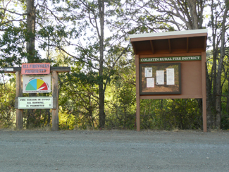
On the right is our new kiosk with its 4' x
3' bulletin case. (Our Fire Danger Indicator sign on the left here was
built in 2011 by Brian Dwyer, one of our firefighters.)
This kiosk in the lower Colestin valley nearly on the CA/OR border
has been several years in the planning due to siting considerations,
and is the District's third posting site for fire season regulation
bulletins, firefighter/first responder training announcements, annual
budget meeting and proposed budget public notices, and other District
news.
(The other two posting sites are our bulletin case on the the postal
kiosk on the Mt. Ashland Ski Road (about one mile up next to the long
row of mailboxes), and the "mini-kiosk" just to the right of Fire Station
One in the center of the valley.)
This new kiosk, the District's first full-size kiosk of its own, was
designed to provide more space for fire safety and prevention materials;
additionally, the area adjacent to the bulletin case will allow for
larger flyers and posters from time to time.
This project is part of our public education and outreach, intended
to encourage and develop fire safety and prevention awareness within
our community. Related locally relevant topics of concern to fire agencies
will also be featured whenever possible.
We hope that as you drive by, or when you get a chance to stop and
check out our postings, you'll find the new material informative, relevant,
and useful.
OF INTEREST:
We have not had back-up support from the Hornbrook Volunteer
Fire Department, our next-closest fire agency, since early
in 2014; however, this may soon change, following the recent Nov. 3rd
special election for Hornbrook's board of directors.
UPDATE: A TV news story on Sun. Nov. 15th reported that with the newly
elected board, volunteer firefighters will be returning to service in
the department sometime within the next week. Details will follow here
as soon as we are able to learn them.
The backstory (all listed articles published by the Siskiyou Daily
News (Yreka, CA), posted online):
"Supes
set election to reinstate Hornbrook fire board," Wed.,
Aug. 5, 2015: "After nearly 16 months without a fire department,
the Siskiyou County Board Of Supervisors voted unanimously Tuesday to
call a special election for board members for Hornbrook’s fire
protection district. [. . .] "Controversy within the Hornbrook
Fire Department began on Feb. 27, when the entire department quit. [.
. .] "The election will be held November 3, 2015..."
"Hornbrook's
entire fire department quits," Feb. 27, 2014;
"Hornbrook
firefighters turn in their gear," Mar. 7, 2014;
"Our
View: Hot mess in Hornbrook," Mar. 14, 2014;
"Fire
board tries to address issues," Jun. 20, 2014;
"Fire
board president Olson resigns," Nov. 3, 2014;
"Hornbook
Fire Department still battling with fire board,"
Jun. 16, 2015.
The Siskiyou Rail Line is back in operation as of November
10th, 2015:
According to the recent news report, "Freight
service over Siskiyou Pass starts today," (Mail Tribune
online, Tues. Nov. 10, 2015): "The Central Oregon & Pacific
Railroad has begun sending freight trains over the entire 296-mile short
line between Eugene and Weed after spending $13 million for the Siskiyou
Summit Railroad Revitalization project. The resumption of train traffic
on the Siskiyou Line south of Ashland means veneer and other wood products
from the region can be shipped by rail. CORP plans to send about 12
freight trains over the tracks each day."
Previously, ODOT's Moving Ahead publication
on Sept. 25th, 2015 (included with the 9/25/15 Mail Tribune), stated
that, "Major repairs to the Siskiyou Rail Line are on schedule
so that the line is expected to reopen by mid-November. // "Freight
service on the historic line, which first opened in December 1887 and
runs 95 miles from Ashland to Weed [CA], stopped in 2008. // "The
Siskiyou Summit Railroad Revitalization project is repairing and revitalizing
a 65-mile section of the 296-mile stretch of the short line railroad,
including rail, tunnels, ties and bridges as well as upgrading its freight
capacity to handle the 286,000-pound industry standard for rail cars."
The line, when re-opened, will provide service five days a week between
Weed, CA., and Medford, OR., with one train in each direction running
on those days; each train will have 12 to 14 cars.
While the expanded shipping opportunities for regional companies with
the re-opening of the rail line are great, we are still concerned by
the rail's transit through our valley as a source of potential fire
sparks, as this has been a very significant issue in the past. While
we hope that recently completed repairs to the line will have alleviated
most, if not all, of the sources of potential fire sparking along the
tracks, we will be monitoring the trains once the line re-opens as we
previously have, particularly during fire season.
For more information, see "Reopening
Siskiyou Rail Line," by Brad Hicks, ODOT, Moving Ahead,
September, 2015, and "Siskiyou
Rail Line Repair - November reopening," ODOT, Moving
Ahead, September, 2015.
Are you interested in becoming a weather spotter?
The National Weather Service recently invited weather watchers to a
FREE severe weather spotter training program. The spotter class was
held Thursday, October 8th, 2015, between 6 and 8
pm at the Carnegie Library, 413 West Main Street, Medford.
The weather service uses reports collected from spotters across the
region to determine the severity of both winter and summer storms. In
the class, meteorologists explain the types of storms we receive in
Southern Oregon, show you how to use a rain gauge, and how and what
to report.
If you are interested in a future class, contact the National Weather
Service in Medford. For details on the recent class, see
the flyer. [Information is from Ryan Sandler of the National
Weather Service in Medford.]

SHAKEOUT
OREGON last took place on Thurs., October 15th, 2015; the
Oregon Office of Emergency Management states that "ShakeOut participants
included businesses, schools, local, state, and federal government organizations,
and many others. The worldwide drill is conducted to practice earthquake
safety and promote emergency preparedness." According to an OOEM
news release, "Approximately 540,000 Oregonians participated in
this year's Great Oregon ShakeOut." Learn
more.
Fire Season and Defensible Space:
Fire officials at all levels are expecting this fire
season to become a very challenging, costly, and potentially devastating
one.
A news report carried in the Mail Tribune, Thurs. June
18, 2015, pg. A2,, "Southern Oregon is drying out early,"
by Ian Campbell, underscores the situation (an original version of this
article by Ian Campbell was published in the Roseburg News-Review as
"Oregon's
drought to lead to extensive and expensive fire season):
" 'We're seeing values right now that we typically see in the
middle of July,' said meteorologist John Saltenberger of the Northwest
Coordination Center.
'We're about a month ahead of schedule for drying.' " [...]
" 'We're on track for a severe fire season, and what we need
is two things,' said Tom Fields, fire prevention coordinator for
the forestry department. 'We need a break from Mother Nature, and
we really need folks' corporation [sic] in keeping fires from starting.'
" [...]
Refering to the multifold increase in burned acres last year, he
adds that "People are not necessarily doing anything differently
. . . but the drought conditions make fires more likely to start
- and to spread."
An earlier news report by the AP on June 9, 2015, carried by the Mail
Tribune, "Feds
say Northwest, Southwest could see catastrophic fires,"
echoes this:
"DENVER — Despite a wet spring over much of the nation,
the Obama administration warned Tuesday of potentially catastrophic
wildfires this summer, especially in the Southwest and Northwest.
" 'We've been very fortunate here in the central part of the
country to have above-normal precipitation to allow us to postpone
the fire season,' U.S. Forest Service chief Tom Tidwell said at
a news conference in Denver.
"But as the summer heat dries out forests and rangeland, the
fire danger will rise, said Tidwell, who joined Agriculture Secretary
Tom Vilsack and Interior Secretary Sally Jewell at the Denver briefing.
"Southern Arizona and drought-stricken California are especially
vulnerable to large, costly fires, Tidwell said. Washington, Oregon,
northern Idaho and western Montana will face increasing fire danger
later in the summer, he said.
"Jewell said climate change and drought are to blame for
worsening wildfires..."
Multiple key factors have contributed to this view, including the almost
non-existent snowpack this past winter, minimal spring rains (2"
below normal), and an increasing
regional drought designation (also see NOAA's
U.S. drought portal).
Temperatures have been extreme for extended periods, with
the month of June being the hottest June on record. (See the Mail Tribune
6/28/15 (Sun.) article,
"Week's temperatures forecast to peak at 111 on Thursday.")
A later news story summarizes the above reports: FIRE
POTENTIAL IN THE WEST, 2015: "Dry Days Bring
Ferocious Start to Fire Season: Officials are warning about the potential
for more catastrophe in the months ahead, as drought, heat and climate
change leave the landscape ever thirstier," a frontpage
article in The New York Times, August 1st, 2015, available online at:
http://nyti.ms/1LX8gcm.
Lightning, always the wild card, is a very serious concern
in this setting. In addition, it strikes the ground more often in drier
years, increasing the potential for new fires.
To minimize your wildfire risk, we urge you
to create or renew fuel breaks (cleared areas,
or continuous perimeters without any flammable fuels) to reduce
potential fuel loads around your home and other structures.
This is essential to making your home and property more defensible.
Prioritize by eliminating
fuels in a primary, secondary, and third zone outward from your home:
mow down tall weeds, which dry out sooner and become flash fuels; take
out any dead trees and shrubs; remove leaves, needles and other debris
from roofs and around structures; and remove any ladder fuels (branches
or other potential fuels that lower toward the ground) that fire can
use to climb. Relocate wood piles to at least 30 feet away from structures.
Relocate items stored under decks and porches, and screen or box in
areas under decks and porches with wire screening no larger than 1/8"
mesh to help keep embers out during a fire.
More wildfire preparation information:
FEMA's
How to Prepare for a Wildfire summarizes all of the essential angles;
WildfirePrepDay.org
(NFPA - Video & more) - the May 2nd,
2015, National Wildfire Community Preparedness Day announcement
for more info & links;
The
NFPA's FIREWISE Communities project
The
NFPA's Fire Adapted Communities project
Fire
Adapted Communities Learning Network (Blog)
April
30th 2015 National PrepareAthon Day
Our Wildland Fire Prevention:
Fuel Breaks & Other Tips page. Call us at 541-488-1768
with any questions.
Thank you for participating in wildfire preparedness and prevention.
As always, the CRFD encourages our residents to engage in wildfire
fuel-thinning projects when and where possible, and in general,
to establish and maintain fuel breaks around homes and other structures.
See our Wildland Fire
Prevention page as well as reviewing information on some
possible fuel-thinning assistance sources (below on
this page):
The Lomakatsi Restoration
Project;
The Oregon
Dept. of Forestry's fuel reduction grant program;
Forestry consultant
and contractor Marty Main; and
The
Partners for Fish and Wildlife Program, run out of the
Klamath Falls Fish and Wildlife Service Office.
Grants and other funding assistance for fuel-thinning projects may
also be available through the sources listed here.
It is instructive to remember that the 1981 Colestin Fire occurred
in fire season conditions very similar to what we appear to be facing
now.
The winter of 1980-81 was one of only four over the past 35 years on
record as "years with low snowpack," and one of the two years
out of the same four low-snowpack years when "dry conditions persisted
through the winter," resulting in "extreme" fire danger
conditions earlier than usual that fire season.*
The Colestin Fire began during dry, intensely hot weather,
on the heels of four consecutive days of triple-digit 110-degree and
over temperatures, on Monday, August 10th, around 12:30 pm just as the
day was about to reach its peak heat, in the inhabited, densely forested
heart of the valley.
Sparks from young children playing with matches in the yard of a home
along Colestin Road near what was then the historic Colestin Stage Stop
Hotel, owned by the Avgeris family, ignited the underbrush and rapidly
involved the tinder-dry forest.
Driven by highly erratic, shifting winds that afternoon through the
steep, rugged terrain, the fire grew to hundreds of acres within a mere
handful of hours.
Firefighting efforts by the five fire agencies that responded from
outside of the area assisted by the CCC and two other hot-shot crews
were severely challenged by the fire's crazy path as it changed directions
numerous times, at one point almost reaching Mt. Ashland Road.
Ultimately, while no lives were lost and only three minor structures
were consumed, over 540 acres burned (some accounts say over 700 acres),
including two million board feet of timber; damage to the local watershed
was also extensive. Altogether, the Colestin Fire took more than 700
firefighters and three days to contain; firefighting costs topped $1
million.
At the same time that season, at temperatures of over 100 degrees in
some areas and also in bone-dry conditions, a dozen other major fires
burned an estimated total of 47,000 acres in four western states; later
that same week alone, new lightning-caused fires scorched approximately
20,000 more acres across Oregon.
[*Ref: "Dry year for Oregon, Washington - Snowpack suffers; one
meteorologist predicts a warm summer ahead," by the AP and carried
in the Mail Tribune, Thurs., January 2, 2014, Page 2A.]
________________
We fervently hope that this is not the kind of fire season that is in
store for us, but because of a lack of significant snowpack this past
winter, we may have to face this. It also means a need for more and
better fuel breaks, more individual vigilance and safe practices, and
more participation in our fire district.
The one major difference between 1981 and the present is the existence
of a local fire agency with trained local firefighters and local firefighting
resources and the fire safety consciousness and prevention measures
of our community and residents.
This may be a fire season when these qualities are not only more important
than ever, but a year when earlier, more extreme conditions leave us
no other choice: either we must be pro-active, or we may have to pay
the price, however high, for not doing all that we are each able to
do ahead of time.
For more information and related articles on the
2015 fire season outlook, see our 2015
Fire Season Chronology, below ODF's sequenced fire season
bulletins.
Community Emergency Preparedness Event - After-Notes
A big thank you to all who attended our Community Emergency
Preparedness Presentation earlier this month (on Sat. May 2nd,
10 am - 12 pm at the Hilt Community Church).
We also extend a huge thanks to Sara Rubrecht, Senior Manager
of the Jackson County Office of Emergency Management, and her husband,
also an OEM member, for coming out to our community and presenting this
timely event.
Sara did a great job covering the universe of emergency management
in less than 2 hours, ending with a brief Q & A opportunity. For
more details, see our Emergency
Preparedness page.
Community interest:
October 11th, 2015, was the 92nd anniversary
of the 1923 D'Autremont brothers train hold-up - also known as "the
last great western train robbery" - as the Southern Pacific
reached the Siskiyou Summit at Tunnel 13, where the train ran at its
slowest on its journey over the Siskiyou mountains.
"Murder on the Southern Pacific - An Oregon Experience"
re-aired on SOPTV's "Oregon Experience" on Wed. October 14th,
2015, at 2:00 am; this was a shortened, half-hour version of
the original 1-hour program that first aired on Mon. June 1st and Thurs.,
June 4th, 2015.
This October 14th, "Murder on the Southern Pacific" was followed
at 2:30 am by a half-hour version of "State of Jefferson: An Oregon
Experience."
For the video preview of "Murder on the Southern Pacific,"
more info and to view the program online, see SOPTV's
program link.
FYI: If
you missed "Big Burn: American Experience"
(1 hr) on SOPTV (KSYS) on Tues. Feb. 3rd,
or the repeat on Thurs., Feb. 5th, 2015, you can still see it online
at http://www.pbs.org/wgbh/americanexperience/films/burn/player/.
SOPTV's program description states:
"In the summer of 1910, an unimaginable wildfire devoured more
than three million acres across the Northern Rockies, confronting the
fledgling U.S. Forest Service with a catastrophe that would define the
agency and the nation’s fire policy for the rest of the 20th century
and beyond. This documentary provides a cautionary tale of heroism and
sacrifice, arrogance and greed, hubris and, ultimately, humility in
the face of nature’s frightening power. Inspired by the best-selling
book by Timothy Egan." This event inaugurated a policy of fire
prevention, rather than "let it burn," eventually causing
the heavy build-up of volatile fuel loads that characterizes wildfires
now - a policy often hotly debated (as it were), always under serious
scrutiny, and one that directly affects the level of danger our own
firefighters now must cope with.
Of interest:
"Woodland owners have much to offer," forestry
consultant and contractor Marty Main's Guest Opinion in the Thurs.,
Jan. 29th, 2015, Mail Tribune: "Today, we are confronted
with increasing amounts of high-severity fire with negative effects...
[. . .] ...if fire historically visited most forest sites every 5-20
years, as current research suggests, and the change toward more large,
severe fires has been the result of decisions we as a society have made
(e.g., put out all the fires while creating more flammable forests),
then we can, once again, choose another path. Our money and efforts
are better spent supporting management activities designed to reduce
fire severity before wildfire visits our forests than after it has occurred..."
To learn more about creating a less fire-prone landscape through a diversified
strategy to forest/woodland management, see Fire
Protection (under Info & Resources) at the Jackson-Josephine
Small Woodlands Association website.
Fire Service Appreciation Day 2015: According
to The Communique, Annual Fire Service Appreciation Day is
held in late January every year. This year, it is being held on Tuesday,
January 27th.
In keeping with passage of HJR 25, events are held across the state
to recognize and honor the fire service. HJR 25 'encourages all citizens
of Oregon to recognize and honor our fire service members for their
efforts to keep our citizens safe from the ravages of fire.' Communities
across the state have "an opportunity to host a variety of events
recognizing members of their local fire departments and districts for
their dedication, commitment and sacrifice."
This year, according
to the Oregon State Fire Marshal's office, "State
Fire Marshal Jim Walker is encouraging communities across the state
to show appreciation to everyone involved in the fire service for their
dedication and commitment to helping others. Oregon follows the national
trend with approximately 70% of firefighters in the state performing
their duties as volunteers. Fire Service Appreciation Day is an opportunity
for everyone to say thanks to volunteer and full-time firefighters alike
for their time, talent, and sacrifice."
ODF FREE/NO OBLIGATION PROPERTY ASSESSMENT FOR WILDLAND
FIRE SAFETY & Fire Hazard Fuel Reduction Grants:
The Oregon Dept. of Forestry announced on Jan. 7th, 2015,
that it is offering fire hazard fuel reduction grants to eligible
residents in Southwest Jackson County. While the focus for
these grants is on properties in the Applegate and Bear Creek areas
in the Rogue Valley, the ODF also states that:
" If landowners outside of the grant areas are interested
in having a free/no obligation property assessment with regard
to wildland fire safety, they are also encouraged to call (541)
664-3328." [. . .]
"For more information about the fuel-reduction
grant program, and to schedule a free on-site fire risk assessment,
call Derick Price at ODF’s Medford office, (541) 664-3328."
View
ODF's Jan. 7, 2015, news release, "FIRE HAZARD FUEL
REDUCTION GRANTS AVAILABLE TO RESIDENTS OF SOUTHWEST JACKSON COUNTY"
(pdf).
Ongoing FREE 10-MINUTE HANDS-ONLY CPR
TRAINING: If you missed this opportunity to get trained
in Hands-Only CPR at one of our previous events, you still can.
Learn more.
FYI: The
Colestin/Hilt Emergency Preparedness Plan Leadership Group held
its first meeting on Sat., January
18th, 2014. Our newly launched Emergency Preparedness Plan Project is
in recognition of the increasing need to be able to effectively respond
to significant emergency events here in our valley, and to provide help
and leadership through the District to our residents. Learn more about
our Emergency Preparedness
Plan Project on our
new page dedicated to developing our emergency preparedness
resources.
The Lomakatsi Restoration Project - Prescribed Fire
Controlled Burns and woodland fuel load reduction in the Colestin valley:
The Lomakatsi Restoration Project notified us of two APPROVED
PRESCRIBED BURNING projects during the fall of 2015. One prescribed
burn took place on Friday, Oct. 23rd, 2015, on a private property near
Nepal Rd. in the middle of the Colestin valley; a second prescribed
burn was scheduled for before Nov. 25th on another private property
here in the Colestin area. See the posted
flyer announcing these prescribed burns. Information on
prescribed burning is also available on Lomakatsi's website at:
http://www.lomakatsi.org.
Previously in 2015, the Lomakatsi Restoration Project
conducted low-intensity prescribed burning in our valley on Wednesday,
Feb. 18th, 2015, and Thursday, Feb. 19th. The burning of brush piles
occurred on private property along Goat Ranch Road in the lower valley,
by pre-arrangement with the owner. This prescribed burn was not related
to another burn a few days earlier done by a private landowner "located
between Colestin Road and I-5."
Lomakatsi also conducted a prescribed burn on Friday, January 30th,
2015, in the Colestin valley, on a private property near Goat Ranch
Road, after receiving clearance from the ODF. Adjacent
landowners were notified ahead of that date. See Lomakatsi's
announcement flyer.
All burns are always contingent upon getting air quality clearance from
the Oregon Department of Forestry's smoke management forecasting. The
CRFD receives maps of designated burn locations and also is notified
just ahead of each actual burn.
Low-intensity prescribed fire controlled burns are by arrangement with
participating residents as part of a program to reduce woodland fuel
loads through density thinning and slash treatments and to restore oak
habitat.
Previously, the Lomakatsi Restoration Project conducted several
prescribed burning projects on private properties within the Colestin
Valley during the fall of 2014 (from Nov. 1st to Dec.
1st). See Lomakatsi's announcement
flyer for additional information on that burn.
Prescribed fire controlled burns were also done during the fall of
2013 through March, 2014 by Greyback
Forestry, Inc., contracted by the Lomakatsi Restoration Project in partnership
with the U.S. Fish & Wildlife Service on private lands within our
district. For details, see Lomakatsi's site under "News & Events"
and the link to Colestin area work with photos at lomakatsi.org/prescribed-fire-colestin-11-1-13/;
also see Lomakatsi's
flyer, "Colestin Valley Prescribed Hand Pile Burn
Notification, Potential Operation Dates: November 2013 through March
2014" (pdf format), and Lomakatsi's
Nov. 2013 flyer, "Colestin Valley Prescribed Fire
Notification," Nov. 1 - 18, 2013, (jpg image; allow approx. 30
seconds to load).
For questions or more information about about prescribed burning projects
or about participating in Lomakatsi's fuel reduction program, see www.lomakatsi.org
or contact them at info@lomakatsi.org
or 541-488-0208.
Oak Restoration - Free Field Day tour in the Colestin valley - Sat.
June 27th, 2015
Lomakatsi invited those interested to join in on
an Oak Woodland Restoration Field Day tour on Saturday, June
27th, 2015, from 9am to 2pm.
This free event was hosted by the Klamath Siskiyou Oak Network
(KSON), a group composed of local state and federal agencies,
Native American tribes, private citizens, and non-governmental organizations
(including Lomakatsi) that provide opportunities for practitioners and
community members to engage on issues affecting threatened oak habitats
in order to promote oak conservation and restoration.
During the tour, participants visited several privately owned oak woodland
sites in the Colestin valley to look at completed oak restoration treatments
and discuss conservation efforts taking place in the local region.
For more information, see
the flyer, contact KSON Coordinator Kate Halstead at keh@klamathbird.org
or 541-201-0866 ext. 7#, or visit http://www.klamathbird.org/the-klamath-call-note/announce/press/2852.
Information is also available on Lomakatsi's website at www.lomakatsi.org.
HELP WITH FUEL REDUCTION
AND OAK WOODLAND RESTORATION:
For those who are thinking ahead, since these projects need advance
planning, here is some information for you to consider:
The Partners for Fish and Wildlife Program, run out of the Klamath
Falls Fish and Wildlife Service Office, is available to help private
landowners restore oak woodland.
"The Partners for Fish and Wildlife Program works with private
landowners and other partners providing financial and technical assistance
to achieve voluntary habitat restoration," according to the Program
brochure.
The Program also includes assistance in identifying areas that could
benefit from prescribed fire, and in connecting landowners with additional
organizational resources in order to help fund and carry out approved
prescribed burning plans. (Due to multiple such events during the fall
of 2011, prescribed burns now also need to be coordinated with the fire
district, partly for fire safety and partly because of the need to limit
smoke in the valley.)
Dave Ross, Fish and Wildlife Biologist with the Klamath office, says
that they have experience working together with both the Lomakatsi Restoration
Project and the Natural Resources Conservation Service, with each organization
handling a different aspect of a project, several of which have successfully
occurred here in the Colestin valley in recent years.
"All three of us work closely together in partnership fashion
to leverage funding, expertise and programs," Ross says.
He encourages anyone interested to:
-
-
-
David A. Ross
Fish and Wildlife Biologist
Partners for Fish and Wildlife Program
Klamath Falls Fish and Wildlife Office
1936 California Ave.
Klamath Falls, OR 97601
For further information about partner organizations, contact:
FYI: The Jackson County Land Steward
Program's 2014
Fall-in-the-Field Land Steward Training began Sept.
11th, 2014.
This is a 13-week in-the-field course that promotes responsible land
management by assisting small-acreage landowners in developing a land
management plan for personal land-use goals. The Extension's announcement
states: "The course is targeting land owners who want to learn
how to balance sustainability with their rural lifestyles."
Course topics include fire safety, fuel reduction,
water conservation, and promoting healthy trees and forests.
"Participants learn to: live safely
in wildfire-prone areas; reduce yard waste and woody biomass;
identify and eradicate noxious weeds; make their own mulch and compost;
promote and develop wildlife habitat; maintain healthy trees and forests;
[and] conserve water and reduce runoff."
Taught by Natural Resource professionals, the course provides handouts,
references, further resources, professional presentations, and field
trip site visits to augment the information.
The current course is held at Jackson County's OSU partnership office,
the Southern
Oregon Research & Extension Center (SOREC) at 569 Hanley Road,
Central Point OR 97503; Phone: (541) 776-7371 (Mon.-Fri., 8:00
am - 5:00 pm). Dates & times are Sept. 11 to Nov. 13th, on Thursdays
from 1-5:30 PM.
The cost before Sept. 1st was $150 per person ($200 per couple); after
Sept. 2nd, the cost rose to $175 per person ($225 per couple). Pre-payment
is required; "Scholarships and payment plans are available for
those in need."
For more information on this fall's course or future sessions of this
course, and for application and registration information, email Rhianna
Simes, Coordinator, at rhianna.simes@oregonstate.edu, or call (541)
776-7371 ext. 211, or see http://extension.oregonstate.edu/sorec/land-steward-program.
"The future of wildfire, and of
hotshot firefighting" - 8/3/13
The above-titled editorial by Bob Sipchen was carried in the Mail Tribune
(Medford, OR) on Saturday, August 3rd, 2013, and was originally published
by the Los Angeles Times on Sun. July 28th. A brief excerpt follows:
"Along with barked orders and the whine of chain saws, the clank
of steel on rock was certainly one of the sounds that rose from a hillside
near Yarnell, Ariz., last month as clouds of superheated smoke roiled
the sky, portending a tragedy . . .
". . . I knew that for the firefighters, at least one thing that
has been offered up as consolation is rooted in truth: They did die
doing what they loved, and part of what they loved was the danger.
"I've come to doubt, however, another often-voiced cliche: 'They
understood the risks.'
"A federal study released this year joins a growing body of literature
connecting the frequency and intensity of wildfires worldwide to the
global climate disruption that we have created by living lives dependent
on the burning of fossil fuels. The Granite Mountain Hotshots may well
have known about this connection. I'm confident that neither hotshots
nor anyone else yet has a clue what it all means for the future of computer-modeled
firefighting strategy, let alone about the multitude of life-or-death
judgment calls firefighters make in any given wildfire."
The complete article may be read on the Los Angeles Times' website at:
http://articles.latimes.com/2013/jul/28/opinion/la-oe-sipchen-fire-hotshots-20130728
(page 1) and http://articles.latimes.com/2013/jul/28/opinion/la-oe-sipchen-fire-hotshots-20130728/2
(page 2).
"Warning: 'These huge fires are the new
normal' - AP, 7/6/13
For those who missed the above article published by the Mail Tribune
(Medford, OR) on July 6th, 2013, a few excerpted bits follow:
"There's a dangerous but basic equation behind Arizona's killer
Yarnell Hill wildfire and other blazes raging across the West this summer:
"More heat, more drought, more fuel and more people in the way
are adding up to increasingly ferocious fires...
"While no single wildfire can be pinned solely on climate change,
researchers say there are signs that fires are becoming bigger and more
common in an increasingly hot and bonedry West...
Wildfires are chewing through twice as many acres per year on average
in the United States compared with 40 years ago...
" 'These huge fires are the new normal,' said John Glenn, chief
of fire operations for the federal Bureau of Land Management. 'Look
at any touchstone - global warming, fuels, invasive species, forest
and rangeland health issues - and then you throw in the urban interface.
It's almost like this perfect mix. What used to be the anomaly is almost
like the normal now.' "
A version of the same story appeared in The Huffington Post on July
5th:
http://www.huffingtonpost.com/2013/07/05/climate-change-wildfires_n_3550397.html
Our hearts are with all of those
grieving the loss of the 19 Granite Mountain hotshot firefighters of
Prescott, Arizona, killed on Sunday, June 30th, in
the Yarnell Hill Fire near the central AZ town of Yarnell (northwest
of Phoenix).
The fire, initially sparked by lightning on Friday, June 28th, blazed
out of control in triple-digit temperatures and erratic, gusty, hot
winds under the state's long-term drought conditions. By Sunday, under
the intense peak heat of the day, an unanticipated major wind shift
from the southeast caused the fire to blow up to an estimated 2,000
acres. The 19 hotshot crew members, trapped with no escape and overtaken,
deployed emergency fire shelters as a last-resort measure; tragically,
there was insufficient time, and the heat was far too unendurable, for
survival. The Yarnell Hill Fire of nearly 9,000 total acres within mere
days is now the deadliest wildfire for firefighters in the U.S. in 80
years.
The CRFD stands in unity with Prescott, its fire department, and its
community in the wake of this horrific event. We solemnly observe, salute,
and honor the courage and bravery of the 19 members of the hot shot
crew and their ultimate sacrifice.
For current information and crew member particulars, see CNN's
news page.
The Spring, 2013, Firebrand:
The Fri. April 26th, 2013, edition of the Mail Tribune contained (the)
"Firebrand," a small newspaper insert with
some great fire prevention information. This edition
has really useful, timely articles:
- "Fire Season Forecast for Southwest Oregon"
- "Fuel Reduction for Your Back 40"
- "CERTS Volunteers Doing the Greatest Good"
- "Building Safer Neighborhoods Through Firewise Communities"
- "Middle Applegate Watershed Pilot Project: A Fresh Approach
to Forestry in Southern Oregon"
- ODF fuel reduction programs, fire-resistant plant spotlight, resource
links, and more
In case you missed it, you can check it out on the RVFPC website
at http://www.rvfpc.com.
(Look under the right-hand navigation column, & scroll down to "Firebrand
Newsletter").
A printed copy is also available upon request by:
- calling Brian Ballou (ODF) at 541-664-3328,
- emailing rvfireprev@gmail.com,
or
- writing to: Rogue Valley Fire Prevention Cooperative, P.O.
Box 3301, Central Point, OR. 97502.
The Firebrand is published by the Rogue Valley Fire Prevention
Cooperative, a non-profit group of fire prevention organizations
based in southern Oregon, and "supports the mission of the RVFPC,
and the outreach and education action items in the Jackson County Integrated
Fire Plan... [a]rticles also highlight projects that protect homes and
wildlands from wildfire, and promote healthy, productive wildland environments.
// The Firebrand also supports emergency preparedness for families,
pets and livestock, and provides information about preventing fires
inside the home."
Also see:
For those who may have missed it, check out this commentary on defensible
space as a crucial strategy for lessening your vulnerability in a wildfire:
"Colorado
wildfires hold a lesson for Oregonians" by Kristin
Babbs, published in the Mail Tribune (Medford), July 24th, 2012. (The
Tribune now allows 3 free guest visits for reading articles if you are
not a subscriber.)
During lightning storms, we rely heavily on the Soda Mountain
fire lookout, staffed for the past 24 years by Ken Struck and
his wife. Situated twelve miles east of Ashland and over 6,000 feet
high, with a bird's-eye view of our district, Ken watches storms, and
tracks lightning hits, smoke, and new fire starts using binoculars and
a firefinder to pinpoint the exact locations.
Soda Mountain is one of ODF's two last full-time manned fire lookouts
in the Southwest Oregon District, as people are replaced by technology
at fire lookout stations. Paul Fattig's article in the Medford Mail
Tribune is a tribute to Ken and the work he does, as well as
an interesting history of the Soda Mountain lookout station.
We in the Colestin-Hilt district continue to greatly appreciate Ken's
watchful presence and long-experienced, knowledgeable assistance from
Soda Mountain, particularly during lightning storms, and in general,
throughout each fire season.
Read Paul Fattig's article " Fire-watcher
era nears end: With cameras increasingly replacing human
lookouts, Ken Struck, who mans the Soda Mountain station, is among the
last of a rare breed." Originally published on Wed. July 28th,
2010, in the Medford Mail Tribune; available
online at: http://www.mailtribune.com/apps/pbcs.dll/article?AID=/20100728/NEWS/7280319.
You may have noticed the large fire safety awareness
signs that have been in rotation on our fire danger indicator
sign structure near Hilt (just south of the CA-OR border) following
the end of the 2011 fire season. (The current sign asks, "Do you
have a fire plan?" with a diagram of possible escape routes.)
These signs were done and donated to our district
by Patty Hood of CalFire. A huge thanks to Patty, for
providing these very visible signs, readable from the road, to enhance
fire safety in our valley!
Food for thought:
Mt. Ashland Ski Area has been raising funds "to recover from
the worst snow year in 20 ski seasons." This is what our local
snowpack was really like last winter [2011-12], despite the water year
report. (Source: The Mail Tribune, Medford, OR., 6/25/12, p. 4A.)
Long-time CRFD member Cheri Avgeris retired in January,
2011,from the Fire District after over 28 years of volunteer service
to our community. A Board member for nearly all of the past 28 years
as well as a firefighter and a First Responder throughout these years,
Cheri later became our Medical Director for the District's First Responder
Emergency Medical Services.
Recently at our annual community picnic, Cheri was given public recognition
and honored for her long years of selflessly dedicated service and commitment
to the District, complementing a commemorative plaque presented to her
by the Board upon her retirement this past year. A brief overview of
Cheri's many contributions is available on our Personnel
page.
JACKSON COUNTY FORESTLAND-URBAN INTERFACE CLASSIFICATION COMMITTEE
MEETINGS AND HEARING:
Public meetings followed by a hearing have recently been held
for the purpose of explaining Jackson County Forestland-Urban
Interface Classification Committee's land identification and classification
process, as part of the implementation of the Oregon Forestland-Urban
Interface Fire Protection Act, often referred to as Senate Bill 360.
The Jackson County Forestland-Urban Interface Classification Committee
and the Oregon Department of Forestry sent letters to more than 13,000
landowners within Jackson county informing them of five public meetings
that were held in January 2011. The meetings were to explain the land
identification and classification process performed by the committee,
as required by the Oregon Forestland-Urban Interface Fire Protection
Act, often referred to as Senate Bill 360.
The owners of lots affected by the Oregon Forestland-Urban Interface
Fire Protection Act are required to create fuel breaks around their
homes and other structures to make homes and other buildings more defensible
against wildfire.
For further information, see our Rural-Urban
Forest Interface Fire Prevention page.
2010 was the centennial anniversary of 1910's Big Burn, the
firestorm that burned millions of acres in Oregon, Washington, Idaho
and Montana. Also called the Big Blowup of 1910, the
firestorm was the result of multiple fires that started in June and
merged on August 20th, burning three million acres in just twenty-four
hours, and killing 84 people. The U.S. Forest Service headed centennial
commemmorations. You can learn more at: http://www.fs.fed.us/r1/1910-centennial/.
The July-Aug. 2010 issue of AAA's "Via" magazine (p.
17) also has a short article on this.
Jackson County Integrated Fire Plan
Planned Community Wildfire Meetings are part of countywide wildfire
protection. Discussion topics include information you need to live safely
in wildfire country, the fire planning process, how your neighborhood
can be more wildfire safe, and meeting your local fire service providers.
Representatives from local Jackson County Fire Districts, Oregon Department
of Forestry, Rogue River/Siskiyou National Forest, and Medford BLM attend
these meetings.
For information about any currently planned community meetings,
contact:
Randy Iverson, Fire Chief Jackson County Fire District #3 (541) 826-7100
Brian Ballou, Fire Prevention Specialist, Oregon Dept. of Forestry (541)
664-3328
Neil Benson, Jackson County Integrated Fire Plan (541) 482-4682
Chris Chambers, Wildfire Fuels Reduction Coordinator, Ashland Fire &
Rescue (541) 552-206
View
ODF's September, 2005, News bulletin as a pdf file.
(This requires Adobe
Acrobat Reader 5.0 or higher, FREE if you need to download
it.)
UPDATE on the West-Wide Energy Corridor DPEIS
- the Decision & background
The WEST WIDE ENERGY CORRIDOR DPEIS [Draft Programmatic
Environmental Impact Statement]:
UPDATE: In August,
2008, the BLM's Medford district office published a "Record
of Decision and Resource Management Plan" for the Cascade-Siskiyou
National Monument which includes information indicating that the energy
corridor under discussion has been sited near the Klamath area and to
the east of Ashland instead of running through our valley. Copies of this
document are available from the BLM at its Medford District Office, 3040
Biddle Rd., Medford, OR., 97504.
The following concerns
CRFD's position on the federal West-wide
Energy Corridor DPEIS (Draft Programmatic Environmental Impact
Statement), concerning the 3,500-foot wide power corridor that could have
run directly through our district. The public comment period on the draft
plans ended on February 14th, 2008.
At the January, 2008, Board meeting, Lisa [Buttrey] provided the Board
with background information and maps, pointed out issues of concern, and
suggested talking points about this project.
The law allowing for the creation of this project was passed in 2005;
the plan itself was released in mid-November of 2007. The plan is to have
a 2/3rds-mile-wide pipeline/power-line corridor in the Valley. A number
of these corridors are proposed throughout the west to handle the power
sources (propane, gas, etc.) that is needed to keep up with increasing
fuel needs in the country.
After discussion at the January meeting, the Board took the position
that this area is not the best to locate this project. Not only are there
environmental and geological concerns, but also the financial costs of
going through the Siskiyou Mountains would be astronomical. Areas of eastern
Oregon, which are flat and uninhabited, would be a far better place to
locate the project.
The Board passed a motion directing the fire district, as the local agency,
to send a letter outlining these concerns, as the project is currently
proposed. Peggy Moore, as the Board Chair, was appointed to write the
letter on behalf of the District.
The CRFD's letter in response to the West Wide Energy Corridor
DPEIS follows:
January 20, 2008
West-wide Energy Corridor D[P]EIS
9700 S Cass Avenue – Bldg 900, Mail Stop 4
Argonne, IL 60439
Ladies and Gentlemen,
At our January 18th Board of Directors meeting, we passed a unanimous
motion to provide written comments on the proposed Corridor (#4-247)
through the Siskiyou Crest from Oregon into California. As the fire
protection agency that is responsible for this area (for both fire and
emergency medical) we STRONGLY oppose locating the corridor in this
area.
There are a variety of reasons for our concerns but we believe the
environmental, geological and financial arguments are the most salient
and deserve your focused attention.
. The Colestin Valley and Siskiyou Pass area are well known as unstable
in terms of their geology. Siskiyou literally means “moving mountain”.
Slumps, shifts and collapses are fairly frequent in the area. As a result
of one of these natural occurrences the Colestin Valley must now employ
a receiver to rebroadcast telephone signals because the cable was rendered
unusable by earth movement along its route.
. Interstate 5 is a vital transportation highway from Mexico to Alaska.
Many of the trucks using this route on a daily basis carry toxic wastes,
including nuclear waste. In addition, essential supplies of all kinds
are hauled on this route day and night. Accidents happen frequently,
sometimes closing the highway or rending one lane or another impassable.
. This particular stretch along Interste 5 (proposed corridor #4-247)
is the longest stretch of 6% grade on the interstate system. Along with
instability and bottleneck problems, the expense of putting lines across
the Siskiyou Pass would be enormous. There are certainly locations in
the state of Oregon that are flat, have far less interstate traffic
and reside in more geologically stable environments. Areas in sparsely
populated Eastern Oregon might be a consideration.
. The proposal, as we understand it, will make the Klamath River dam
substation a destination for the proposed energy corridor. In doing
so, you are targeting a substation connected to a dam that may soon
be dismantled when court-ordered priority concerns for Klamath River
salmon prevent re-licensing of Klamath River dams.
. The energy corridor segment, which is proposed for California’s
Jenny Creek Falls, is a Redding BLM area of critical environmental concern.
We appreciate that when notified by many concerned citizens you moved
the original 3,500 foot energy corridor out of the Cascade-Siskiyou
National Monument, but we still believe that for the reasons stated
above, putting it in this region at all is a serious mistake.
We are a small, entirely volunteer fire district that, for 25 years,
has provided needed fire and emergency medical services to the residents
of our community. We simply do not have the resources, nor are more
likely to appear, to support a crisis occasioned by a “mega”
corridor .The location of our area makes it difficult (and at times
impossible) for outside agencies to respond in a timely fashion.
We believe, once these facts are reviewed and the costs of locating
the corridor in this area thoroughly researched that [the desirability
of] finding a more geologically friendly, more cost effective and less
populated traffic area will become clear.
We would be happy to provide further information to you on this matter.
Thank you for your attention to our concerns and we hope that you will
find a more hospitable location for this project.
Sincerely yours,
Peggy A. Moore
Chairperson
Colestin Rural Fire District
Board of Directors
c. Chief Avgeris
Board
The comment period ended February 14th, 2008. Thank you to all
those of you who submitted your comments to the West-wide Energy Corridor
D[P]EIS planners.
For further information, see the West Side Energy Corridor website:
http://corridoreis.anl.gov
For a more complete, easy-to-understand summary of the plan
as it may affect us locally, together with issues to consider, maps, and
further information, see the (PDF-format) article "West-wide
Energy Corridors Routes Planned," published in the Jan.-Feb.
2008 issue of The Colestin Valley Buzz, and re-published
here with publisher Lisa Buttrey's permission.
Community Wildfire Protection Plan (CWPP) News:
In June, 2005, the Fire Plan Committee (John Ames, Elaine Shanafelt,
and Lisa Buttrey) completed and released the Colestin-Hilt Community
Wildfire Protection Plan (CWPP) that was in the works for over
a year. In addition to a public presentation of the main points of the
plan by Committee Chair and Coordinator Lisa Buttrey at the community
barbeque on Saturday, June 18th, the plan is now available in detail here
on our site, through our Colestin-Hilt
Community Wildfire Protection Plan (CWPP) page.
"The completed plan," according to Lisa Buttrey,
"has an Intro section, a Description section, a brief 'Risks' section,
and finally the meat of the document in the last section, 'The Action
Plan,' followed by the 'Appendices.' "The Action Plan gives detailed
ideas for things to do and calls for volunteers to do them. [We] hope
to get a few 'Action' items assigned to willing takers (from outside
the fire department proper!)."
The Plan has an enormous wealth of information in it, and
reflects a tremendous amount of time, extensive research, many meetings
with other fire agency and county officials, and hard work. The result
is a document that provides a working plan of action for our community
to pro-actively achieve a much better level of fire prevention and protection
and disaster preparedness than we have ever known. We are also now in
compliance, ahead of schedule, and coordinated with the County's new regional
fire plan. Check
out the Plan on our CWPP page.
Also of interest are some very interesting articles
that were edited out of the final CWPP: "Geology of the Districts,"
a summary by local resident Russell Juncal, and according to Lisa, "very
readable for all residents." The second is "Fire Regimes,
Fire History and Forest Conditions in the Klamath-Siskiyou Region: An
Overview and Synthesis of Knowledge, by Evan J. Frost and Rob
Sweeney. Lisa states that this is "a scientific paper, quite lengthy
at 59 pages, but full of info about fire history, fire regimes, suppression
history, logging impact on fire, etc." A third article that was not
considered part of the official plan but that is also relevant is a Homeowner's
Safety Checklist from the Fire Safe Council. All
of these articles are now available through our CWPP page as well.
Josephine County's Plan, by comparison:
On January 18, 2006, the Oregon Dept. of Forestry announced in a press
release that Josephine County's Integrated Fire Plan has been awarded
statewide recognition: "Josephine County was recently chosen to receive
the 2005 Partners for Disaster Resistance and Resilience Outstanding Natural
Hazards Mitigation Plan. Josephine County was recognized for the collaborative
planning effort that resulted in the Josephine County Integrated Fire
Plan..." To learn more about how our neighboring
county has prepared a fire plan that has now been recognized throughout
the state of Oregon, read the full text of ODF's
Josephine County Integrated Fire Plan press release (Jan.
18, 2006).
CWPP Phone Tree and Road Signage Projects
The "New & Improved Emergency Phone
Tree" and Road Signage are two other developments related
to our Community Wildfire Protection Plan. Read
more.
COMMUNITY ANNOUNCEMENTS:
COUGAR ALERT:
We need to continue to be aware of cougars near our homes.
For updated details on local cougar attacks, information on cougar behavior,
and safety tips for cougar encounters, see our community
page.
DEAD DEER:
SPECIAL NOTE: Dead deer have been found in our area,
due to a virus disease. If you find one, the OR. Dept. of Fish & Wildlife
requests that you report it to Steve Neimela at (541) 826-8774 x239. See
our community forum page for details.
Top of Bulletin Page
